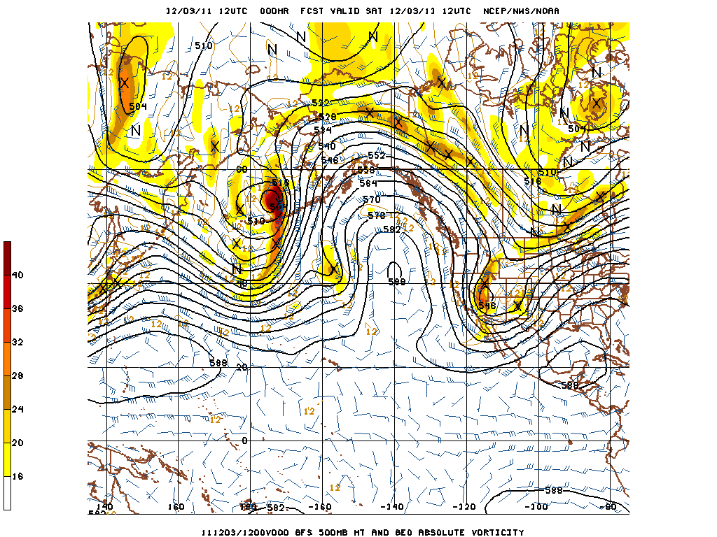
Much of the fall has been very dry across large portions of California, and what precipitation did fall came relatively early in the season and was generally not sufficient to generate meaningful runoff. The past week has seen one of the most powerful Santa Ana/offshore flow wind events in recent memory, with reports of widespread damage and wind gusts well in excess of 100 mph on some mountain peaks. Unfortunately, the prevailing pattern is not showing many signs of change in the near future.

A large, powerful and persistent blocking ridge has set up in the Eastern Pacific, creating high amplitude meridional flow upstream and downstream of the block (poleward in the Central Pacific, equatorward over the Great Basin and Intermountain West). Occasional disturbances riding down the backside of the block have generated strong pressure gradients and powerful offshore winds over California and other Southwestern states in recent days, and will most likely continue to do so for the next 1-2 weeks as the blocking ridge holds strong.
Prospects for a pattern change in the immediate future are pretty slim. These sorts of blocks can be difficult to break down, usually requiring an easterly extension of the East Asian jet to displace the Central Pacific ridge. Two other options are for the block to retrogress and the equatorward flow on the east side to shift westward, or for the block to slowly weaken with time. The former option brings the possibility of Arctic intrusions along the West Coast, and the latter brings the possibility of very slow-moving cutoff systems forming southwest of California. One caveat is that the MJO does appear to be fairly active in the Western Pacific, and the GFS is indicating that the signal may begin to propagate eastward over the next 1-2 weeks. If this does indeed occur, there is some hope for the block to break down and for more zonal flow to take over along the West Coast. We’ll just have to see about that…
Despite early fall rains in Northern California, very dry offshore flow with continuing strong winds in the higher elevations is beginning to lead to fire weather concerns. Though December Red Flag Warnings are not particularly rare in Southern California, they certainly are in the northern half of the state. The possibly very strong wind event for later next week could result in critical fire weather conditions from the Sierras to the Bay Area, which would be extremely unusual, to say the least.
We have now entered the critical period for Northern California rainfall. Each day that passes without precipitation adds to the deficit that must be made up later in the season if we are to avoid a significantly below average water year. Since the first half of December appears unlikely to produce that sort of pattern, we may have to hope for wetter conditions in the new year.
© 2011 WEATHER WEST
Discover more from Weather West
Subscribe to get the latest posts sent to your email.