One of the defining characteristics of California’s Mediterranean climate are its well-defined wet and dry seasons–corresponding to meteorological winter and summer, respectively. One can almost always expect a bone-dry summer outside of occasional summer thunderstorms in the higher mountains, and increasingly heavy winter rains and mountain snows beginning some time during the late fall or very early winter.
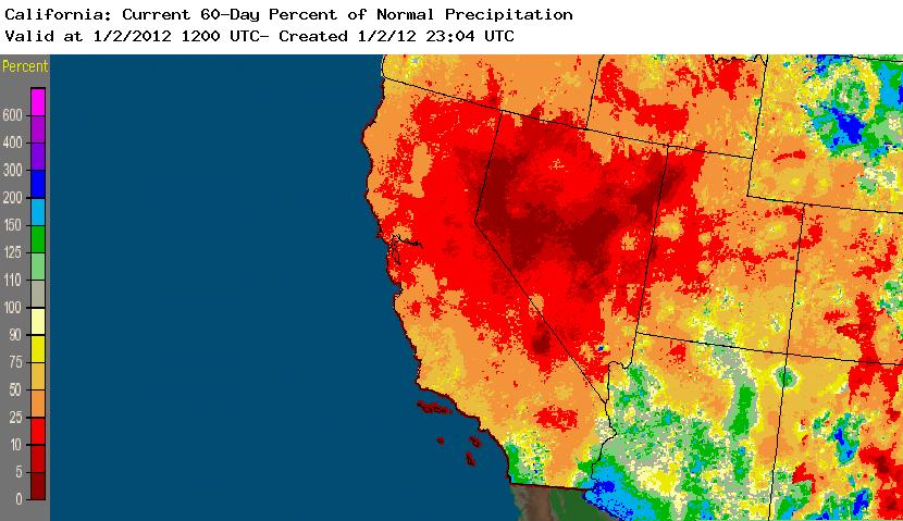
The observed weather in 2011, however, didn’t follow these time-honored expectations. The rainy season in Northern California lasted until early July, and fresh snow on the ground greeted July 4th revelers in the Sierra Nevada. The wet season seemed to be getting off to a respectable start, with a fairly strong system bringing significant rain and wind in mid-October. After a few more minor precipitation events in early November, though, the proverbial spigot shut off abruptly in Northern California. In Southern California, an unusual series of “outside slider”-type systems brought some significant (and in some cases anomalously heavy) rainfall to coastal areas through November. By the beginning of December, however, even the outside sliders tapered off, and December 2011 turned out to be one of the driest Decembers on record for almost the entire state. In fact, most of the state (with the singular exception of the far northwestern corner) received essentially no precipiation at all–and what little did fall was hydrologically insignificant.

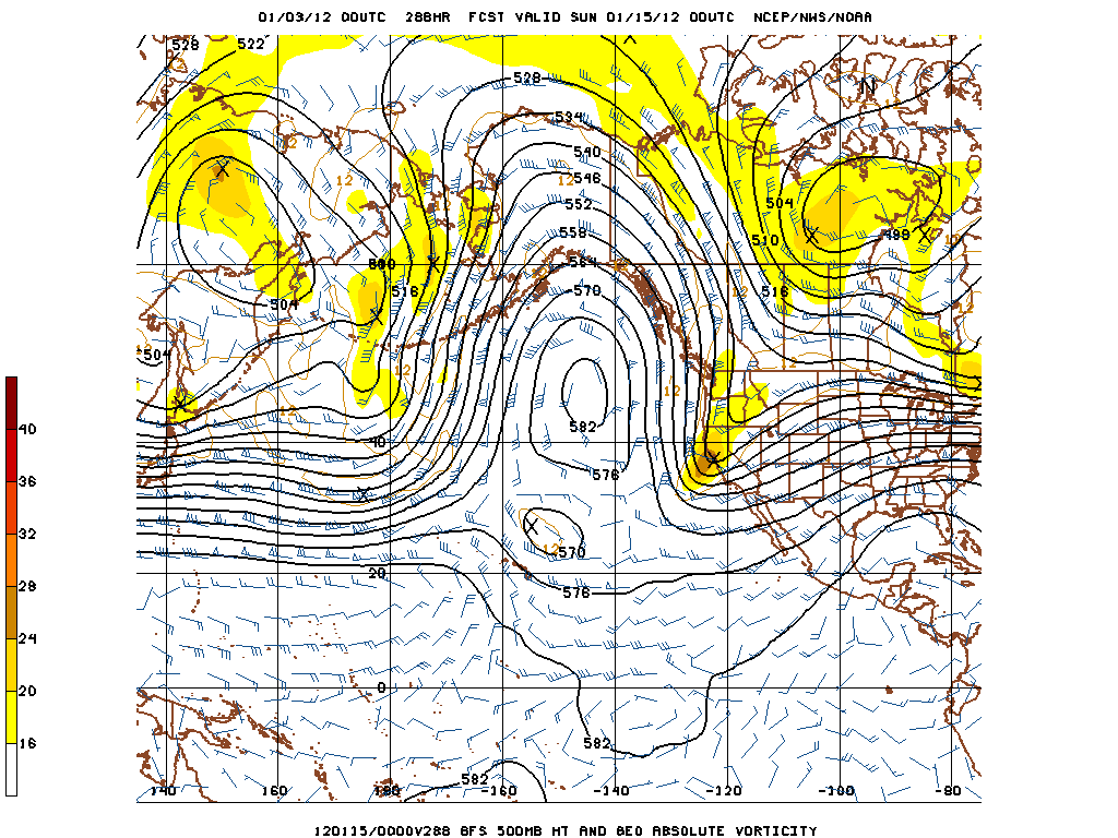
The question, of course, is how long this present very prolonged dry spell will continue. The answer, in short, is that it will last at least another 1-2 weeks. There are not, at present, any compelling indications of a major longwave pattern shift in the near future. In fact, it appears that the persistent East Pacific ridge will strengthen in the coming days, bringing balmy conditions to much of California with continued dry and stable weather. The MJO–which in most winters is a fairly significant indicator of impending westerly jet incursions–appears to be rather unimportant this year in forcing pattern changes (which is not extremely surprising given prevailing La Nina conditions).

The only interesting feature in the extended forecast models at the moment is some early indication of a potential retrogression of the ultra-persistent block over the Pacific. If this actually does occur, it could shift the mean trough axis towards the West Coast, though because flow would be highly meridional and northerly over California conditions could become dramatically colder and unsettled but ultimately result in little precipitation due to the cold continental origins of the source airmass. In any case, this possible development is still far in the future–and extremely dry patterns such as the present one are notoriously persistent. For now, we can only hope that the pattern in early 2012 becomes more promising than the one that closed out 2011…
© 2011 WEATHER WEST
Discover more from Weather West
Subscribe to get the latest posts sent to your email.