A quick blog update amid shifting conditions
I suspect that more than a few of us, at our busiest and most chaotic moments, have exclaimed to exasperated friends and colleagues that we “wished there were two of us to help share the load!” Well, in this present moment, I am not sure a single clone would suffice. ?
In any case, this is my way of saying that this blog post will be relatively brief–but I do think it’s important to offer at least a succinct update as this week’s expected weather has changed significantly in NorCal vs expectations from over a week ago when I wrote the last blog post.
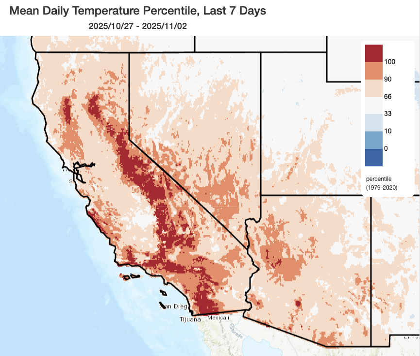
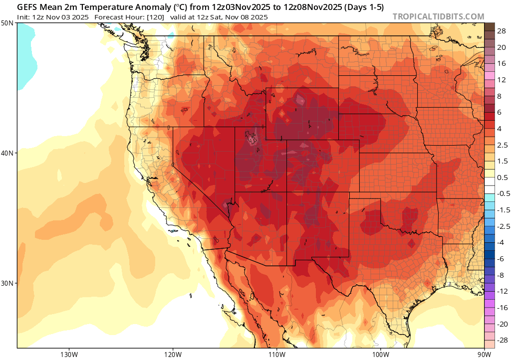
California did indeed see its “pumpkin ridge” (as some Weather Westers in the comments section have dubbed it), and it brought an episode of pretty notable and locally record-breaking heat to parts of California and the West over the past week. Much of SoCal saw the mercury rise well into the 80s and 90s, with a fair number of daily records set. Mountainous areas in both northern and southern California were exceptionally warm last week, with some places also setting records. The anomalous late-season heat extended all the way eastward to the Rocky Mountain Front Range, where Denver experienced its warmest November day on record. And there has been an uptick in wildfire activity, once again, in SoCal–though none of these have been particularly consequential.
But this ridge, at least on its northern flank, now appears to be less persistent than had originally been indicated by model ensembles 7-10 days ago. In fact, NorCal may see a fairly substantial storm Tuesday into Wednesday. Read on below!
Substantial storm associated with strong atmospheric river in NorCal Tue into Wed!
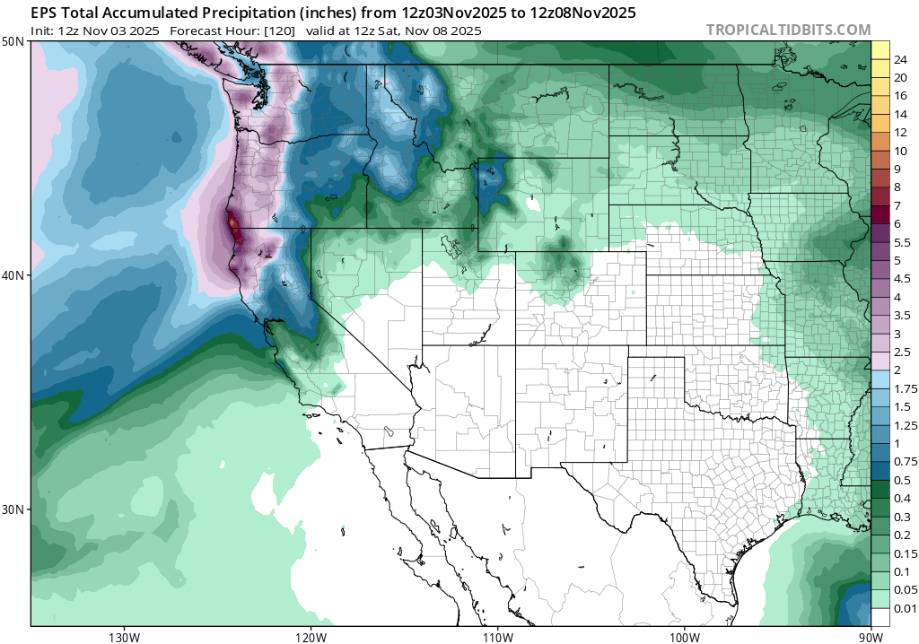
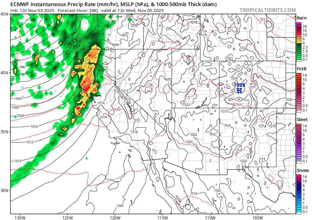
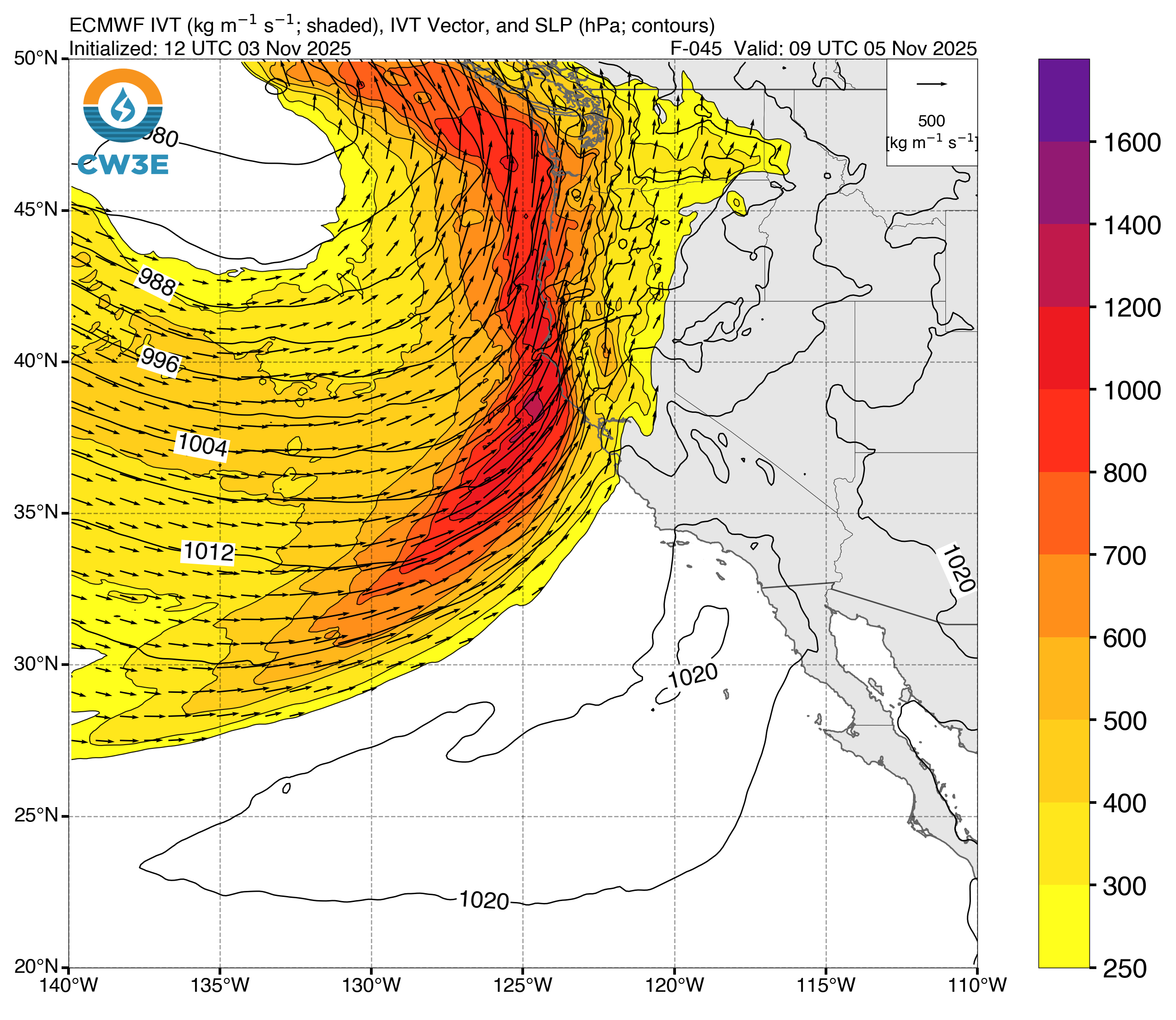
The wet north-dry south precipitation “dipole” I mentioned a week ago will still be in full effect for the next week, and perhaps into mid-Nov. But the dipole now appears to be a solid 100-150 miles farther south than earlier anticipated–and this has substantial implications for northern California even as southern California continues to be dry and mild. A substantial storm is now expected from later Tuesday into Wednesday across most of northern California. It will be associated with a strong–perhaps even very strong–atmospheric river along the North Coast that will be supported by extremely moist air and decent dynamic lift.
Along the North Coast, widespread heavy rainfall and some strong gusty winds are likely. A surface low will likely spin up fairly close to the coast, amplifying wind gusts along and ahead of a strong cold front. Concurrently, a strong atmospheric river will develop as the combined result of very moist air (boosted, once again, by the vast region of anomalously warm offshore and nearshore ocean surface temperatures) and a strong low-level jet. In northwestern California, this will be a notable early-season storm and winds may be strong enough to cause some local damage (especially to deciduous trees that still have their leaves). Rainfall will be pretty heavy and may fall in an especially intense burst around the time of cold frontal passage, but flood risk will mainly be confined to “nuisance type” given the lack of antecedent rainfall and the lack of a heavy follow-up rain event later in the week. Still, this will be a fairly dramatic cold frontal passage–especially given the shift in the forecast from last week at this time.
This storm will also bring notable rain and wind at least as far south as San Francisco, and probably at least a little rain as far south as Monterey Bay or so. In the SF North Bay and possibly also central Bay Area (as well as inland points eastward), a relatively brief period of heavy rainfall along with fairly strong and gusty winds are likely on Wednesday morning. The main impacts will probably be road and air travel related, with a messy morning commute but relatively little risk of flooding (beyond some relatively modest urban/street inundation) or wind damage (though here again, along coastal areas and in the hills, winds may be gusty enough to cause some problems in places where deciduous trees have not yet lost their leaves).
This storm will also bring at least the possibility of isolated thunderstorms, which may be associated with a fairly intense band of downpours and gusty winds along the cold front itself. In the Sierra Nevada, this will be a pretty warm and wet system–rain will fall to high elevations (8k ft and above), with snow accumulations only occurring at the highest elevations (likely above pass level for the most part).
SoCal should remain completely dry this week, with warmer than average temperatures continuing (though that may be under partly to mostly cloudy skies at times).
Looking ahead to mid-month: Despite a transient ridge popping up in between systems and bringing overall near to above average temperatures in most of California, conditions may be somewhat more unsettled than previously expected and some additional light to moderate rainfall is possible during this period. There is higher uncertainty in SoCal vs NorCal, and thus the range of outcomes is wider–but there is at least a chance for more significant rainfall in SoCal as we head toward mid-month (so about ~10-11 days from now). How that plays out remains TBD, and it could potentially remain dry down south, but that’s a story for next week’s livestream!
Find me online, and maybe even in person, later this week…
While I won’t have the time for a dedicated YouTube office hour this week, that’s because I’m going to be frantically running around between various virtual and in-person events–so hopefully you’ll catch me there!
First, I just recorded a brief (~10 minute) long video response to the much-discussed Bill Gates climate change memo from late October. If you want to know my thoughts, check out my various written social media threads or my YouTube monologue here.
Then, if my YouTube monologue hasn’t whetted your appetite for billionaire philanthropist-related climate change discussion, or if you want to hear a wider range of views on the subject (always a good idea, in my opinion!), you can catch me live tomorrow (Tuesday Nov 4 at 1:30pm PT) at a special Covering Climate Change-hosted event discussing the Gates climate memo (I’ll be joined by several other climate scientist colleagues, as well as former LA Times journalist Sammy Roth). This virtual event will be open to the public following online RSVP, and also recorded for subsequent viewing.
And finally: I will be traveling to Irvine, California on Wednesday (Nov 5 at 7pm PT) to deliver an evening lecture on hydroclimate whiplash and extreme events at the National Academy of Sciences’ Beckman Center. This event is also open to the public, both virtually and in person following online RSVP, and will again be recorded/made available after the fact. See some of you there!
Discover more from Weather West
Subscribe to get the latest posts sent to your email.