Coast-inland temperature persists across CA, with a mild start to July in most spots
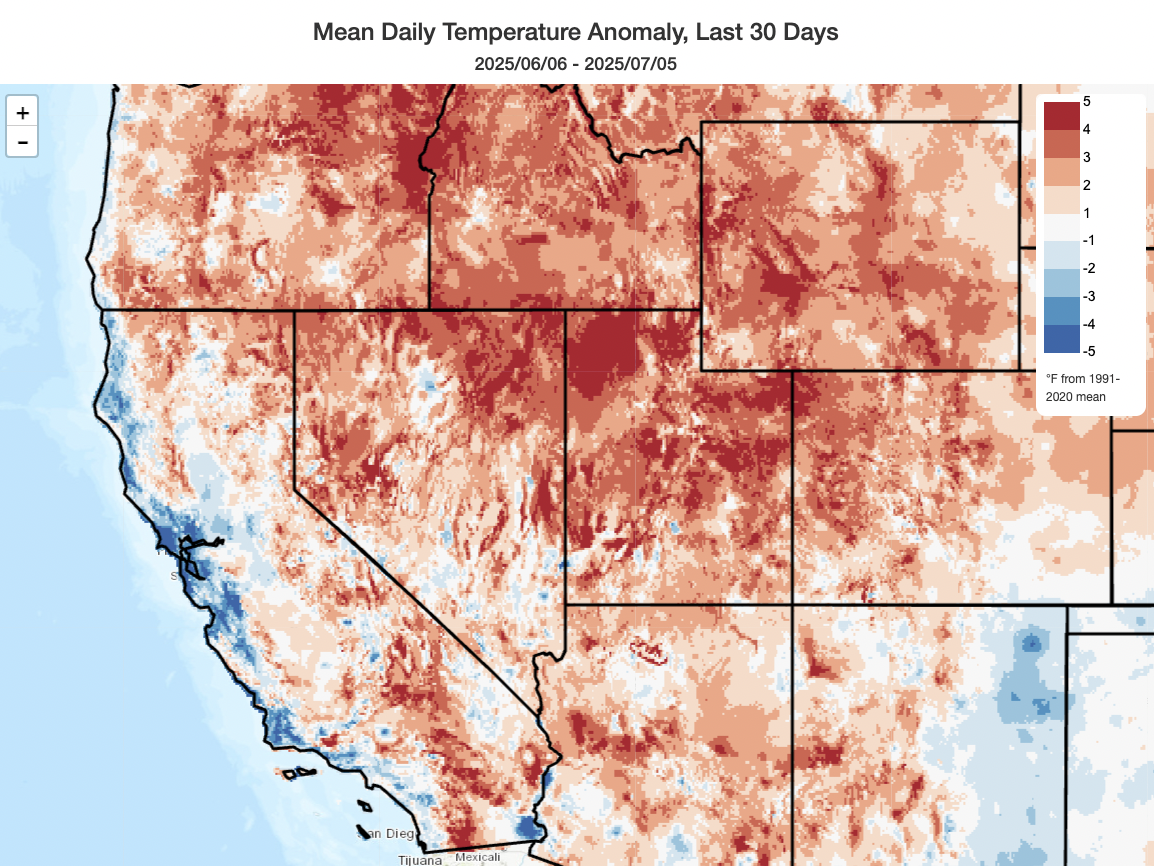
Well, that anomalously cool coast-hot inland dipole pattern (in which the usual cool coast-hot inland pattern was amplified even more than is usual in summer) has continued since last update–and, at this point, a bit later into the still-young summer than seasonal ensembles had originally suggested. The last couple of weeks, in particular, have featured relatively mild and sometimes unsettled weather–with multiple episodes of (mainly) mountain thunderstorms. Those thunderstorm episodes have themselves turned out to be rather consequential, and were associated with both the deadly recreational boating tragedy on Lake Tahoe and also an outbreak of lightning-sparked wildfires in California’s northern mountains in recent days. Several of these fires have now burned at least a few hundred acres–not huge fires by contemporary standards, but an indication that conditions even in higher elevation forests have become drier in recent days and that subsequent ignitions amid renewed heat will likely become more active than others so far this season. Notably, there has been active fire behavior within high-intensity fire footprints from as recently as 2018 (i.e., the Carr Fire near Redding).
In addition, the largest California wildfire of the season so far–the Madre Fire, which has burned around 80,000 acres across remote portions of the Los Padres National Forest and adjacent Carrizo Plain–is currently burning in Southern California. This fire is notably larger than either of the pair of devastating January 2025 wildfires in Los Angeles (which destroyed or damaged nearly 20,000 structures and killed dozens with a collective footprint under 45,000 acres) yet has (as of this writing) burned few if any structures. (Among other things, this clearly illustrates just how imperfect a metric “acres burned” really is when it comes to describing the impact of wildfire.)
High confidence in notable, though not extreme, heatwave later this week
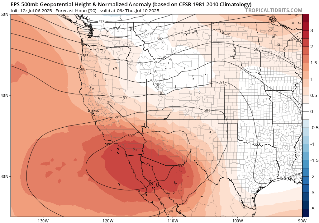
The present weak cut-off low pressure system near the CA coast will quickly be replaced by a double-barreled ridge later this week, with one axis centered over the Desert Southwest and SoCal and the other across the Pacific Northwest. This will result in a fairly prolonged period of above average temperatures for the vast majority of CA, though I am not currently seeing much evidence for an “extreme” heat event (more of a “slow simmer”).
By Thursday or Friday, much hotter than average temperatures will be widespread everywhere in California except (again) along some immediate coastal portions of NorCal. This means that most of the Central Valley, for example, will be well into the triple digits and in some cases will approach/exceed 110F. Right now, it does not appear that any serious temperature records are at risk–but it will nonetheless be quite hot inland once again, and temperatures will remain warm well into the night (especially in middle-elevation thermal belts).
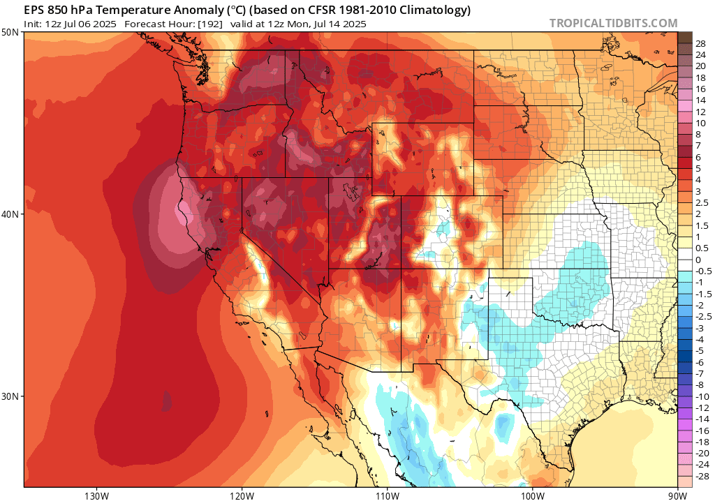
There is, for what it’s worth, an apparent slight disconnect between the magnitude of surface temperature anomalies predicted by models for this upcoming heat event and the magnitude of temperature anomalies aloft. In other words: temperatures at middle levels of the atmosphere look considerably more anomalous, in relative terms, than do surface temperatures in the same locations. I am not quite sure why that’s the case here, though it may be because the ridging aloft won’t be quite strong or persistent enough to cause strong subsidence, bringing the full magnitude of those warm temps to ground level. But there’s also a slight chance the models are underestimating the magnitude of surface warmth in this pattern, so it’ll be worth keeping an eye on whether surface temperatures start trending warmer as the event draws nearer.
Fire weather, especially away from the coast, will be elevated during this period due to hot temperatures, low humidity, and occasionally breezy winds. However, I do not foresee any extreme fire weather on the horizon due to lack of record temps, no especially strong winds, and no obvious dry lightning events. As recent fires have demonstrated, though (especially in Southern California) vegetation is now more than dry enough at lower to middle elevations to sustain fast-moving fires when ambient weather conditions are conducive. So during this period, I would expect to continue to see a steady escalation in fire activity on a path toward above-average activity by Aug-Sep (both in California and more broadly throughout the West).
Uncertainty regarding (possible) renewed/more intense heat in late July
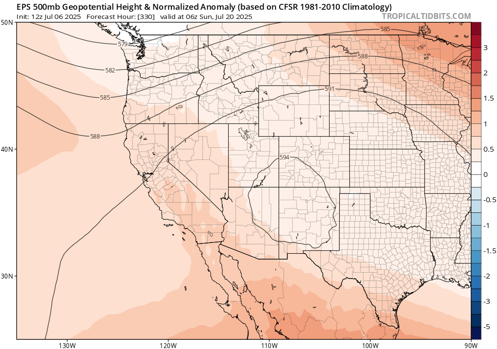
There is a bit of a tug-of-war going on in numerical model ensemble land right now regarding the mid-late July pattern over the northeastern Pacific Ocean. The current distribution across ensembles is rather bi-modal, with slightly more than half of all members indicating a substantial re-strengthening of the western flank of the robust Four Corners ridge and therefore another potentially prolonged and even more widespread round of anomalous California summer heat. In fact, a few members in this camp depict rather extreme (i.e., record-breaking) heat for interior portions of California–though most are merely in “major heatwave” territory.
However, slightly less than half of model members either show a greatly muted return of anomalous ridging or its opposite–the re-emergence of the seemingly “sticky” weak trough over the Pacific Northwest that has dominated California weather over the past few weeks. This would certainly prevent a major heatwave, and likely keep temperatures closer to average during mid-late July.
Right now, it’s not clear which outcome will win. There is slightly more support for the “enhanced ridging and very hot weather” scenario–but given the bi-modality of model predictions right now, that’s not something I’d put a lot of stock in. So, this is probably one of those “wait and see” windows.
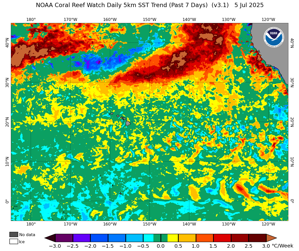
Two things do appear likely during this window, though, regardless. There is now ensemble agreement of a pretty anemic start to the Southwest Monsoon over the next couple of weeks, especially on its western flank. So the odds of major westward incursions of monsoonal moisture appear to be fairly low at least over the next 10 days or so regardless of which scenario plays out. Also, and notably, near-shore ocean temperatures have warmed considerably in recent days and are now well above average in the SoCal bight (and are continuing to warm from below average along the central/northern CA coastlines). This trend will likely continue, reducing the temperature dipole between inland and coastal regions (and coastal SoCal may start to be warmer than average by default, even in the absence of pronounced ridging, as relatively warm ocean waters persist). The SST warming off the NorCal coast will continue if the ridge pattern wins out, but will likely level off in 7-10 days if it doesn’t. But it does look like the persistent upwelling from prolonged northwesterly flow along the coast is likely to fade, likely allowing the coast to warm noticeably more than it has during recent weeks.
YouTube live office hours on Mon, Jul 7, at 10am: Special session on Texas floods
On Monday at 10am Pacific Time, I’ll host a special YouTube livestream focused primarily on the context of the devastating Texas floods–including both the meteorological setup, the geographic and societal context surrounding why this event became so deadly, and how this all intersects (or not) with various funding and personnel cuts to federal government weather, climate, and disaster preparedness/response entities. I’ll also offer some direct debunking and myth-busting surrounding various viral theories surrounding the event and its aftermath, and also reflect on why I am especially concerned about the rapid increase in extremely heavy convective (thunderstorm) rain events in a warming climate. I will also–at the end of the session–discuss the upcoming California heat. See you then!
Discover more from Weather West
Subscribe to get the latest posts sent to your email.