Intense, prolonged, and potentially record-breaking June heatwave
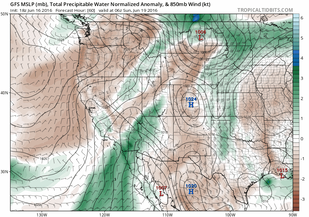
An amplified atmospheric configuration: Pacific low; desert high
After an extended period of quiescent weather in California, an unusually amplified atmospheric pattern will bring a potentially prolonged period of very hot conditions to a large portion of the American Southwest.
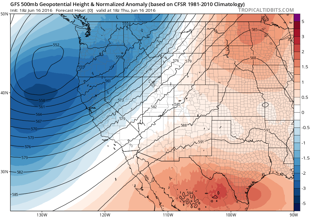
As of this writing, a very deep and cold (for June) low pressure system was situated over the far eastern Pacific Ocean just offshore of the West Coast. This slow-moving system has brought very active weather to the Pacific Northwest in recent days–including heavy rainfall in British Columbia, thunderstorms and very late-season snowfall in the Cascades, and even some frozen precipitation in California’s own Sierra Nevada. Some showers may yet occur as far south as the Bay Area and Sacramento region later on Thursday, though precipitation in these areas is expected to be minimal.
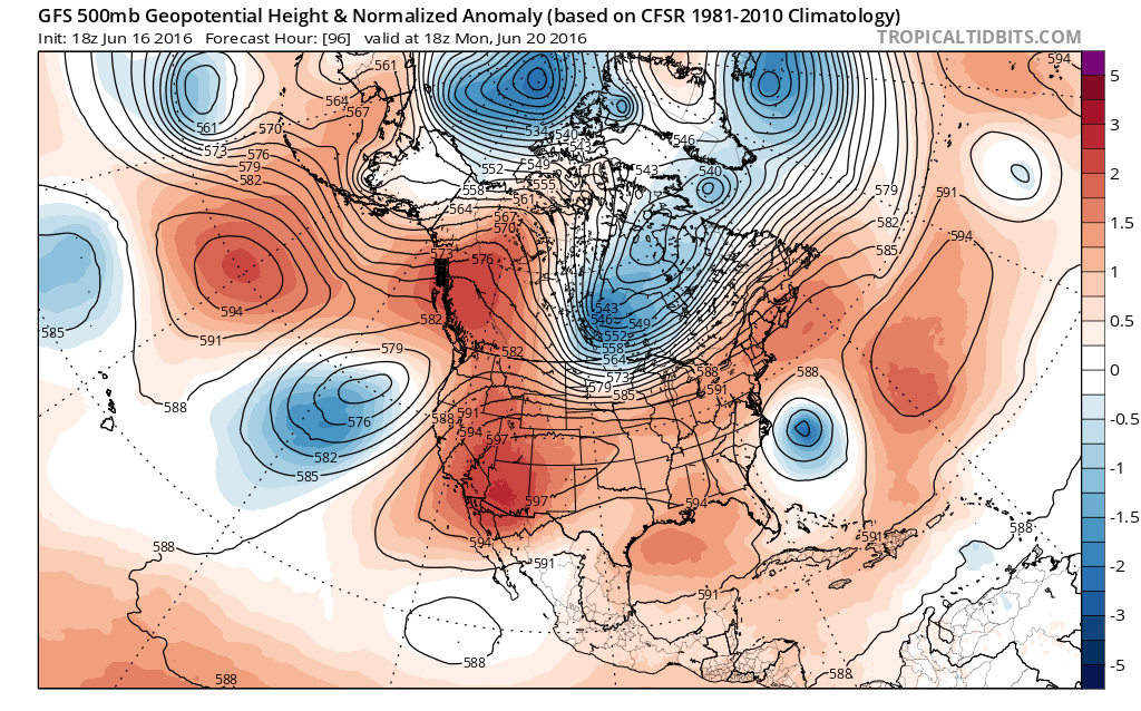
This won’t be the last we’ll see of this deep low, however. Instead of dissipating or moving eastward with the prevailing winds, this system will likely “retrograde” back toward the west and southwest over the next few days–setting up shop well southwest of Central California over the weekend. Meanwhile, an increasingly strong region of high pressure will build and expand westward from the Desert Southwest. California will be situated in a region of warm southerly/southeasterly flow between these two anomalously strong systems–allowing a warm desert airmass to slowly encroach upon coastal areas and advecting an increasing amount of mid to high-level subtropical moisture into the state.
Extreme, possibly record-breaking heat possible across a wide region
While there is still some uncertainty regarding exactly how hot it will get–and precisely where records are most likely to be broken–it is now abundantly clear that numerous locations throughout southern Arizona , Nevada, and California will exceed (and in some cases shatter) existing daily high temperature records. In fact, the magnitude of the upcoming ridge and associated heatwave may be sufficient to threaten a handful of all-time monthly temperature records. The magnitude of the coming heat is made all the more remarkable given that mid-June is not climatologically the warmest part of the calendar year in this part of the world, where temperatures typically peak later in the summer (or even in the autumn, closer to the coast). In the lower deserts of southern Arizona (including Phoenix) and far southeastern California, this likely means temperatures approaching 120 degrees. Most of the major urban centers in Southern California will probably see temperatures near or above 100 degrees on consecutive days (except along the immediate coastline), which further elevate already extreme fire danger and possibly threaten the local/regional electricity grid. As an increasing amount of subtropical moisture begins to move across the region by early next week (see below), even slight increases in surface dewpoints will make for very warm (and uncomfortable) overnight low temperatures–further exacerbating the risk of heat stress.
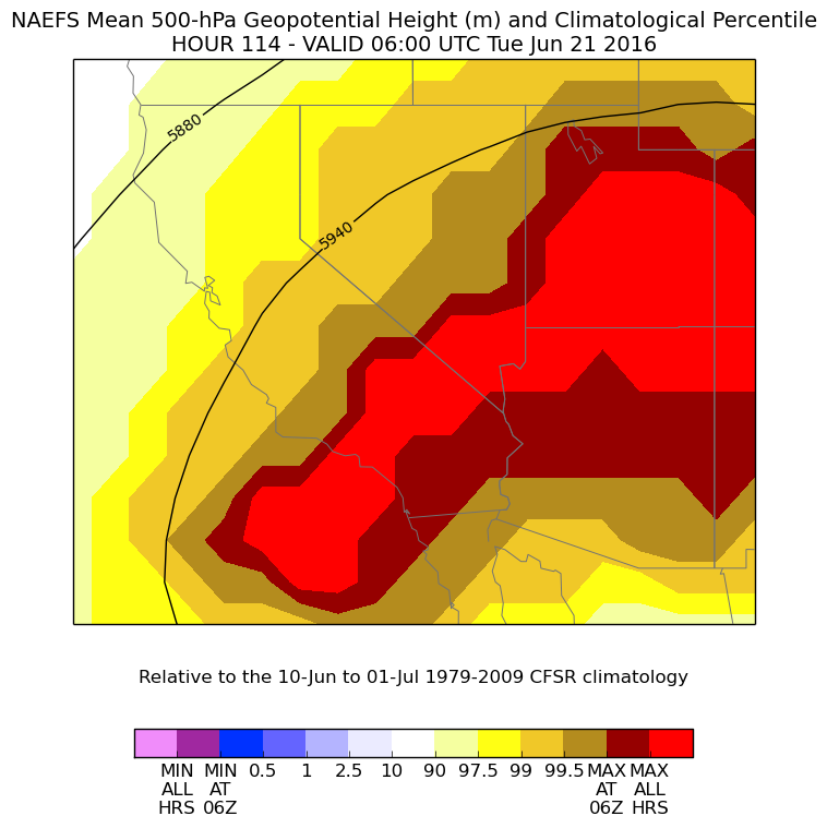
Unfortunately, this very hot weather regime will probably be here to stay for quite some time. In fact, latest weather model ensemble guidance (from both GFS and ECMWF) suggest that the anomalously strong Southwestern ridge will persist in some form for at least the next 10 days, and perhaps through the end of June. There may be some temporary relief from the most extreme heat in some areas by Tuesday or Wednesday of next week, but it does appear that a resurgence of extremely hot temperatures may occur once again by the end of next week.
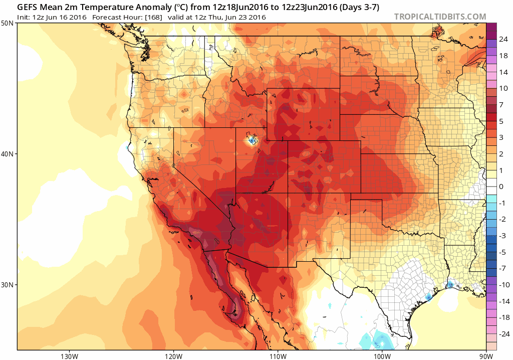
This second surge of heat next week may be focused a bit further north, expanding to include most of Northern California as well. The Central Valley may be particularly affected, and the cities of Bakersfield, Fresno, Sacramento, and Redding may all endure a prolonged streak of days with temperatures exceeding 100 degrees. If the GFS is to believed, there may even be a few days near or above 110 degrees in these inland valley cities next week. The magnitude of the mid-tropospheric ridge for much of next week is expected to be essentially unprecedented for June, so it is possible that the eyebrow-raising temperatures coming out of recent model guidance might actually come to fruition. While it will also be hot in the Bay Area, the risk of extreme heat there will be somewhat mitigated by a lingering marine influence (though there is some potential for temperatures to be much warmer than forecast, should offshore flow be slightly stronger than expected).
Needless to say: this upcoming heat event is one to take seriously, particularly given its expected longevity and the relative lack of relief expected next week.
Subtropical moisture: increasing risk of elevated convection, dry lightning, and associated fire risk
The prolonged southeasterly flow over California next week will bring an increasing amount of subtropical moisture in the middle to upper levels of the atmosphere. This setup strongly resembles that commonly associated with moisture surges later in the summer associated with the North American Monsoon, which bring thunderstorms mainly to mountain and desert regions but occasionally also to regions closer to the coast. Recent model runs have increased the amount of moisture during the middle to late portion of next week across much of California–meaning that some elevated convection (and perhaps some dry or mostly dry thunderstorms) may be possible at times nearly anywhere in the state in the 5-10 day period.
It’s virtually impossible to be more specific at this time, as any convection would probably be associated with relatively subtle atmospheric perturbations that are difficult to discern more than a couple days in advance. The lightning potential next week will certainly be of considerable concern from a fire weather perspective, given both the persistence of what will by then be an ongoing severe heat wave and the broader context of California’s still extremely drought-stressed vegetation.
As always, follow Weather West on Twitter for more frequent micro-updates on California weather and climate in real time!
Intense, prolonged, and potentially record-breaking June heatwave Read More »