Overview
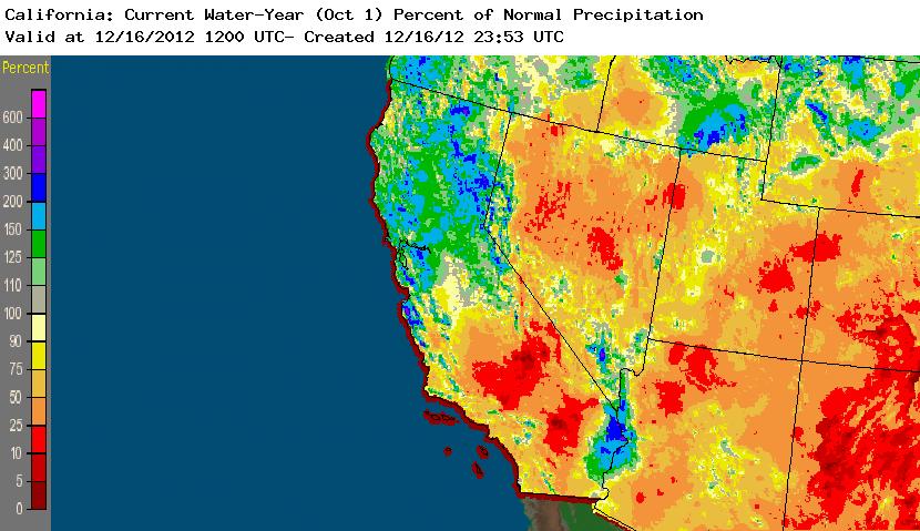
Winter has gotten off to a pretty active start across much of California. A series of major storms–including an impressive atmospheric river event–brought some flooding to Norcal at the beginning of December, but fortunately a longwave pattern shift brought an end to the persistent heavy rains and prevented some of the more serious hydrological problems that had been feared. This series of storms have pushed Water Year-to-date precipitation totals well above normal for some parts of Norcal, while Socal remains modestly below average for this time of year. The flow over the far Eastern Pacific and California has once again become very active and is expected to stay that way for the foreseeable future.

Short Term
An ongoing series of cold storms has been impacting mainly the northern portions of the state for the past several days. Cold air trapped in the Central Valley behind one of these systems brought accumulating snow to the Sacramento Valley floor near Redding on Saturday and as far south as Red Bluff on Sunday morning, which is a pretty unusual occurrence. Additional snow could fall locally between 500-1000 feet with the midweek storm, and snow levels elsewhere will also drop to fairly low levels (perhaps a bit below 2000 feet as far south as the Bay Area). However, precipitation is expected to be limited to widely scattered convective showers by the time the coldest air arrives, so I doubt there will be more than an inch or two of snow in some isolated lower elevation locations. Elsewhere in Norcal, periods of cold rain will continue for much of the upcoming week, and rain totals will start to add by by Thursday and Friday. Socal will see some precipitation, but it will be considerably lighter than in the north.
Long Term
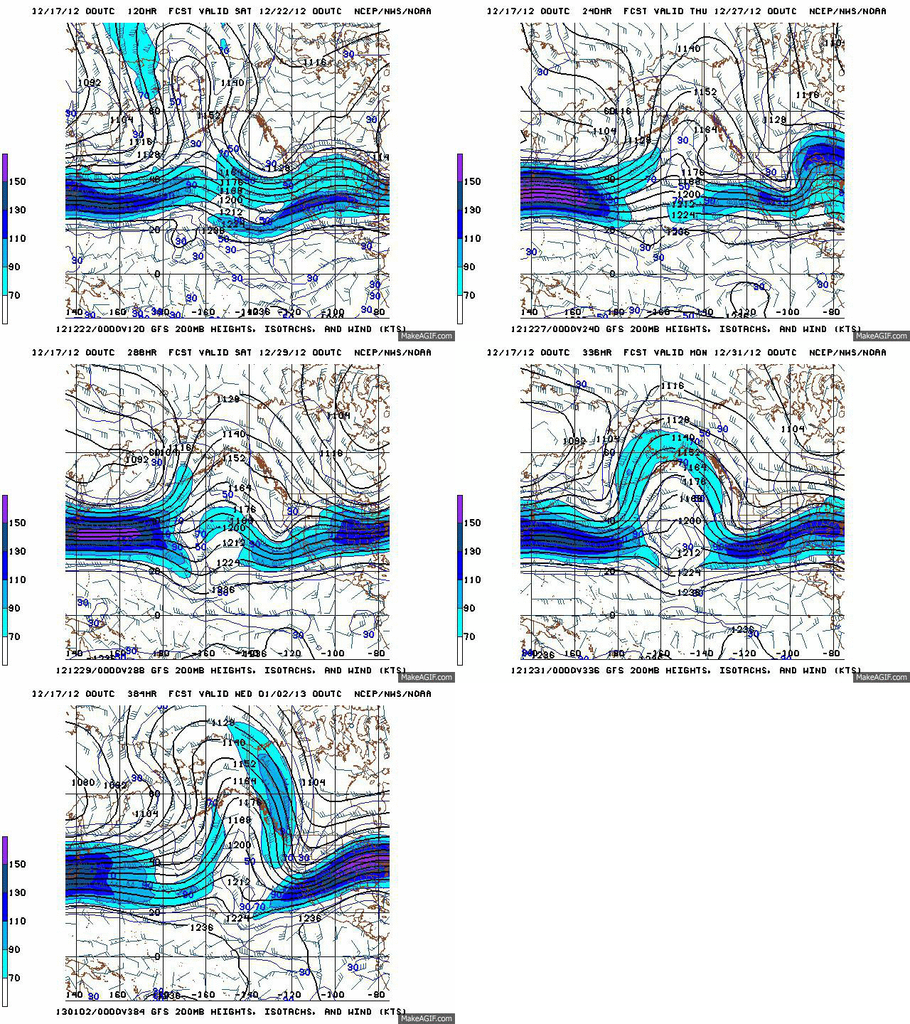
The numerical models have been struggling tremendously with the current and near-future pattern. The prognosis beyond day 5 has been changing pretty dramatically from day to day, but the screaming message is this: an already active pattern is likely to become even more active by next weekend and to stay that way through the end of the month. The details are very fuzzy at this point, but today’s GFS and ECMWF runs are keying in on potentially strong storm systems on day 7/8 and again on days 11/12. It remains to be seen if these features still exist in tomorrow’s runs, but regardless I expect a very wet pattern to continue for the foreseeable future.

It appears that a strong high pressure region is trying to set up shop in the Central Pacific, far enough to the west of California that the persistent equatorward flow in the downstream trough will be offshore. This is a very favorable pattern for cold and moist systems from the Gulf of Alaska to impact California. While such a setup makes moist subtropical connections less likely, it increases the potential for rapidly deepening surface lows to impact the CA coast directly (bringing occasional strong winds and intense rains) and also opens the door to the possibility of low snow level events if retrogressive flow over western Canada sets up. The 00Z GFS depicts a remarkably stable and increasingly high-amplitude block straight through the end of the calendar year. Stay tuned!
© 2012 WEATHER WEST
Discover more from Weather West
Subscribe to get the latest posts sent to your email.