Brief window of elevated wildfire potential today in NorCal
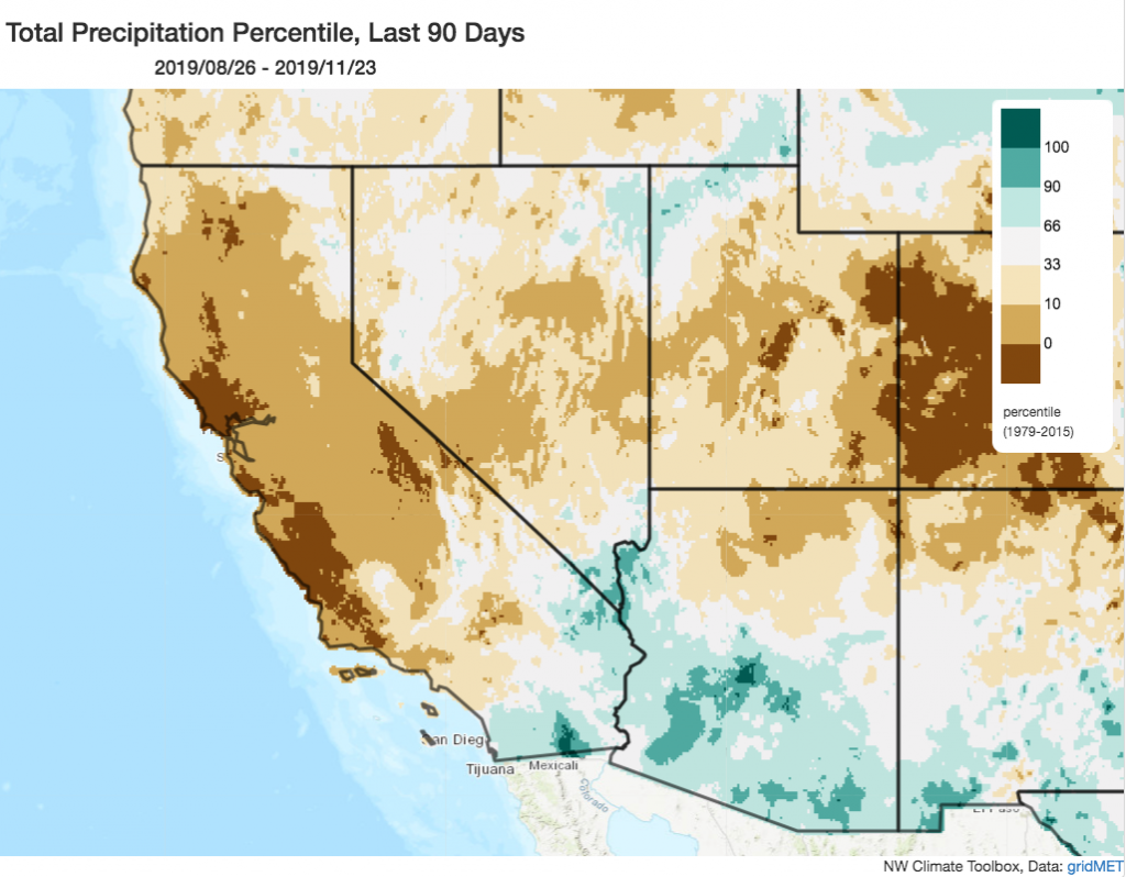
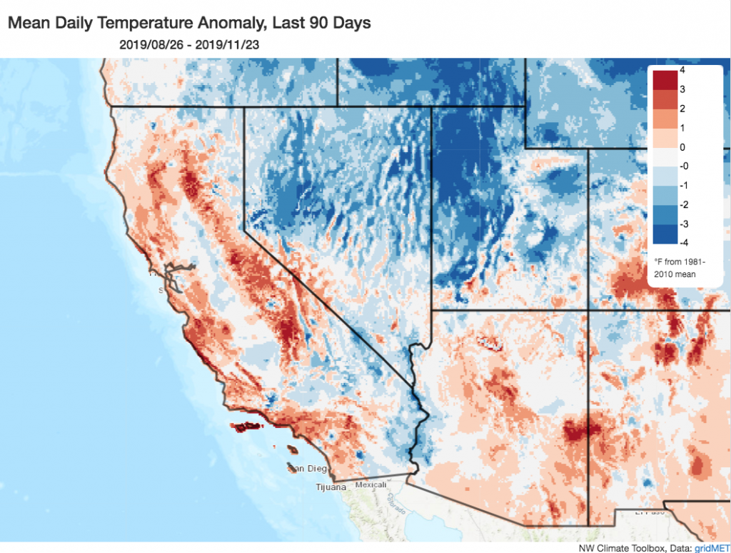
To start off what will ultimately become a pretty wet and wild weather week throughout California, the first item to contend with will be…briefly critical fire weather conditions across most of northern California, including the Sierra Nevada foothills and the Bay Area (yes, on *November 25*). For folks in SoCal who might need a reminder: most of Northern California has still not seen measurable precipitation since mid-May (since the precipitation event last week missed the northern half of the state). As a result, much of coastal northern and central California is currently (as of today) experiencing its driest autumn-to-date period on record. In fact, much of California would likely have experienced its driest autumn on record–save for the widespread precipitation event that will arrive just in the nick of time (i.e., the last 4 days of the 3-month Sep-Nov season). Interestingly, despite the relative coolness in early autumn, recent late-season heatwaves have pushed season-to-date temperatures above average across most of the state (although, compared to recent record warm autumns, this was still a relatively “cool” fall by recent standards).
Thus, vegetation continues to be at summer-like (and record for the date) dryness across most of NorCal, where gusty northerly winds are expected to mix down to the surface today along with fairly low relative humidities. No PG&E PSPS are expected with this relatively brief event, which will last from around the time of publication of this post through this evening. Hopefully we can make it through what may effectively be the last 24 hours of fire season without any additional significant fires!
Tuesday transition to widespread rain & wind
Winter arrives…tomorrow afternoon across most of Northern California (and late Tuesday into Wednesday for portions of SoCal that didn’t see much rain with the last event). A rapidly-deepening low pressure system will approach the far NorCal/Oregon coastline later on Tuesday–dragging a fairly strong cold front from north to south across the entire state.
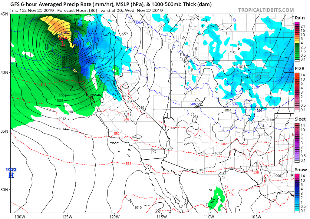
The low making landfall near the OR/CA border will be pretty impressive in its own right, technically meeting the meteorological definition of a “bomb cyclone” as it will deepen by more than 24mb in a 24 hour period. (Now, to be clear: the term “bomb cyclone” is a real scientific term that has been widely misused and misunderstood in the past couple of years in the media. It refers specifically to rapidly-strengthening low pressure systems, which tells us little about the absolute strength of the storm or its potential impacts. In this case, hurricane force winds (sustained at or above 74mph) will occur over the open ocean west of the far NorCal coast, but winds over land will be less extreme (with local gusts of perhaps 65-70mph along the far North Coast, which is a decidedly windy place during winter storms) This low pressure system and its associated cold front will bring a burst of fairly heavy rain and gusty winds (perhaps as high as 50mph or so as far south as the Bay Area) to most lower elevation parts of NorCal late Tuesday, and heavy snowfall to the mountains. The weakening cold front will likely hold together to bring at least light rainfall to SoCal, as well.
Snow at relatively low elevations and thunderstorms possible
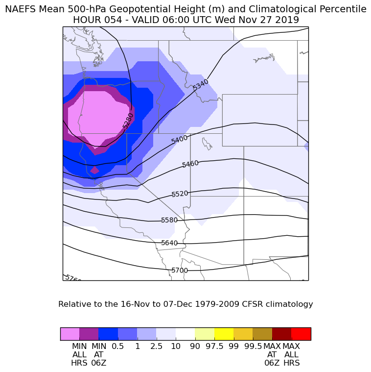
In some ways, the most interesting weather of the week will arrive after the cold front passes through. On Wednesday, the entire state will be under the influence of a very anomalously cold airmass for the time of year. As CA will remain within the broader trough axis, the atmosphere will be quite unstable, with widespread convective showers and isolated thunderstorms statewide. Given the unusually cold airmass for late Nov, with 850 mb temperatures as low as -3 or -4C nearly statewide, accumulating snowfall is likely down to 2,000 or 2,500 feet nearly statewide–which includes essentially all of the major travel corridors in California (on Thanksgiving week, no less!). In far NorCal, snow levels will be even lower–perhaps down to 1,500 feet locally. In fact, the far northern end of the Sacramento Valley could even see a bit of light snow (around Redding, between 500-1000 feet in elevation).
This is the kind of pattern that could bring some significant snow accumulation to well-traveled roads between 2000-3000 ft that don’t typically experience it. Additionally, the cold and unstable airmass will be conducive to locally strong thunderstorms dropping accumulating small hail even at sea level, so that could cause additional travel disruptions. At at the highest elevations of the Sierra Nevada, snow accumulations may be measured in feet rather than inches.
More precipitation likely by next weekend
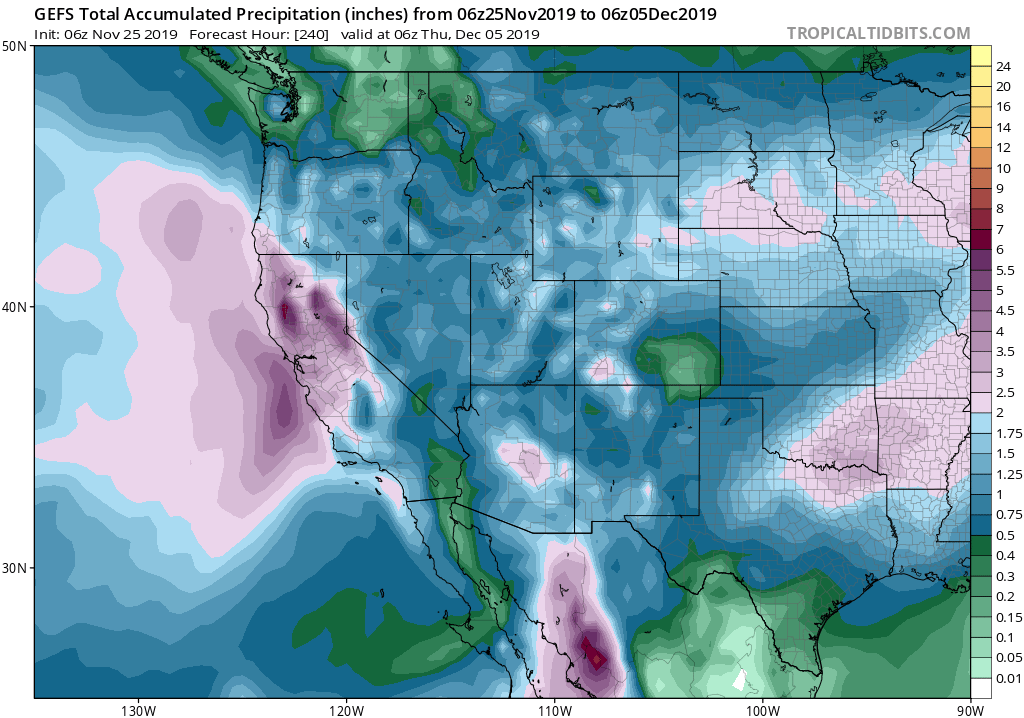
Thanksgiving itself actually looks fairly dry across most of the state. But more precipitation is possible next weekend. Right now, there is some uncertainty whether this will be a pretty minor or rather significant rainfall event in some areas (i.e., a possible atmospheric river). Until the potential event draws closer, it’ll be hard to say more than that.
One thing that I will say, though, is that aside from travel disruptions from the general wet weather (and, likely to a greater degree, the low elevation snowfall potential), this will be a hugely beneficial weather pattern change for California. It seems likely that the upcoming 5 day period of wet and cold conditions will effectively end fire season across the entire state without causing any *widespread* flood concerns, and will help to build a nice early base for the Sierra Nevada snowpack. This is good news, especially given that seasonal forecasts continue to suggest an elevated likelihood of a drier than average winter overall. It’s also worth reflecting on just how prolonged fire season 2019 actually was, despite its relatively slow start during May and June. This year, there was effectively no autumn transition season across most of the state–we’re jumping straight from summer-like to winter-like conditions between today and tomorrow. It is truly extraordinary that we’re still talking about critical fire risk during Thanksgiving week in Northern California–and I think quite a few folks will be thankful for the season-ending rains slated to arrive tomorrow. So enjoy the rain and snow this week!
Discover more from Weather West
Subscribe to get the latest posts sent to your email.