As projected, August was a hot one (in most spots). But where’s the monsoon?
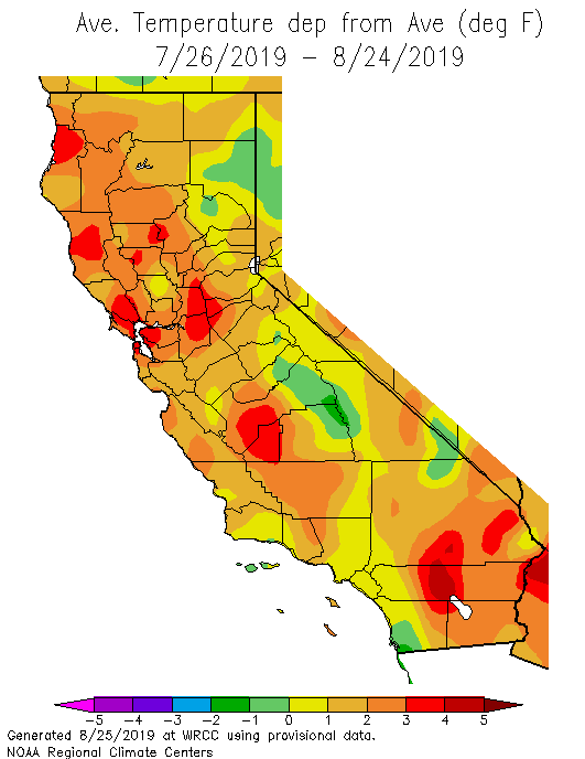
As projected in seasonal forecasts and mid-range modeling outlooks, the past 30 days have been substantially warmer than average across the vast majority of California–featuring several significant heatwaves, especially in north coastal areas. Two somewhat conspicuous exceptions to the otherwise broad warmth were parts of the Sierra Nevada and the far southern coastal strip from Los Angeles southward–so despite the widespread warmth a substantial fraction of California’s population (and mountain vacationers) experienced near-average August temperatures. A similar pattern is currently manifesting itself across the state, with very hot conditions in the northern third and essentially average conditions along the south coast.
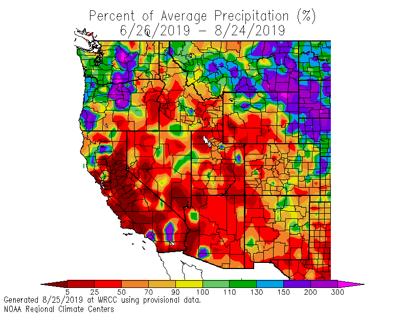
Another notable feature of Summer 2019 is the near-total failure of the North American monsoon (which has been, in the parlance of the Weather West comments section, “a total bust”). This “non-soon” has been among the driest on record across nearly the entire interior West–including in spots which derive a substantial fraction (or even majority) of their annual average precipitation from warm season thunderstorms. While California typically exists at the far western periphery of the typical monsoon zone, even the relatively brief and modest monsoonal incursions that typically occur in the state have been conspicuously absent thus far this summer.
Dry lightning possible across NorCal and Oregon this week
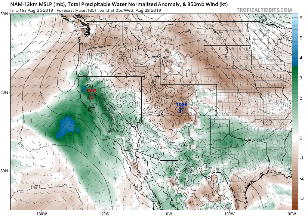
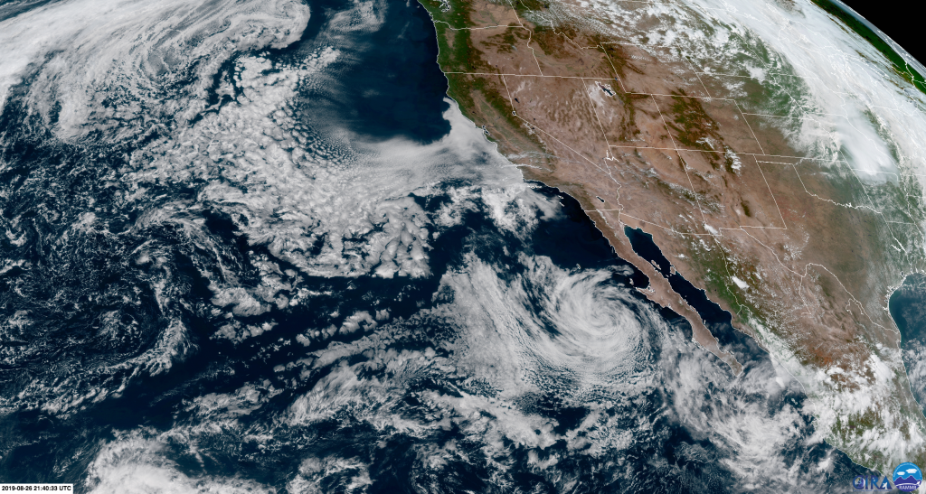
Tropical Storm Ivo lived out its relatively uneventful life west of Baja California over the past week, and has now dissipated into a remnant low (visible as a spin of stratus and weak cumulus clouds on satellite imagery). However, the legacy of Ivo may yet affect portions of California over the next couple of days. A slug of deeper moisture and instability associated with the former tropical storm is currently moving northward off the CA coast, and is expected to make landfall from about the SF Bay Area northward from late Tuesday into Wednesday. This moisture will possibly be associated with a weak circulation in the mid-troposphere–nothing remarkable in and of itself, but a feature that could add just enough vertical lift to spark some high-based thunderstorms. Since the unstable layer is very elevated, any thunderstorms that develop would bring little to no rain–raising the potential for dry lightning and associated wildfire starts. While the risk of dry lightning is modest as far south as San Francisco, the likelihood increases considerably over the northern 1/3 of the state (including coastal and valley areas) and across much of Oregon. In fact, Fire Weather Watches for dry lightning are now in effect across much of interior NorCal and southern Oregon–a region that is currently experiencing a significant heatwave. While these kinds of events are notoriously difficult to pin down more than 12 hours in advance, the potential does exist for a significant dry lightning/wildfire event across far northern California and Oregon over the next few days.
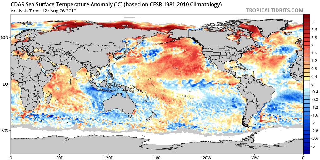
Extremely warm North Pacific ocean temperatures persist
Update on the “Return of the [Warm] Blob” in the North Pacific: it’s still there. A very broad region of highly anomalous ocean surface warmth persists, as it has for at least the past 4-6 weeks. Seasonal models continue to suggest this anomalous warmth will continue for at least the next month or so before slowly moderating. For California, this likely means a continued likelihood of above average temperatures for much of the autumn and perhaps a slightly increased likelihood of ridging along the West Coast. While it may slightly tilt the odds in favor of below-average precipitation this autumn, the precipitation signal really isn’t all that strong and things could still go either way (as opposed to the warm temperature signal, which is strong indeed).
Also, in case you missed it: a nice piece this week in the LA Times on the history of “Cordonazo Storms” in southern California (including my take on the hypothetical set of conditions that would need to occur for a true hurricane to approach California).
Discover more from Weather West
Subscribe to get the latest posts sent to your email.