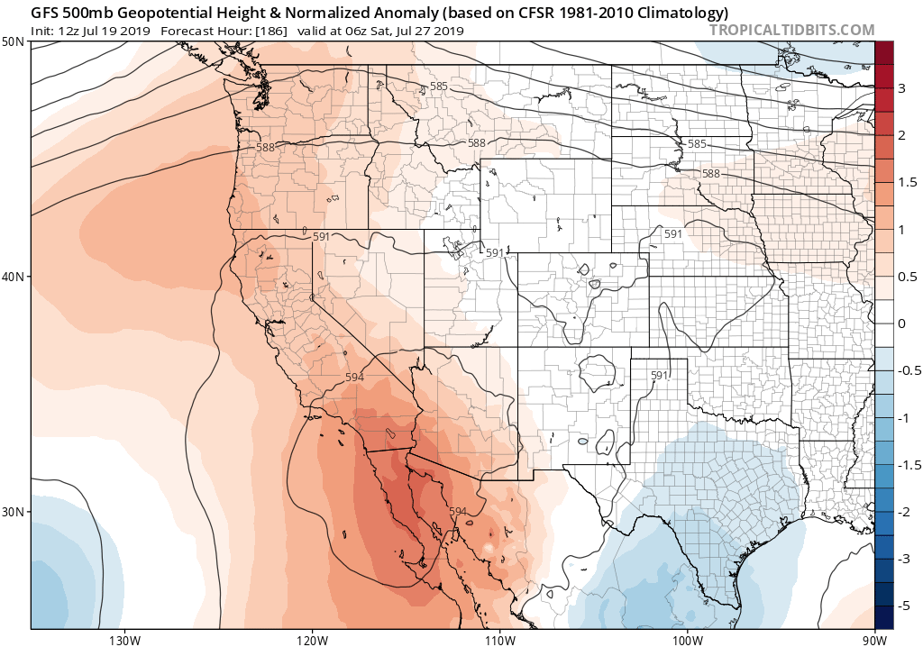
Substantial warming trend as desert SW ridge builds

The first half of July has been relatively uneventful across California, with no big heatwaves nor any significant North American Monsoon-related thunderstorm activity–even over the mountains and deserts. In fact, temperatures have been running near to below average for the month to date in most spots, and it has been especially cool in the Sierra Nevada. Much of this quiescent weather can be linked to the slightly late development of the traditional summertime Four Corners high pressure system–the genesis of which usually precedes the arrival of the monsoon across the Desert Southwest. That seasonal high pressure system has now finally developed across the region, and will continue to build over the coming week.
As the desert SW ridge strengthens and extends gradually westward into California, temperatures will begin an at-first gradual warming trend through this weekend (to near or slightly above average levels), then warm further during much of next week. While extreme heat is not currently anticipated during the next 10 days, a substantial heatwave is nonetheless possible across much of the state in the 5-7 day period (though nothing like the unbearable heatwave currently enveloping the entire eastern 2/3 of the United States). Interestingly, the evolution of temperatures across California this month has been pretty consistent with the CFS sub-seasonal predictions discussed in the last blog post (those forecasts called for cool conditions in the first part of July, gradual mid-month warming, then hot conditions to round out the month).
Monsoonal moisture arrives across southern California
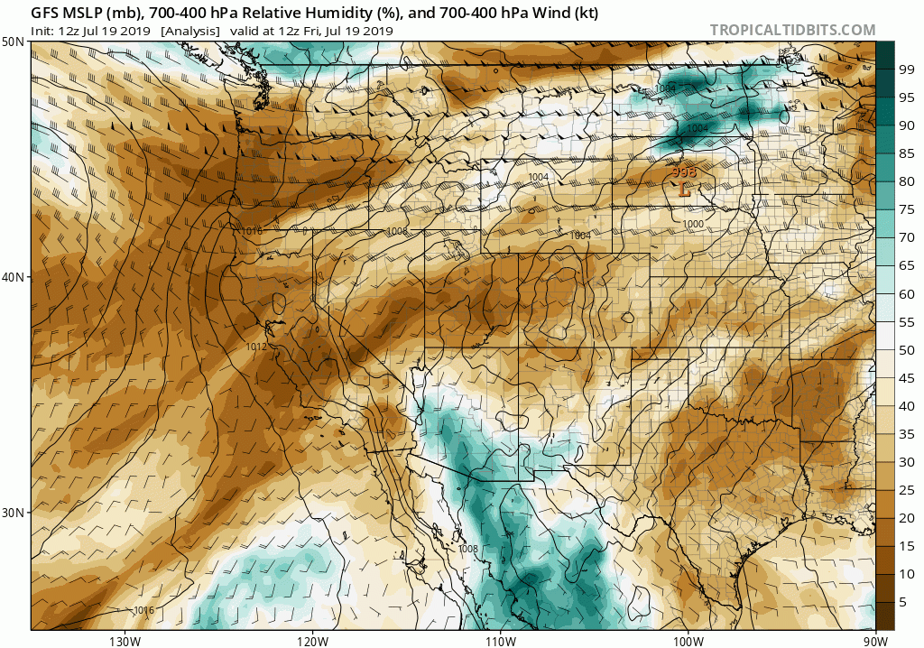
In addition to much warmer temperatures, the building desert SW high pressure system will begin to circulate some mid- and high-level moisture into southern/central California from the southeast beginning later this weekend. Such monsoonal incursions are always hard to predict more than a day or two in advance–since the difference between a sky full of cirrus and altocumulus clouds and a day of widespread thunderstorms hinges on pretty subtle mesoscale atmospheric features. But at the moment, most models are suggesting the potential for a decent and somewhat prolonged surge of moisture across the southern half of the state by mid next week. I would expect, at minimum, lots of mid- and upper-level cloudiness to coincide with the heat, with some mountain and desert thunderstorms also possible. The GFS is currently depicting the potential for a couple of stronger easterly waves to move across Southern California, which could theoretically act as a trigger for some convective activity across coastal areas. At the moment, though, this remains an outside possibility.

“The Blob” returns–a hot autumn to come?
Despite ocean temperatures presently near seasonal average values along the immediate California coast at the moment, ocean temperatures elsewhere in the Pacific have recently soared to far above average levels. (Yes, again.) Nearly the entire North Pacific, in fact, is currently experiencing highly anomalous warmth–extending all the way from Papua New Guinea in the tropics to the Bering Sea west of Alaska.
Two features of note are worthy of discussion from a California weather perspective. First: it appears the North Pacific “Blob” of warm water has now officially returned–and is likely to stick around for quite some time. Coupled ocean-atmosphere seasonal forecasts suggest this region of unusually warm ocean water will persist and perhaps even expand to include the immediate California coast over the next couple of months, and might even stick around through the first half of the winter to come. The most immediate effects for California may be to boost autumn temperatures–especially closer to the coast. Since September and October are already peak season for heatwaves along the immediate California coast, that suggests the relatively cool start to summer in some regions will not be representative of a pretty hot autumn to come. The seasonal models are actually in pretty good agreement that the September-November period will be significantly warmer than average for most of the West. In California, a key question will be: will these projected warm autumn temperatures coincide with frequent and/or strong offshore wind events? At the moment, it’s too early to say. But if so, we could well experience another severe autumn fire season given the prodigious growth of grass and brush due to the cool/wet conditions this past spring. (For those interested, we have some research currently in the works on precisely this topic–currently making its way through the peer review process. Stay tuned…)
Another notable anomaly on the SST map is the rather extraordinary warmth in the high latitude Northern Hemisphere oceans–particularly near Alaska. Much of the region just experienced a prolonged heatwave that broke nearly all extant temperature records, and the nearly 24-hour sunlight at that latitude this time of year (combined with record-early melt of sea ice this spring) has allowed the ocean surface to warm dramatically. One rather striking statistic: the water temperature in Norton Sound near Nome, Alaska (64.5°N latitude) is significantly warmer than that off of Ocean Beach in San Francisco (37.8°N latitude)–60 vs 56 deg F.
Now, that’s not *quite* as dramatic as it sounds at first glance; as I explain in this thread, several quirks of oceanography make this more likely than you might expect. But the extreme high-latitude ocean warmth this summer has implications for the autumn and winter to come. All that extra energy stored in the surface ocean will release heat into the atmosphere for months to come, delaying Arctic ocean re-freeze and potentially perturbing weather patterns over the North Pacific for the first half of the rainy season to come. I’ll be sure to revisit this part of the discussion in a couple of months.
Discover more from Weather West
Subscribe to get the latest posts sent to your email.