Notable spring showers keep things damper than expected over past couple of weeks. Plus: some climate context…
Well, weather conditions across a good portion of California have been a bit more unsettled (read: active) than anticipated over the past couple of weeks. That recently culminated in a pretty cold late-season low that brought widespread April snow to the Sierra Nevada, as well as some convective showers elsewhere (mostly light but locally rather intense in narrow corridors). Perhaps more noticeably, the West Coast ridge previously mentioned in the last post did not really materialize over the past couple of weeks, with instead a progressive flow pattern consisting of alternating ridge/trough sequences prevailing.
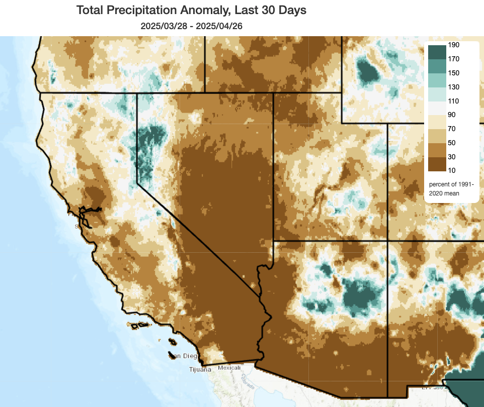
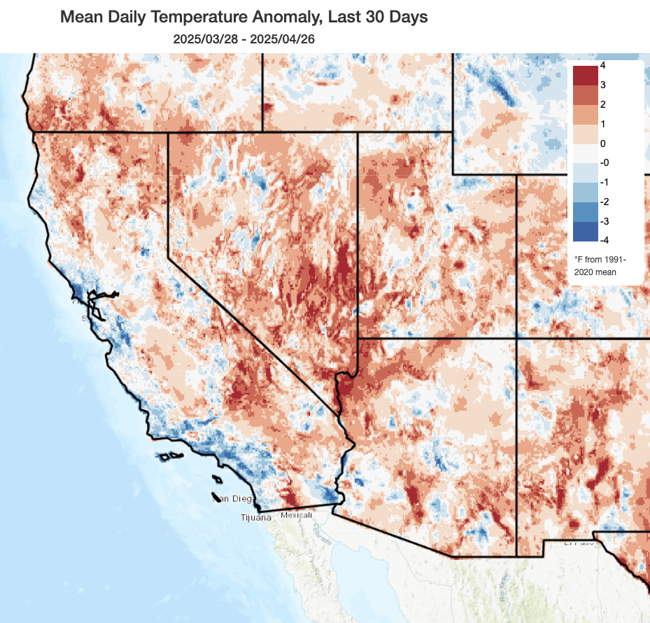
Over the past month, though, precipitation has still been well below average across most of California (except for portions of the Sierra Nevada, especially east of the crest). Temperatures, overall, were slightly above the recent average across inland areas but slightly below the recent average along much of the coast–which, as has been noted previously during such patterns, is indeed where most Californians live.
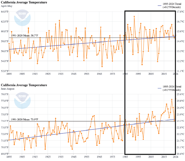
I do want to take a moment to offer some climate context here. “Averages,” when it comes to quantities like temperature, precipitation, or snow water equivalent–are generally defined relative to a moving average baseline period (often ~30 years). In 2025, most such statistics are, accordingly, reported by NOAA or California state agencies relative to the 1991-2020 period. In a climate that is non-stationary (i.e., changing over time), that means that long-term averages will always be a “moving target”–ever evolving, and in the case of something like temperature, ever increasing (or in the case of snow water equivalent in California’s mountains, decreasing). As I’ve previously discussed, there’s nothing inherently wrong with using a 30-year moving average window that shifts each decade; we’ve got to choose something. But it does leave us susceptible to what others have termed “Shifting Baseline Syndrome”–essentially, the fact that conditions that would have been exceptional or even record-breaking just decades ago are increasingly perceived as “ordinary” despite the fact that our built infrastructure and ecosystems have not been able to shift nearly as quickly as our perceptions.
In this setting, it is worth contextualizing recent temperatures in California in a longer term context. I pulled up some data from NOAA this morning, and it tells an interesting story about how late spring temperatures have changed as opposed to summer temperatures in California over the past 125+ years. Conditions are, indeed, still notably warmer today during April-May than they were earlier in the 20th century. But the trend since the mid 1980s is striking: in April and May, California has not really seen an increase in the very hottest months at all, but it has seen a large decrease in the coolest Apr-May periods. This is in great contrast to summer (Jun-Aug), when California has seen much faster warming–to the extent that more than half of California’s warmest summers on record have occurred in the past decade. The fact that this pattern may be repeating itself again this year, with comparatively mild early-mid spring temperatures possibly transitioning to another top-10 hottest summer, is certainly interesting. Whether this pattern will continue, or whether we’ll start to see more even warming in spring vs summer, would require some deeper study–but it’s likely linked to long-term trends in tropical Pacific Ocean temperatures that themselves are not yet fully understood.
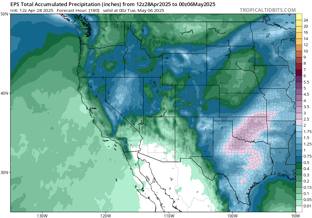
Another cool spring system to bring cool weather and (mainly mountain) showers again later this week
After a brief warm-up this week, another colder and somewhat damp system appears likely to arrive in California this coming weekend. This system will have a quicker and more inland trajectory (perhaps riding right down the CA coast), and thus will probably generate fewer coastal showers (though some are still possible, as are a few thunderstorms depending on exact trajectory given the cold air aloft and strong early May surface solar heating). The bigger story may be in the higher mountains, especially the Sierra but also perhaps the highest mountains of SoCal, where a significant late spring snowfall could again occur (so don’t be caught off guard if you’re driving/hiking!).
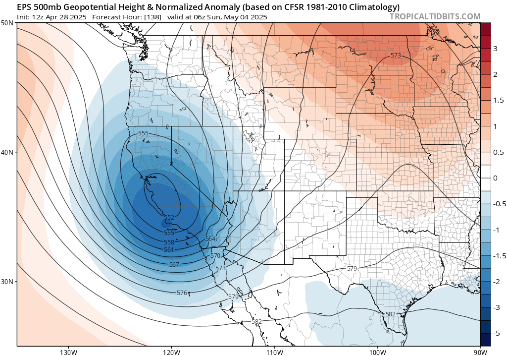
This is one of those set-ups where slight shifts in trajectory could make a fairly big difference; slightly slower and farther west, and more widespread showers/thunderstorms could occur, and slightly farther east/inland would likely mean dry conditions near the coast and less snow over the mountains. For now, I’ll split the difference, but I’ll discuss the details later this week (via YouTube livestream tomorrow; see link below) and elsewhere on social media. Right now, it is looking like precipitation (largely in the form of snow) could be pretty substantial in the central/southern Sierra in particular. That would, fortuitously, overlap with the region that’s seen rapid snowpack loss in recent days.
All in all, though, this is shaping up to be a pattern that will further delay the onset of fire season in NorCal and continue to top up an already quite respectable water year in the part of the state that is home to most of California’s major reservoirs (which are all, following multiple decent-to-good winters, all “sitting pretty” this spring despite the redevelopment of drought conditions in SoCal and the broader Colorado River basin in recent months). It is also tamping down fire risk in SoCal for the time being, though I don’t think that effect will last much longer than another week or two down south (but in NorCal, the legacy of past and recent dampness will likely persist well into June (or beyond, at high elevations) from a vegetation/fire perspective).
Still signs of hotter conditions second half of May and beyond, and perhaps a notably hot summer ahead in the West
Despite the milder period at present, which will likely continue through the first 10 or so days in May if current ensemble outlooks are to be believed, there is still strong multi-model consensus that the closer we get to June, the more likely we will see a pretty large shift toward much warmer than average conditions across California and the broader Southwest. There are indeed some hints of this in the current ECMWF/GFS ensembles looking forward toward mid-May (and yes, I’m aware they didn’t do so well in the past couple weeks, but it gets much harder to sustain a progressive West Coast pattern by mid-May!). I’m certainly still not seeing indications of any severe heatwaves over the next 2-3 weeks across California, though the larger-scale pattern currently suggested for later in May-Aug and beyond suggests a notably high potential for them later this season. Still, it’s certainly nice to have (in the meantime, and for the next couple of weeks) a rather benign spring weather pattern. If you can, get out and enjoy it!
Upcoming virtual weather & climate office hour: Tuesday, April 29th, at 1pm PT
I’ll discuss recent unsettled conditions in California and the broader state of western snowpack/drought conditions as we head into May. I’ll also offer a brief federal update, though this won’t be the focus of the session. As usual, I’ll also take questions live from attendees via the live chat! See you then.
Discover more from Weather West
Subscribe to get the latest posts sent to your email.