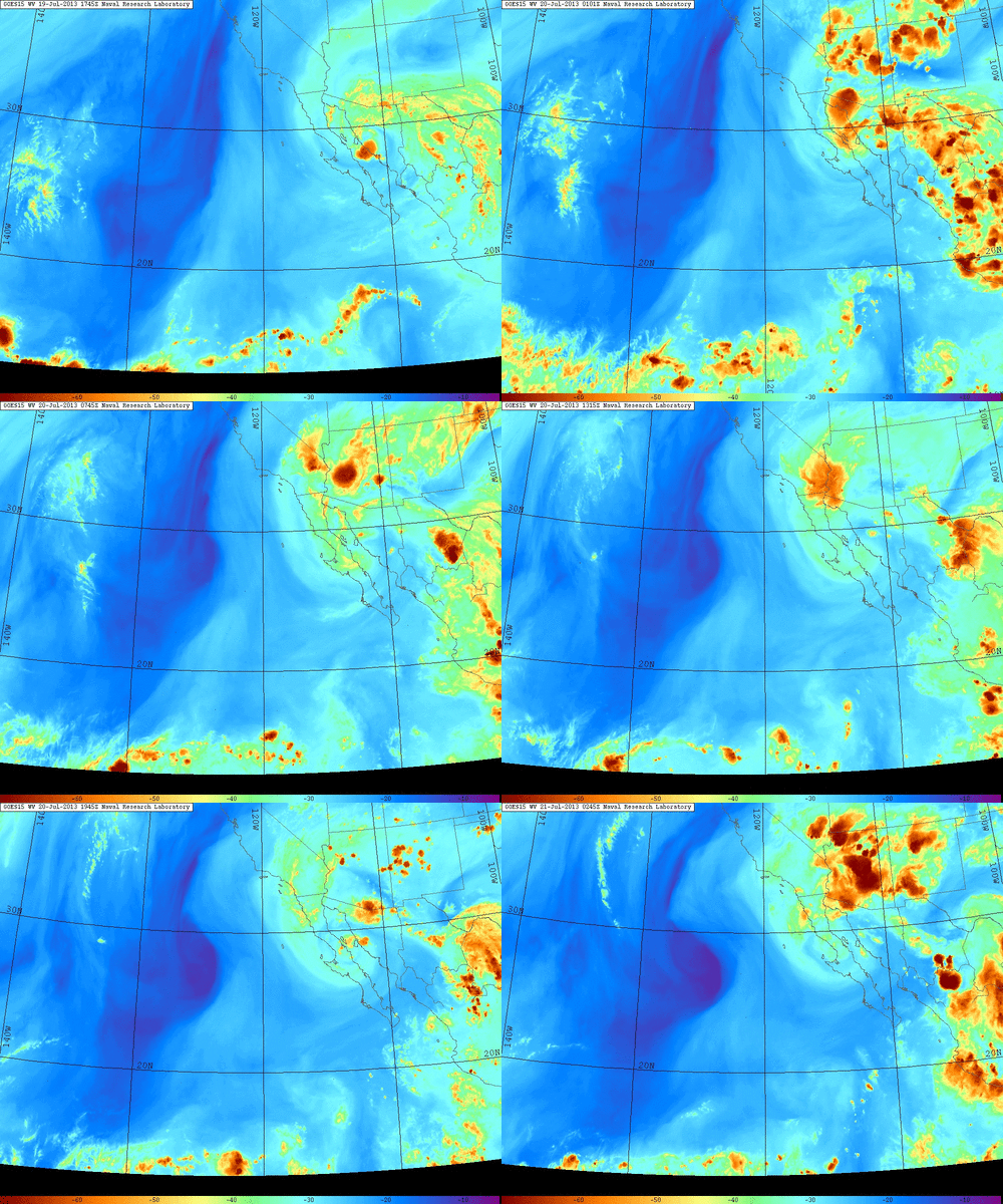
The prevailing pattern over California has been rather active thus far this summer, and that trend appears likely to continue for the foreseeable future. A very active summer monsoonal surge is ongoing over the Desert Southwest this weekend, with intense thunderstorms and significant flash flooding taking place in parts of Arizona, New Mexico, and Nevada.

A rather large mesoscale convective system (MCS) that developed late yesterday over Arizona propagated westward over Southern California earlier today, triggering more thunderstorms over inland areas and bringing some showers as far west as the coastal areas in Los Angeles County. While that old MCC has since dissipated and moved out over the Pacific Ocean, a new and even more impressive MCS has developed over Arizona this evening and is moving westward once again. Also prominent in water vapor imagery is a weak cut-off low centered near the international border near Baja California. The combination of this westward-propagating MCS and the prevailing easterly flow of monsoonal moisture around the northern periphery of the low will bring extensive cloudiness and occasional shower activity to much of SoCal over the next day or so, with occasional thunderstorm activity when subtle triggering mechanisms move through. This moisture will very slowly move northward over the next 72 hours and will bring widespread mountain thunderstorm activity in NorCal. There is some possibility, given the very moist air and the presence of a couple of weak upper-level waves, that a few showers or thunderstorms could occur in NorCal by Wednesday as well, though chances are certainly higher south of the Monterey Bay Area. This active monsoonal pattern will certainly be worth watching over the next few days.

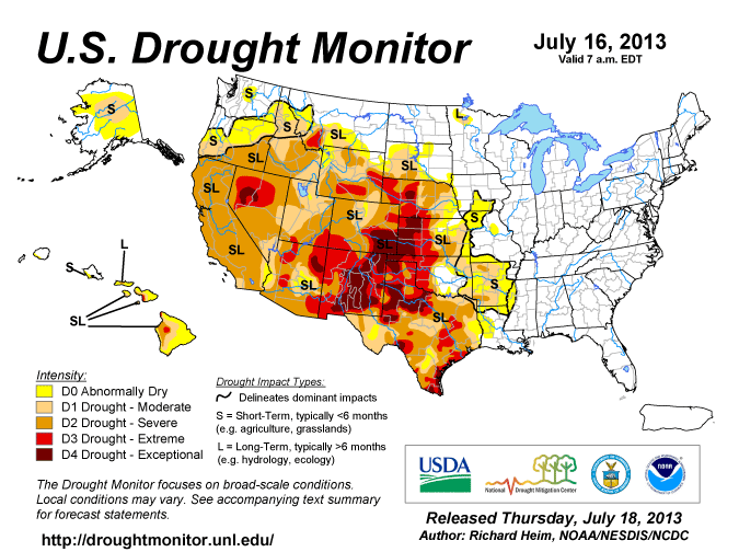
Also worth mentioning at this time is the current state of drought in the Golden State. Most of you are acutely aware that the January-May 2013 period was the driest such period on record in most parts of California, and that season totals were significantly below average nearly everywhere. The extremely dry second half of the rainy season was offset somewhat by an extremely wet November-December in 2012, but since this dry year comes on the heels of another dry year last rainy season, we’re starting to experience some pretty significant impacts from the present multi-year dry spell. The most recent Drought Monitor classification places nearly the entire state under “severe drought” conditions, which is a significant increase in intensity and extent since the last evaluation. California is on the western periphery of a very extensive region of drought that extends from the lower Mississippi Valley in the southeast to the Northern Rockies in the northwest, including a large region of extreme to exceptional drought in the western Great Plains and Southern Rockies. While it’s too early to say how these drought conditions might change once the new rainy season begins late in Fall 2013, it’s pretty clearly going to take a lot of water to make up for some of the large deficits that have accumulated over the past few years.
© 2013 WEATHER WEST