Early season rains soak Northern California; statewide storms likely in January
Modest drought relief in NorCal, but SoCal remains relatively dry
As highlighted in the last post, substantial and widespread precipitation has fallen in recent days across the northern half of California.
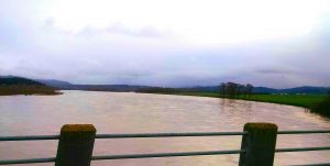
Along the North Coast and in Mendocino County, this rainfall has actually set a number of daily precipitation records and caused minor flooding of some rivers and streams. The Eel River–which as readers may remember has run dry multiple times over the course of the ongoing drought–reached and exceeded bankful in a few spots earlier this week. These recent systems have been very moist but dynamically unimpressive, meaning that there has been dramatic orographic enhancement of precipitation (often at the expense of rain-shadowed valleys, where observed precipitation has been quite a bit lighter). As of this writing, most of Northern California had received a near-average amount of precipitation to date, ranging from quite a bit above average in the far north to slightly below average in the south. SoCal, unfortunately, has not seen nearly the same amount of beneficial rainfall as NorCal in recent days. While conditions haven’t been completely dry in the south, nearly all of Southern California remains below average for the season to date.
Even more notable, though, is the current Sierra Nevada snowpack–which currently stands at 112% of the long-term average for this date in December. This is a remarkable milestone in a state where snow was virtually absent even at the highest elevations well into February last winter, and has been consistently far below average for 4 consecutive years. The early season storms in NorCal have been rather cold ones, which has allowed for a very healthy accumulation of snow across even the middle elevation regions (which has been very hard to find in recent years).
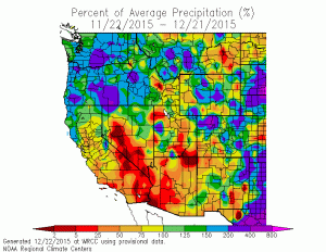
For the northern half of the state, at least, this early-season rain and snow is bringing modest but noticeable drought relief (and the snow especially is great news for the state’s water supply). Of course, it’s important to remember that California’s accumulated multi-year water deficit is equivalent to ~2 year’s worth of precipitation in many places, and the concurrent “snow deficit” is on the order of tens of feet in many of California’s snowier spots. So, while recent conditions have been highly beneficial, there is still a very, very long way to go.
Southern Californians have understandably been frustrated by the lack of rain so far this rainy season, but (as I’ve emphasized numerous times in previous posts) the main effects of a powerful El Niño event tend not to be felt until the core winter months of January-March. And, as I’ll discuss below, that long-awaited pattern shift (that would bring more storms directly to SoCal) may now be tantalizingly close.
Cold storm this week to affect entire state this week
A classic Gulf of Alaska storm system will dive southeastward toward California overnight tonight into tomorrow, dragging with it a robust cold front and plenty of cold, modified Arctic air. Nearly all of California will see a quick shot at rain and fairly strong winds around the time of cold frontal passage, with showers and isolated thunderstorms becoming pretty widespread in the unstable post-frontal airmass.
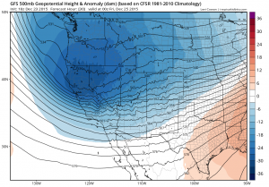
Strong coastal winds could create some coastal flooding problems as rainfall combines with very high King Tides and El Niño-induced sea level rise along the West Coast. Precipitation probably won’t be overly heavy in most spots due to the lack of atmospheric moisture, but some convective downpours are certainly possible along with showers of small hail. Widespread sub-freezing overnight temperature are likely over the weekend.
Sierra Nevada snowfall will be widespread and fairly impressive, and once again may exceed 1-2 feet in the more favored spots. Lighter snowfall will occur above 2000-2500 feet, even in SoCal, and could locally fall down to 1500 feet in NorCal. In fact, if you live above 2000 feet, there may be a pretty good chance of a white Christmas in many spots. All in all, this will be another beneficial (and perhaps picturesque) system for stricken California, though it may cause some travel headaches.
El Niño-enhanced storm track on horizon
The drought-weary have been keeping a close eye on the Pacific storm track for several years, having become all-too-accustomed to the tenacity of the Ridiculously Resilient Ridge. Well, that seemingly malevolent feature is now gone, although the pattern that has replaced it has not been quite the one we typically associate with strong El Niño winters. It is worth pointing out that astronomical winter did not officially begin about 48 hours ago, and meteorological winter tends to lag a couple of weeks beyond even that. As I’ve discussed extensively in recent posts, the typical seasonal cycle of the jet stream means that El Niño doesn’t have a huge influence upon California precipitation until later during the rainy season–especially the critically important months of January-March. So, what’s the current diagnosis?
The Pacific Northwest has been extraordinarily wet in recent weeks, drenched by numerous atmospheric rivers and suffering through widespread flooding and landslides. This very heavy precipitation has recently started to sag southward toward far Northern California as the powerful zonally-oriented Pacific jet starts its seasonal equatorward migration. This very strong Pacific jet may itself be a manifestation of El Niño, since tropical warming tends to greatly strengthen preexisting the north-south temperature differential that drives these high-velocity upper-atmospheric winds in the first place. But for the most part, this El Niño-enhanced jet stream has been too far north to bring statewide soakings to California.
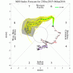
Frequent readers may be familiar with the Madden-Julian Oscillation (MJO), which is a tropical atmospheric phenomenon characterized by periodic active/suppressed periods of tropical rainfall (i.e. convection/thunderstorms). This “intraseasonal” (30-60 day) oscillation, which propagates from west to east along the equator, can have a profound influence not only upon tropical weather but also mid-latitude conditions during winter. In California, the MJO exerts a substantial influence during ENSO neutral (and perhaps La Nina) years, but usually has less of a pronounced effect during strong El Niño years. While this may still be true, it does appear that the MJO is becoming somewhat active presently and may begin to send a coherent signal eastward across the Pacific basin in the coming days.
Since both El Niño and the MJO are tropical phenomena that affect the intensity and placement of tropical thunderstorms (which can ultimately affect California weather by injecting energy into the upper atmosphere and strengthening the jet stream), these two phenomena can either reinforce or diminish one another. Over the coming 1-2 weeks, the increasingly active MJO will probably interfere with the ongoing and powerful El Niño forcing, perhaps leading to a strong but relatively short-lived West Coast ridge. After the Christmas storm, conditions will be relatively quiescent over most of California as the jet stream surges northward all the way into British Columbia.
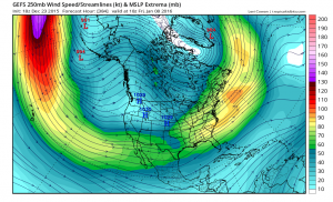
But during the first week in January, the overall Pacific pattern will likely change rather quickly and dramatically. There is presently very strong inter-model ensemble support suggesting that the effects of El Niño and the MJO will combine to produce an impressive extension of the East Asian jet, delivering a parade of low-latitude storms to most or all of California. This kind of storm track would actually favor central and southern California as opposed to more northern parts of the state–in other words, the classic “El Niño pattern” that is in everyone’s minds.
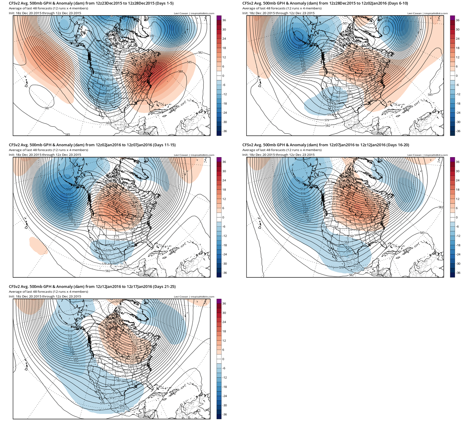
It’s worth noting that seasonal forecasts have strongly hinted at precisely this evolution for many months now–showing a dry autumn, and equivocal December, and subsequently a very wet January-March period for all of California. Right now, model solutions for the first 2 weeks in January are converging on just such an outcome. So, for now, I’d advise everyone to enjoy the cold storm this week and keep a close eye on what appears to be very promising evidence that our long-advertised pattern shift will finally arrive in early January.
© 2015 WEATHER WEST
Early season rains soak Northern California; statewide storms likely in January Read More »