Unsettled weather across California through this weekend, with thunderstorms possible at times
Recent weather overview
While much of coastal California has seen quiescent weather in recent days, interior parts of the state have actually been experiencing rather active conditions. Widespread thunderstorms over mountain areas–including the Sierra Nevada, Coast Ranges, and the mountains of Southern California–have brought a remarkably wide variety of conditions over the past 10 days. Somewhat surprisingly, some of these storms have been able to sustain themselves after moving westward into the Central Valley–resulting in a number of very intense lowland thunderstorms that produced quite a bit of large hail, localized flooding, and even a couple of tornados. This pattern–characterized by deep east-to-west flow over California and an unstable atmosphere–has resulted from the persistence of a deep trough over the Great Basin in recent days, with a successive series of low pressure systems sliding southward just east of California.
Spectacular #lightning photos from CA Weather Blog reader Robert J. Neep of tonight's storm near Folsom, CA. #CAwx pic.twitter.com/1FfSyOexeg
— Dr. Daniel Swain (@Weather_West) April 30, 2016
Unusually prolonged period of active convective weather to develop Wednesday-Saturday virtually statewide

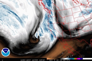
Thunderstorms are a rather unusual event in coastal California, so it’s not surprising that we don’t often see even a chance of thunderstorms in the forecast in major urban areas for 4 consecutive days. Yet that’s exactly what appears to be in the cards for the rest of the week, courtesy of a slow-moving cut-off low currently approaching California from the west. Often referred to as the “weatherman’s woe,” cut-off lows so-named for their propensity to meander aimlessly after being separated from the “steering flow” of the jet stream. Such systems can linger for days at a time and tend to have erratic trajectories–and making specific forecasts when they’re in the vicinity is very challenging, indeed.
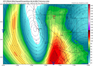
At the moment, though, it appears that our present cut-off low will park itself more or less directly over California from Wednesday through Saturday before finally ejecting to the east later on Sunday.

While the low itself is relatively moisture-starved, it will bring with it a very unstable airmass (by California standards, anyway)–bringing a relatively prolonged period of active convective weather through the weekend to nearly the entire state. 850mb temperatures will as low as 0C and a strong May sun angle will combine to produce steep lapse rates, and much of California will remain in the dynamically favored divergent region on the east side of the system. Meanwhile, spokes of vorticity will pinwheel around the low and bring periods of enhanced shower and thunderstorm activity at times.

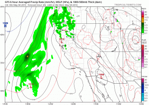
For all of this activity, average precipitation totals are expected to be on the lighter side (less than half an inch in most spots), but given the convective nature of the precipitation some places could see quite a bit more than that. Also, the Sierra Nevada will be favored in this setup (including the eastern slopes), and there will likely be at least a couple of inches of much-needed late season rain (and high elevation snow) there through the weekend. As mentioned earlier, this pattern brings the rather unusual possibility of thunderstorms in the vicinity of San Francisco, Sacramento, Los Angeles, and San Diego on several consecutive days. At a minimum, this will make for some great cloud watching; but there is also some potential for more significant weather (locally including hail and intense downpours). While it’s too hard to pinpoint specific regions of interest at this point, I would not be surprised to see at least a few severe thunderstorms (especially in the Central Valley on Thursday/Friday).
As always, I’ll have more frequent micro-updates on California weather and climate over on the Weather West Twitter page!