Major storms approaching California; significant flooding possible
Overview
A dramatic change to an extremely active weather pattern is currently unfolding over the Eastern Pacific. The first in a series of powerful storm systems will approach the California coast tonight, bringing a brief period of heavy rain, high winds, and possibly thunderstorms Wednesday morning. Additional storms will continue to slam into the coast through the upcoming weekend, bringing additional periods of very strong winds and heavy rainfall. An atmospheric river event could bring extremely heavy precipitation to a relatively small area by this weekend, possibly resulting in significant flooding.
Short Term Discussion
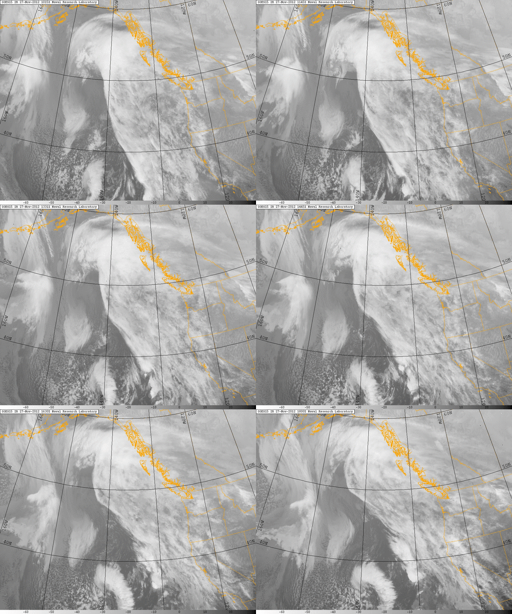
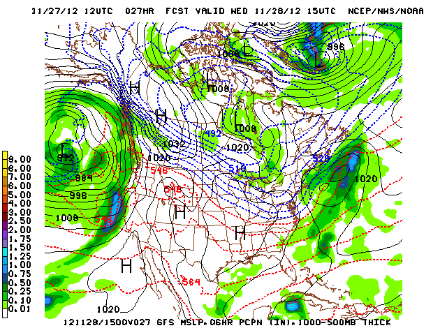
A quick glance at satellite imagery appears to verify what the numerical models are currently depicting: a rapidly strengthening storm system 500-800 miles off the coast of California. The developing surface low is expected to move in a more northeastward fashion overnight as the associated cold front moves almost due east and approaches the coastline by dawn tomorrow. The models are projecting that this front will be quite intense as it moves ashore, accompanied by a burst of very heavy rain and a period of strong to very strong winds. There is already very strong dynamic lift along and just ahead of the front itself, and this is only expected to increase over the next 12 hours. Strong upper-level divergence, coincident with some rather impressive positive vorticity advection, support a fairly dramatic cold frontal passage tomorrow morning that may be accompanied by thunderstorms containing torrential rainfall and winds in excess of 50-60 mph. 850 mb wind fields are already quite strong–in the 50-70 kt range–so I would not be at all surprised to see some potentially damaging gusts over 60 mph gusts mix down to the surface in convection. Flooding is not a big concern with this first system since it will be very fast-moving, though that will change with subsequent storms later this week. Most of Thursday will be a “break” day except over the far north, though rain will return in earnest by evening.
Long Term Discussion
Even stronger and more impressive storm systems are slated to arrive by Friday and continue through at least Sunday. Friday’s storm will, of course, contain heavy rain and strong winds once again, but there indications that the synoptic scale feature may act on an existing plume of subtropical moisture (atmospheric river) to produce excessive rainfall in some part of Norcal on top of the intense cold frontal rains. The models have been struggling with the placement (and even existence) of this particularly enhanced band of precipitation, so there remains uncertainty regarding where it might fall and how much rain it might produce. Regardless…rainfall totals will really start to add up by Friday evening (and will probably be approaching double digits already in orographically-favored areas).
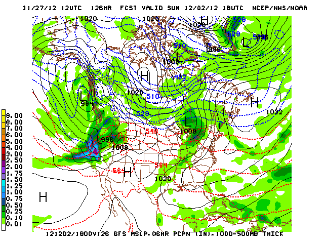
The Saturday-Sunday storm system, though, is the most concerning and potentially the strongest of the bunch. The orientation of the deep longwave trough off the coast will begin to shift by the weekend, directing parcels of positive vorticity right at NorCal. One of these disturbances will be in a very favorable position to rapidly develop a surface low as it approaches the coast on Saturday, and given the extremely moist subtropical atmosphere already expected to be in place at that point some very heavy precipitation could result. The persistent atmospheric river will be directed over Central California at this time, and may even shift back northward temporarily as the developing synoptic-scale storm system offshore matures. This could mean that the heavy precipitation band actually passes over a single location three times–first on its slow southward trek, then again as it lifts north ahead of the main front, then one final time as the front finally makes progress inland. Rainfall totals where this occurs are going to be excessive, and right now the focus of this final system is squarely on the Bay Area. Significant flooding will probably result if this scenario pans out as currently depicted. It’s also worth noting that the 12Z operational run of the GFS brings very strong winds with this final system as well, possibly stronger than the Wednesday storm.
It’s worth noting that Southern California isn’t likely to see a great deal of precipitation or wind out of any of these systems. While a soaking rain may occur as far south as Los Angeles, in general the rain/no rain (or probably more accurately the heavy rain/light rain) line will be rather sharp, as is often the case with atmospheric river-related heavy precipitation events. In any case, the best chance for some interesting weather in Socal out of this storm series probably will come with the Sunday system, as that one will dig significantly farther south along the coast than either the Wednesday or Friday storms in Norcal.
Even further out, the prognosis is pretty fuzzy. The models do generally depict a drying trend by Monday as the deep trough loses amplitude and the jet shifts northward. However, there are some indications that this break may be short-lived, with significant precipitation potentially returning by midweek (at least to northern portions of the state). Let’s get through the next week first…
© 2012 WEATHER WEST
Major storms approaching California; significant flooding possible Read More »


