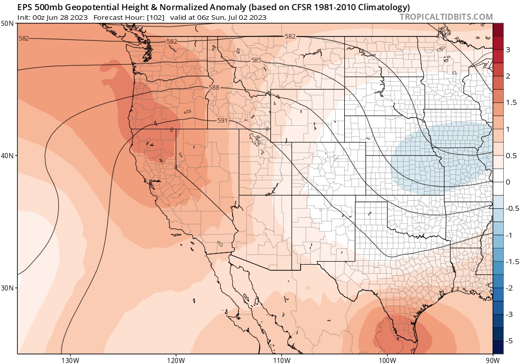
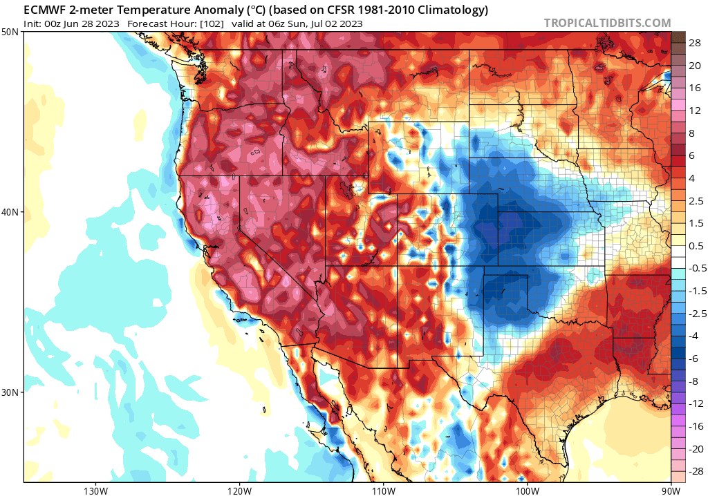
Significant, though not extreme, heatwave in California for the holiday weekend
After long mild period, significant heat arrives by Fri/Sat
It has been a notably mild spring and start to summer across nearly all of California to date, following the coldest winter in several decades in many parts of the state. That’s especially notable since much of the rest of the world has been enduring extraordinary periods of sweltering, record warmth in recent weeks (including much of Canada (where the ongoing fire season continues to shatter records, much like California’s did in 2020), northern Mexico and Texas, southern Europe and Northern Africa, much of South and Southeast Asia, and a number of island nations). California, and some other parts of the U.S. West, have been the notable global exception during this period of genuinely weird weather across the Northern Hemisphere. This is going to be a short blog post due to time constraints, so I won’t have time to go into detail regarding my thoughts as to why, in a broader sense, this is all happening–but please do check out my recent YouTube live office hours for a lengthier discussion.
Heatwave impacts will be amplified by recent cool weather & holiday weekend (read: fireworks)

Well, the switch is about to flip in California by the start of the holiday weekend–temperatures will spike to well above early July averages by Friday or Saturday–bringing the most widespread and substantial heatwave of the season to date. To be clear: this does NOT appear be an exceptional/historic heatwave for California by any means. It is possible that a handful of locations will hit daily record highs at some point during the event, but July monthly records should be safe everywhere. But this heatwave might punch a bit above its weight for two reasons. First, there have not really been any widespread major heatwaves in the past 30-40 days–so people (and some crops) are not yet acclimated to the heat. That tends to increase the risk of heat-related illnesses and crop damage beyond what the absolute temperatures might suggest (or which might occur during a heatwave of a similar intensity later in the season).
Second, we’re headed into the Fourth of July holiday weekend–a period during which human ignition of wildfires almost always spikes due to (you guessed it) unauthorized fireworks. The rising heat and falling humidity will act to dry out vegetation, and the holiday fireworks surge will provide potential sources of ignition. Again, I want to emphasize that this will not be an exceptional or highly concerning fire weather pattern. It’ll be hot and dry, and “fine fuels” (grasses and smaller shrubs) at lower elevations will become increasingly flammable, but strong winds are not anticipated and humidity will not reach critically low levels. Perhaps more importantly, heavier fuels (dense brush and trees) are still moister than usual for the time of year in most parts of California thanks to an exceptionally wet/cool winter and a late-melting snowpack at higher elevations–reducing overall vegetation flammability relative to recent years. So I’d expect to see a fair number of small fire starts this weekend due to the combination of hot/dry weather and various holiday weekend activities, but I would not expect to see a major outbreak of fast-spreading or very large fires.
Overall, low triple digit temperatures will be widespread across inland areas–and few well inland valley locations in NorCal could hit 110F (the hottest parts of the lower deserts of SE CA will, of course, be even hotter–as they typically are). Temperatures should fall somewhat by the Fourth of July holiday itself, but may remain elevated across the northern interior for an extended period.

Finally, rivers and streams along both the western and eastern slopes of the Sierra Nevada are still running very high (and a couple might spike above flood stage again this weekend) due to high elevation snowmelt (yes, there’s still quite a bit at the highest elevations!) amid the heatwave. These water bodies will be running fast and very cold–and there have been a number of drownings and near-misses this year due to the unusually high/cold flows. Please be careful if you’re out on the water during the holiday weekend heatwave–Sierra rivers are behaving very differently this season from most other (drought) summers in recent memory.
A photographic interlude: High Plains supercell
Finally: some photos I snapped while watching an isolated supercell thunderstorm over southeastern Wyoming (east of Chugwater) last Friday (June 23). The cyclic storm produced at least 6 separate tornadoes (of which I witnessed 4) over mainly rural areas. The thread below documents the storm’s evolution in real time as it unfolded last week (click to expand).
Significant, though not extreme, heatwave in California for the holiday weekend Read More »