After hot start to May, spring storm to bring rain & some thunderstorms to NorCal
Return to comfortably cool conditions following early season heatwaves
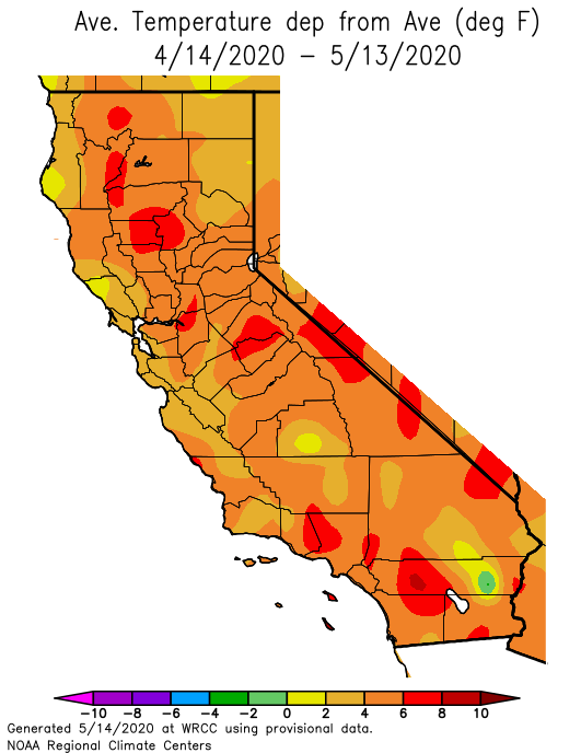
Late April and early May were very warm and occasionally hot across most of California. This was especially the case across the south and the interior, where quite a few new daily high temperature records were set. But that early season heat is now (at least temporarily) in the rear view window. Unsettled conditions have returned to the northern third of the state (at long last!). Soaking rains fell well north of the I-80 corridor, with lighter precipitation as far south as the SF Bay Area. Along with the rain up north, much cooler temperatures have returned to the entire state in recent days. Altogether, this has resulted in a temporary reprieve from what had until recently been an extraordinary early start to the fire season in that part of the state due to exceptional ongoing long-term dryness across NorCal.
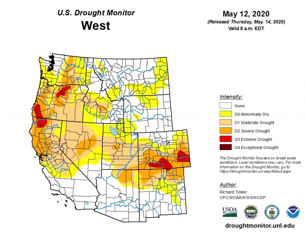
Speaking of that dryness–it is worth noting that a fairly widespread drought is now building across much of the American West. This includes the northern half of California (most intense in the northern third of the state), but pockets of severe to extreme drought have also been expanding across parts of Oregon and Colorado. (This includes much of the upper Colorado River watersheds). So far, most of these drought conditions have a relatively recent onset–and some spots over the interior West are places where significant precipitation does fall in the summer during monsoon season. So there may be opportunities to recoup some of these water deficits later this summer in those areas–dependent, of course, on a heathy monsoon and the lack of anomalous heat. I’ll have a update on these drought conditions–including prospects for a La Nina event in the Pacific by next autumn–in a future post.
Respectable spring storm to bring widespread rain and some thunderstorms to NorCal Sun-Tues
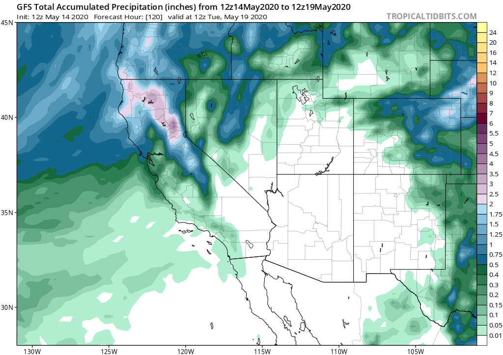
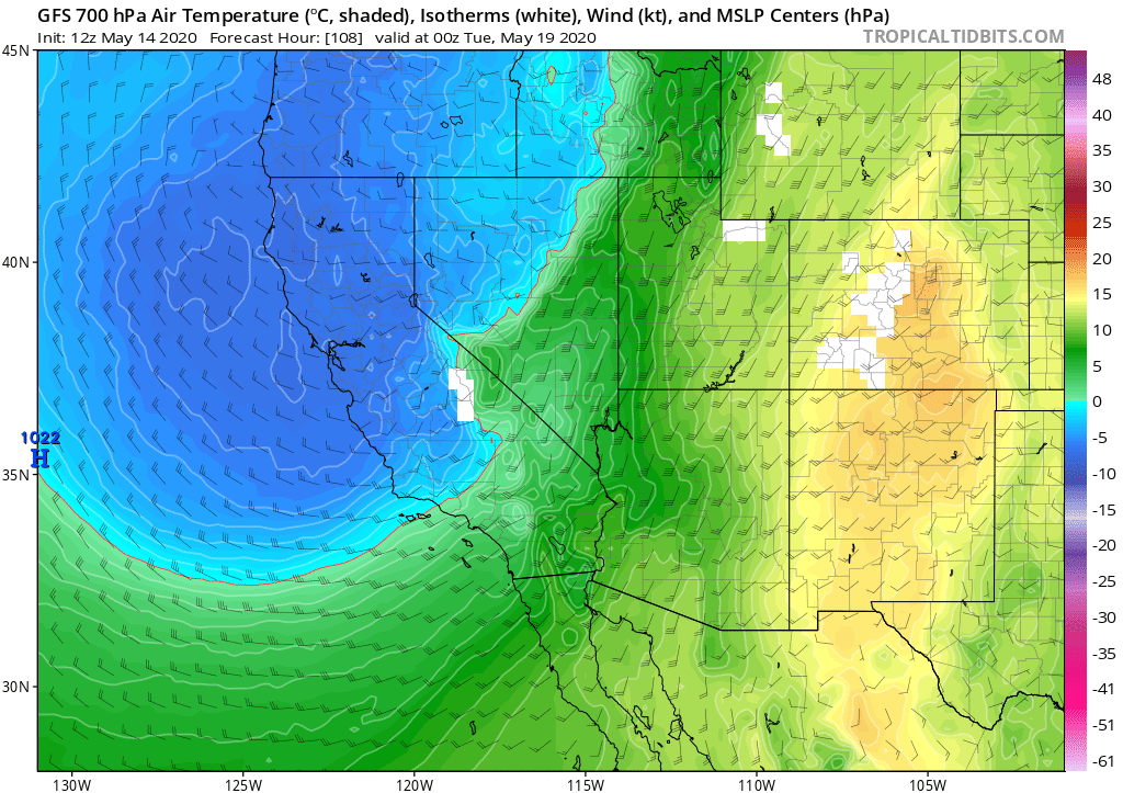
More rain is on the way to NorCal–in fact, a low pressure system due in on Sunday will bring fairly substantial precipitation accumulations for this late in the season. Widespread showers–perhaps even locally heavy at times–will spread across NorCal initially associated with a weak cold front. Then, behind the front, a relatively cold and unstable airmass will move in–continuing widespread convective showers and at least isolated thunderstorms from the Bay Area northward on Monday and possibly into Tuesday. Half an inch of rain could fall as far south as the I-80 corridor, which is not bad for the second half of May in these parts. Locally up to 2 inches of rain could fall in the typically favored spots in the far north–which will add some serious moisture to parched vegetation and put a damper on fire season for at least a couple of weeks. A few inches of late-season snowfall are possible at pass level in the Sierra Nevada. Little precipitation is expected in southern California from this system–but considering all of the wet weather late this winter and early this spring down south–this is a pretty favorable spatial pattern. I wouldn’t rule out a few light coastal showers, but accumulations should be pretty minimal (if any).
As noted above, there will be a pretty good chance of convective activity and thunderstorms across NorCal Sun/Mon. Isolated cells are likely just about everywhere, and these could easily contain small hail. More widespread storms are possible in the favored areas of the Central Valley (i.e., northern Sacramento and eastern edge, along the Sierra Nevada foothills). Given the time of year and subsequently strong surface insolation between breaks in the clouds, I would not be surprised to see a few low-topped mini-supercells in those favored spots on Monday.
Warming and drying for late May
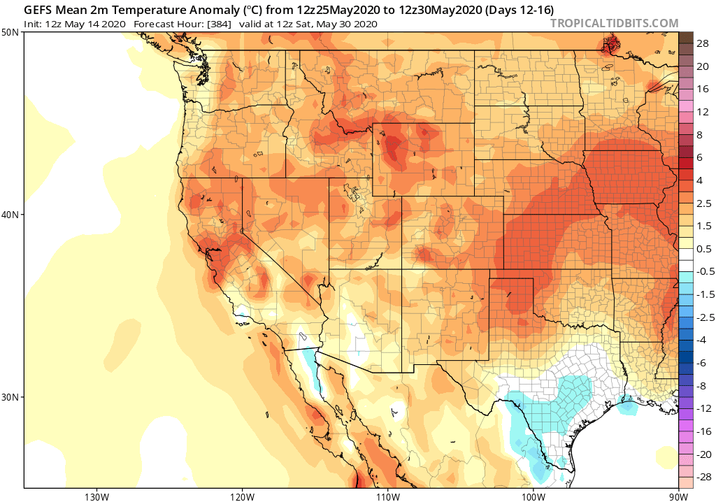
Once the NorCal system moves off to the east by Wednesday next week, conditions will quickly dry out and warm up statewide. While there are not currently any major heatwaves on the horizon, it does appear likely that temperatures will once again rise above seasonal averages by the end of the month. There are some indications that a weak cut-off low may try to set up shop over northeastern California at some point, which could perhaps trigger scattered mountain showers/thunderstorms. Still, after next week’s system it does not appear that widespread precipitation is likely for the foreseeable future thereafter (as should be expected heading into June!).
After hot start to May, spring storm to bring rain & some thunderstorms to NorCal Read More »