The North Coast just saw some rain, but…get ready for what’s coming.

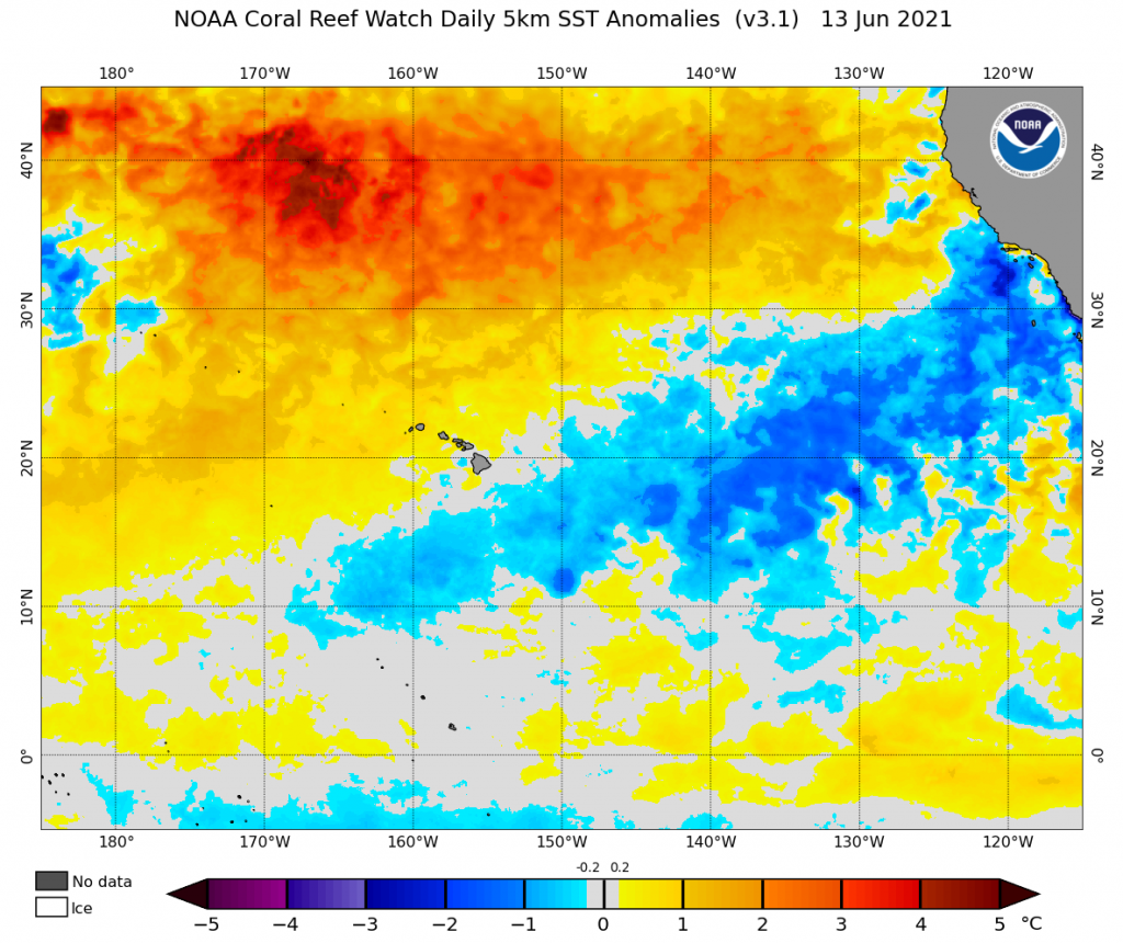
Amazingly enough, an unusually moist and very late season atmospheric river ended up bringing a considerable amount of rainfall to the Pacific Northwest over the past couple of days. Several inches of water fell on parched watersheds in coastal Oregon. And believe it or not (it is hard to believe if you live anywhere else in CA), the far north coast (mostly limited to the Arcata-Eureka area) saw as much as a couple of inches of rainfall from the far southern tail end of this AR! Precipitation did not even make it all the way into the NW Mountains of CA, staying confined pretty close to the coast, though some coastal drizzle from an enhanced marine layer did make it as far south as the Bay Area. Everyone else, though, has stayed…quite dry indeed. And interestingly, the sudden cessation of NWly winds (and subsequent oceanic upwelling) off the coast of NorCal has caused some rather dramatic warming of near-coastal ocean temperatures–from well below average to slightly above!–over the past couple of days.
That’s about where the good news ends, I’m afraid. Looking forward, it appears that California is in for a potentially prolonged heatwave–which, at least across inland areas, could well break a lot of records and kick fire season into much higher gear.
Severe to locally extreme heatwave likely across interior CA this week

I’ll cut to the chase: it’s going to be very hot across the inland 3/4 of California beginning Wednesday or Thursday and continuing through at least Saturday–and perhaps into the early portion of next week. Many areas are likely to experience record temperatures during this relatively early-season heatwave–especially across the Central Valley and the deserts of SE CA, though possibly elsewhere. All-time June monthly records may plausibly fall in these places, and there’s even a chance that a few spots could approach all-time record high temperatures (again, most likely in the southern Sacramento/San Joaquin Valleys and in the SE desert counties).
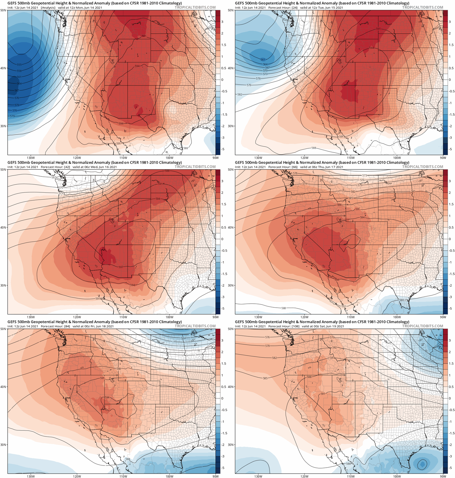
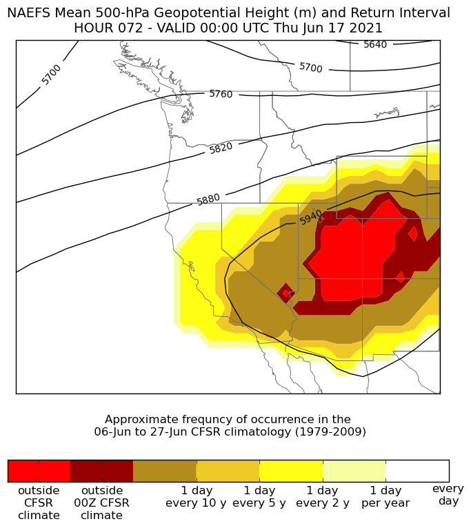
This heatwave will be caused by a record-strength mid-June high pressure system over the Four Corners region of the Southwest that will slowly retrogress (move westward) toward CA by Thursday. All-time record high temperatures are possible in other interior SW areas already accustomed to extreme heat–including both southern Nevada and western Arizona (Las Vegas and Lake Havasu City may see their highest temperatures in recorded history). The blistering heat across these regions (well above 120F in some lower desert spots) will last for many consecutive days in these areas, and will pose major risks to public health. Given the rapid expansion in wildfire activity across Arizona, Utah, and western Colorado in recent days, I would expect that many consecutive days of record-breaking temperatures will just exacerbate the situation.
It’s worth noting that the region of maximal extreme heat during this event–which will likely break some all-time records–is broadly co-located with the epicenter of the still-worsening extreme to exceptional drought conditions across the Southwest. This is probably not coincidental, as the record low soil moisture will allow a much greater than usual fraction of the sun’s energy to go toward heating the atmosphere (rather than evaporating water from the soil). The notion that extreme dryness can beget extreme heat, which further exacerbates the dryness, is a classic “positive” (self-reinforcing) feedback in the climate system.
Most extreme temps Central Valley and SE deserts, but hot elsewhere too
The ECMWF and GFS models have been recently spitting out some eye-popping high temperature numbers for the Thurs-Sat peak of the heatwave across the Central Valley (widespread 112+, locally 115+) and the SE desert regions (locally above 120F). In the near-coastal transition zones (i.e., SF and LA area inland valleys), numbers are less exceptional but still quite impressive for mid-June (105-110+). The immediate coast will be very warm, but temperatures will probably not be record breaking in most spots due to lack of offshore flow.

I’ll be honest: I’m not sure whether to believe the all-time record high temperatures currently being spit out by the operational model surface schemes for the Central Valley (though the SE desert numbers are more believable). On the one hand, these models do have a track record of historically generating heat wave extremes that are just a bit too hot. But on the other hand, the soil column across much of NorCal is presently drier than it has been in recorded history–and that might be enough to add a couple of degrees to what otherwise might have been slightly less extreme values. For now, I would expect actual highs to come in a few degrees cooler than the absurdly hot temperatures currently being predicted by the ECMWF for the Hwy 99 corridor in the Central Valley (widespread 115-117F). But even then, that’s still a widespread 110-112F+ heatwave–and given the above caveat there’s at least a chance that the models are right.
Coastal areas may see only a couple of warm to hot days later this week, but inland areas will likely be very hot (well over 100F) on each day from Wed through at least Sunday, and perhaps as late as next Tuesday. Thus, human health and agricultural impacts from this event have the potential to be extreme in these areas–especially against the backdrop of already exceptional drought in many areas. Additionally, I would expect to see a major uptick in wildfire activity this weekend virtually everywhere as vegetation dries even further beyond its currently record-dry levels (for the calendar date) and people spend time outside to try to escape the heat.
Just to reiterate: this will not be a typical June heatwave across inland areas, and could rival (or even surpass, in some areas) the extreme and record breaking heat experienced last Aug/Sep in those areas (though not at/near the coast). Prepare accordingly.
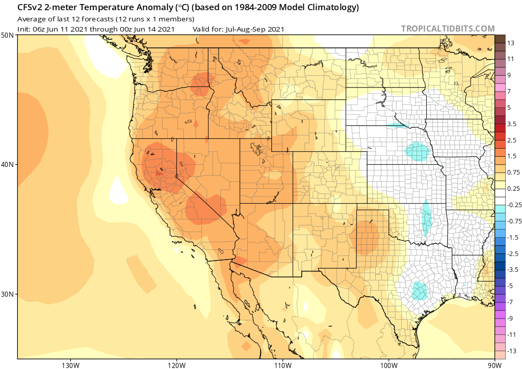
Outlook for rest of summer: continued hotter than usual
I wish I had something else to share other than a prediction for continued warmer/hotter-than-usual conditions in California, but…that’s what all indicators are pointing to. Part of this is simply a product of the exceptional intensity of the West-wide drought–as noted above, dryness begets heat begets more dryness, and yet more heat. While it’s possible that the interior Southwest sees a decent monsoon this summer (I certainly hope so!), that doesn’t really affect the outlook for California–which is at the far western periphery of the monsoon even in the best of years.

Discover more from Weather West
Subscribe to get the latest posts sent to your email.