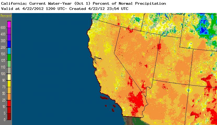
It has been an odd rainy season this year in California. Things got off to an early start in October, but rainfall and overall storm activity over the far Eastern Pacific dropped off dramatically during the traditionally wet months of November through February. Since approximately the end of February, however, storms returned to the state of California, bring much-needed rainfall and substantially boosting the previously anemic Sierra snowpack. Still, while recent precipitation has greatly reduced the potential for any serious or widespread water concerns this summer, water-year precipitation remains substantially below average for most of the state.
Source: NWS/NOAA
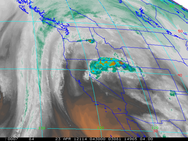
At the present time, a fairly complex and increasingly active pattern is evolving over the far Eastern Pacific. A cutoff low is currently circulating several hundred miles off of the California coast, which triggered mountain thunderstorms this evening in the moist, warm, and slightly divergent southerly flow on its eastern side. As this low begins to approach the SoCal coast over the next 48 hours, I expect the coverage of showers and thunderstorms to increase. Tomorrow afternoon, a weak perturbation and associated vorticity maximum will lift north over NorCal, likely triggering scattered convection in many places (especially over the mountains). Similar activity could occur on Tuesday, though there doesn’t appear to be a specific focusing mechanism on that day so shower/thunderstorm coverage could be somewhat more limited.
Source: NOAA.
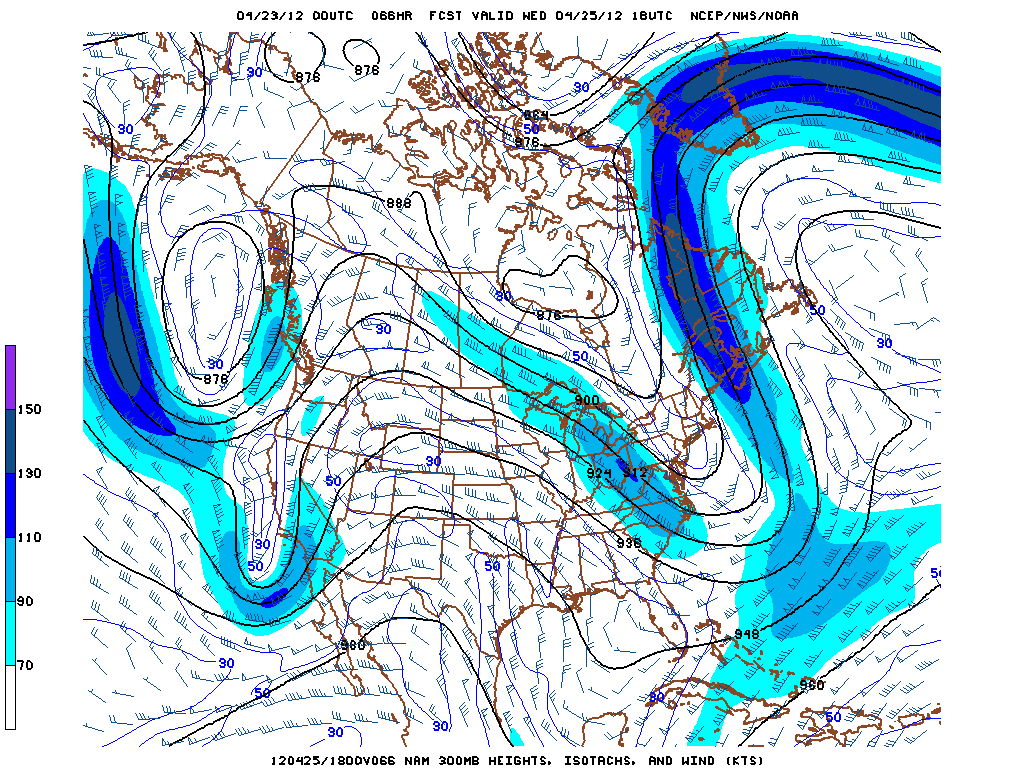
On Wednesday and Thursday, the cutoff low will move inland near the Los Angeles area, bringing a fair bit of rain and possibly thunderstorms to a wide swath of the state. At the same time, a modestly stronger and colder low will begin to approach the state from the northwest. The confluence of these two systems will bring unsettled and potentially active weather over most or all of the state into late Thursday.
Source: NCEP.
Thunderstorm potential is difficult to assess at this point given the complexity of the developing pattern, but there may be lightning observed somewhere in the state each day between now and Friday. Right now, the mountains, the Central Valley, and the coast from the L.A. Basin sourthward appear to have the highest thunderstorm potential this week, but this may change. Stay tuned!
Subscribe to get the latest posts sent to your email.
Looking for the comments? They're still here! Comments on Weather West are hosted by Disqus, a third-party service. Loading them shares some data (such as your IP address) with Disqus. See our Cookie Policy.
Manage Consent
Looking for the comments? They're still here! Weather West now asks for your permission before loading third-party services. Click Accept to restore the site just as before, including comments (hosted by Disqus), embedded posts and videos, and visitor statistics (Google Analytics and Jetpack). These services are run by other companies that may set cookies and receive information about your visit, such as your IP address and the pages you view. The site is now ad-free. If you choose Deny, you can still read everything, and load comments anytime using the button below each post.
Functional
Always active
The technical storage or access is strictly necessary for the legitimate purpose of enabling the use of a specific service explicitly requested by the subscriber or user, or for the sole purpose of carrying out the transmission of a communication over an electronic communications network.
Preferences
The technical storage or access is necessary for the legitimate purpose of storing preferences that are not requested by the subscriber or user.
Statistics
The technical storage or access that is used exclusively for statistical purposes.The technical storage or access that is used exclusively for anonymous statistical purposes. Without a subpoena, voluntary compliance on the part of your Internet Service Provider, or additional records from a third party, information stored or retrieved for this purpose alone cannot usually be used to identify you.
Marketing
The technical storage or access is required to create user profiles to send advertising, or to track the user on a website or across several websites for similar marketing purposes.