Update: Heatwave will be more intense, prolonged, and dangerous than previously anticipated
I don’t usually write two weather posts in one week, but this time I’ll make an exception. Earlier this week, I wrote about a “sustained warming trend and long-duration inland heatwave” that would develop this week in California. Well, that’s still true…but that language turns out to have been more than a little understated. A very intense and prolonged heatwave now appears likely for a large portion of California over the next 7-10 days, and this event will likely have wide-ranging impacts from human health, wildfire, and electricity demand perspectives. I suspect this event will probably end up being one of the most significant widespread California extreme heat events in the past decade, if not longer.
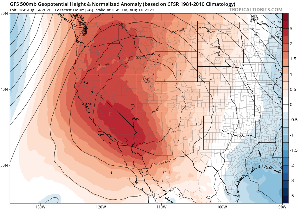
As noted in the last post, California will be located directly beneath a strengthening ridge axis moving building overhead from the southeast. In the meantime, a humid tropical airmass is being advected over the state from the southwest on the western periphery of this ridge, largely thanks to the remnants of former Hurricane Elida. This same basic pattern will essentially remain locked in place for at least the next 7 days, and very possibly longer. As a result: prolonged heat is expected across nearly the entire state, with the possible exception of the immediate coastline (i.e., < 10 miles from the coastline in some places)–where conditions will still be much warmer than average but will not be unbearable. The likely movement of many folks from regions of extreme inland heat seeking relief along the immediate coastal strip may pose major challenges given the ongoing need for social distancing amid the pandemic.
Across the Sacramento Valley and inland valleys in SoCal, many consecutive 100+ days are expected (likely at least 7-10 days in a row). The magnitude of the heat will wax and wane slightly over the course of the event, but on the hottest days temperatures will likely reach or exceed 110 even in typically “cooler” parts of the Sacramento Valley and Delta region. Many daily record highs are likely, especially across NorCal.
Even more problematic than the extreme daytime temperatures, though, will likely be the very warm overnight temperatures and elevated atmospheric humidity during this event. The tropical moisture noted above has already blanketed much of the state with mid and upper-level cloudiness, and even brought a few showers and thunderstorms along the Central Coast. This unusually humid airmass (by CA standards) will persist thought the first week of this heatwave–raising apparent temperatures, and even producing heat indices *higher* than the actual temperature. Overnight temperature recoveries will be especially poor–I expect to see lots of overnight lows in the 70s, and locally even 80s in the thermal belts. This is relatively rare in many parts of California, and matches the signature of other historic high-impacts heat events in California (July 2006 comes to mind).
I expect sustained extreme temperatures of this magnitude to produce widespread human health, wildfire, and electrical power supply impacts. Some of these impacts will undoubtedly be amplified by the ongoing pandemic. This will be an event to take quite seriously.
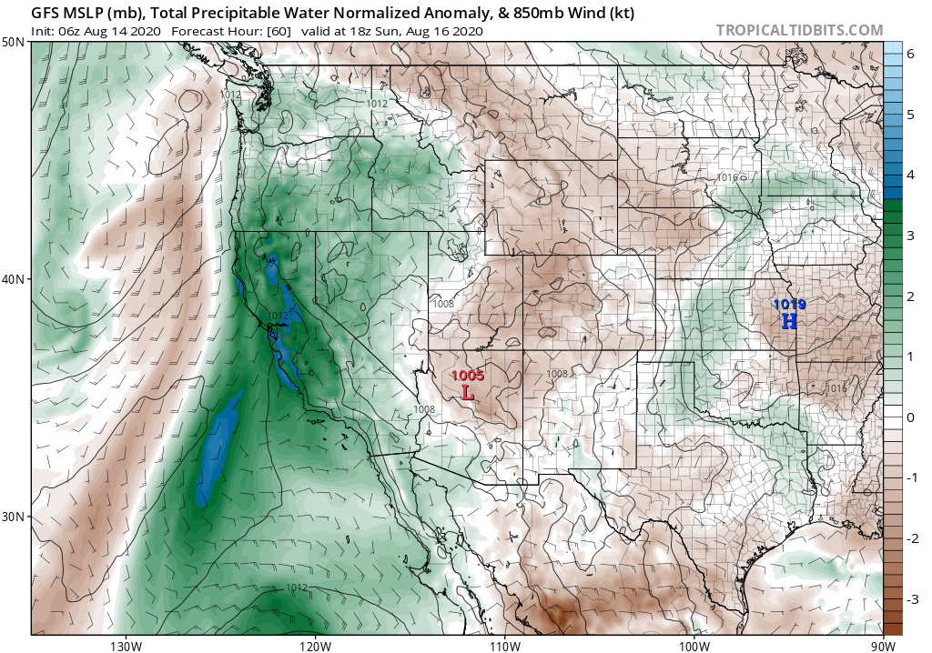
Finally, I do also expect to see occasional tropical/sub-tropical moisture incursions over California over the next 10 days, coincident with the extreme heat. This will not only act to keep mugginess levels elevated, but will also bring at least the possibility of occasional bouts of isolated showers/thunderstorms just about anywhere–including valleys and coastal regions. I don’t anticipate any widespread precipitation at this time, but don’t be too surprised to witness some “un-Californialike” subtropical-looking clouds over the next week or so. The possibility of isolated thunderstorms will also be important to keep an eye on from a fire weather perspective, as vegetation is already much drier than typical levels for the time of year across most of California (and that’s before the heatwave).
Stay safe out there. I’ll be following this event closely, with frequent micro-updates, as usual on Twitter.
Discover more from Weather West
Subscribe to get the latest posts sent to your email.