Driest Jan-Feb period on record for most of California
I don’t think it’s any surprise to anyone reading this blog that the past couple of months have been astonishingly dry across nearly all of California. The official stats certainly reflect this: the 2 month period during January-February 2022 was the driest such period in well over a century of record keeping for a majority of California (i.e., the northern 2/3). In some places, essentially zero precipitation fell during this period–especially remarkable as these are typically the wettest two months of the year across much of the state. February was also a highly anomalously warm month in many areas, with numerous areas breaking daily high temperature records on multiple days and some spots hitting new all-time monthly records for February warmth.
Obviously, this is not the pattern that anyone hoping for meaningful drought relief wanted to see.
As a result, vegetation conditions in some parts of the state are presently are record-dry levels for the calendar date. This is reflected in a handful of wildfires that have occurred even in some of the wettest parts of Northern California in recent weeks. Although the grasses at middle to upper elevations remain green in most spots, they are starting to cure/brown at lower elevations–which is exceptionally early, and likely portends a very early start to the active part of fire season unless something changes drastically in the next few weeks.
Light to moderate NorCal precip likely at times next 2-3 weeks, but still below average
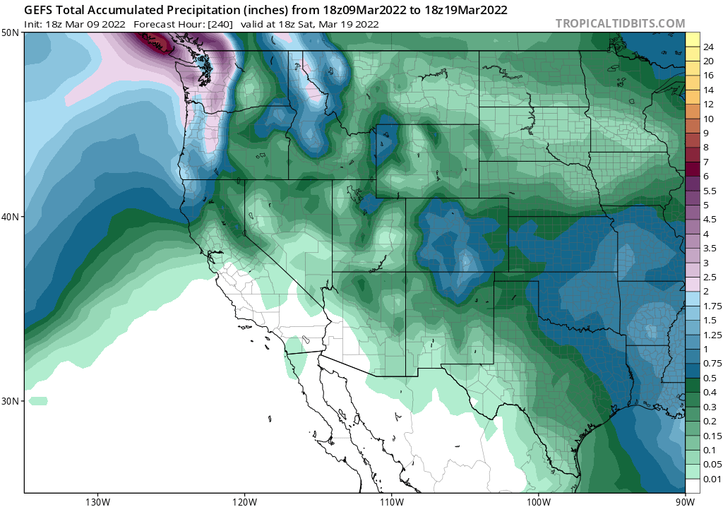
The good news: there is some rain in the forecast for parts of NorCal over the next 10-14 days. In fact, the far North Coast may end up only slightly below average for the period! But that’s about where the good news ends, since precipitation is expected to be well below average virtually everywhere else across California over the next 2-3 weeks. NorCal, perhaps as far south as about the I-80 corridor, will see occasional opportunities for light to moderate showers at times–but none of these systems look particular cold or dynamic, so these are more likely than not to be the kind of systems that “underperform” as they try to make progress in a pre-existing warm, dry, and stable airmass. So while I don’t think the next couple of weeks will be a complete shut-out (and Del Norte might make out reasonably well), precipitation deficits will continue to accumulate elsewhere.
What’s the culprit? Say it with me now: “a persistent ridge of high pressure over the northeastern Pacific Ocean.” Is it Ridiculously Resilient? At this point, I’d say we’re close. It now shows up in 2+ month average plots of atmospheric fields, and if it sticks around in such plots until the next blog update, I’ll make it official. (I’m giving it one more chance to fall apart before calling it.)
Seasonal outlook portends a re-strengthening of drought in coming months
2021-2022 is unfortunately turning out to be a year in which early seasonal model predictions for substantially drier than average conditions across California and the broader Southwest are coming to fruition. That’s not great news, especially given recent research indicating that the broader regional multi-decadal “megadrought” focused on the Colorado River Basin has further intensified in the past few years. The latest tranche of model data, looking forward toward the rest of spring, doesn’t offer much hope for a widespread pattern change: above-average odds of below-average precipitation are still depicted across nearly all of the American West (and much of the Great Plains as well, for that matter) for the April-June period. In fact, if the real world ends up being as dry over such a wide area as the latest NMME prediction below suggests is possible, I would expect to see a dramatic expansion of drought spatial extent and (to a lesser degree) severity heading into summer across nearly the entire western half of the contiguous U.S.
Shout-out regarding an interesting opportunity
If you are in interested in the intersection between the fields of meteorology, journalism, and California, the San Francisco Chronicle has recently announced their plans to build in-house expertise on weather/climate/data visualization. The plan, it seems, is to build something analogous to the Washington Post’s Capital Weather Gang–but with a San Francisco Bay Area and California focus. Check it out!
Discover more from Weather West
Subscribe to get the latest posts sent to your email.