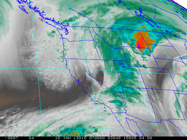
After a modestly long quiescent period after December’s major storm activity in California, a major shift in the jet stream is bringing a drastically colder airmass to California. Temperatures at 850 mb that approached 15 C today have already dropped below 0 C over NorCal as of late evening, and will continue to fall through tomorrow. 850 mb temperatures will fall as low as -3 C near the Mexican border, -5 C around the Bay Area, and -8 C near the Oregon border. These temperatures are quite cold by California standards and may actually be the coldest experienced over such a wide region in several years.

The primary result of this modified Arctic airmass will be to bring a dramatic cooling trend, with cold temperatures and strong winds expected for the next several days at least. Well below freezing temperatures are expected inland, and even near-coastal regions could approach the freezing mark during the overnight hours. Moisture associated with this long wave trough is very limited, but there is enough overwater trajectory coupled with extremely steep lapse rates to generate convective showers, mainly near the coast. It’s not clear exactly how widespread convective showers may be, since there is a very large cold air cumulus field in the East Pacific headed for CA, but numerical models project only light precipitation and generally confine it to the immediate coast. Very low snow levels are already in place, however, and will continue to fall through tomorrow. Snow will fall around 500 feet along the North Coast (locally lower), around 1000 feet in the Bay Area, and possibly below 2000 feet as far south as the Mexican border. While precipitation will mostly be very light or nonexistent, it’s possible that a few locations that rarely see snow could see a dusting or maybe an inch or two in some of the higher coastal hills. This system is also poised to bring snow at sea level to both Seattle and Portland, which gives some indication of how cold this airmass is.
The deep trough will shift inland slightly over the weekend, shifting the axis of coldest air to the Great Basin region. However, a few weak disturbances will slide down the backside of the trough and could possibly produce snow at very low elevations where trapped cold air remains, which is a significant possibility given the multiple days of sub-freezing overnight lows expected. It’s still too early to tell which regions might be affected, but it’s certainly worth keeping an eye on over the next couple of days. The other effect of this deep trough will be to induce very steep pressure gradients between SoCal and the Great Basin region, which could produce some very strong offshore winds this weekend. Again…it’s still a bit early to tell, but this could end up being a pretty significant cold wind event. Stay tuned!
© 2013 WEATHER WEST
Discover more from Weather West
Subscribe to get the latest posts sent to your email.