A rather unremarkable December to date


It is occasionally refreshing to be able to write about a month where nothing is serious amiss as far as California weather goes, and I think December 2019 largely fits the bill. Periodic but generally light to moderate precipitation has occurred statewide (but mainly in the north) over this period, with above average but not exceptionally warm temperatures. The Sierra Nevada snowpack is in pretty good shape (i.e., near average for the calendar date) mostly thanks to some heavy falls back in late November, although it has been melting out a bit at lower elevations in recent days. For the season to date–including the autumn–California has experienced a mix of precipitation anomalies, ranging from somewhat below average across the northern two thirds of the state to well above average in SoCal. All in all, this has so far been a pretty quiet month across California–a trend that is expected to continue for at least the next 5-6 days.
Occasional rain continues into next week, but bigger SoCal storm possible in ~7 days

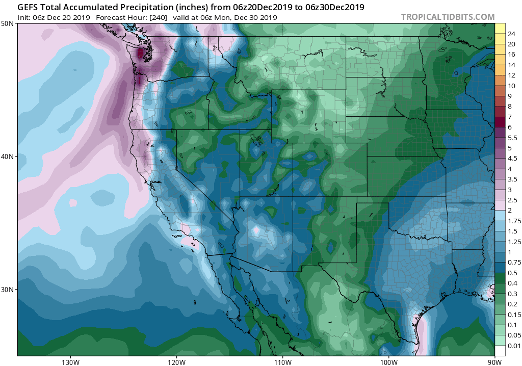
A handful of weak to moderate systems will affect mainly Northern California into early next week, bringing some additional rain and mountain snowfall (without any notably strong wind or rain rates). As we head closer to the end of December, the large-scale flow pattern will begin to favor “outside slider”-type storms that dive southward west of California before swinging eastward and inland near Southern California. Such a patterns tend to be pretty wobbly and hard to pin down much in advance, so the forecast for next week is still a bit up in the air. It’s also the kind of pattern that can produce significant storm events in SoCal that largely bypass NorCal–similar to what happened in November. Right now, the ECMWF is suggesting just such a storm about a week from now, which would bring the possibility of widespread heavy rainfall south of Point Conception. The GFS, however, suggests a much lesser event. For now: suffice it to say that SoCal will stand a decent chance of an increasingly active pattern beginning around the middle of next week and heading toward New Year’s–and that a significant rain event is possible. Meanwhile: NorCal will continue to see occasional bouts of modest precipitation, but there’s not currently anything especially significant on the horizon.
Relatively dry and cool pattern in the new year, but don’t rule out a surprise
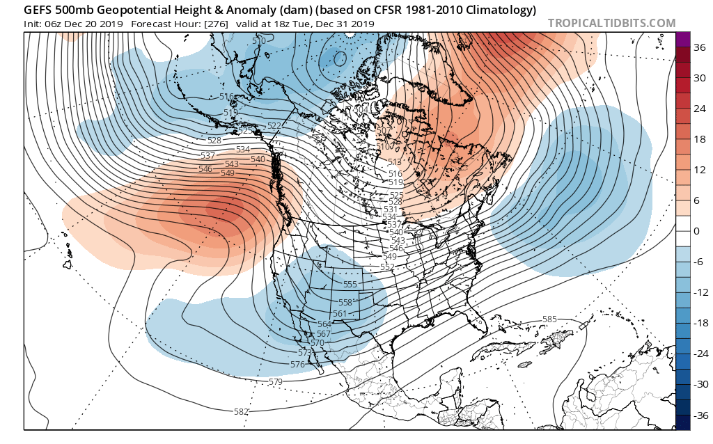
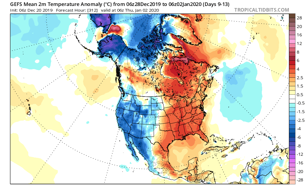
The long-range outlook (supported by multi-model ensembles) suggests a high likelihood of an amplified North Pacific circulation pattern developing around January 1st and perhaps persisting for much of the following month. This type of pattern–characterized by a large (blocking) high pressure system in the northeastern Pacific and a downstream trough over or just east of California–is a complex one. To a first order, such patterns usually bring below average (but not zero) precipitation and colder (sometimes much colder) than average temperature to California as moist Pacific systems are forced northward over the ocean but then dive sharply southward along or just inland of the West Coast. These types of systems tend to be relatively moisture-starved, but can still be good Sierra Nevada snow producers due to their cold/Arctic origins.

Assuming this type of set-up does indeed develop, I would expect colder and drier than average conditions to develop along the entire West Coast by early January and to persist for at least a couple of weeks thereafter. However, periodic cold showers/mountain snow events (perhaps even to pretty low elevations) are still probable during that period. Additionally: when this kind of pattern develops in January or February, when the Pacific jet stream is at its climatological maximum strength, there’s always at least some potential for the subtropical jet to “undercut” the NE Pacific ridge–bringing very stormy conditions to the southern half of California. To be clear: I don’t see any indication of that kind of evolution yet, but it something to be watchful for given the time of year and the large-scale set-up that’s likely to unfold.

Discover more from Weather West
Subscribe to get the latest posts sent to your email.