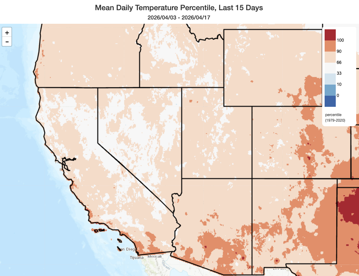
Milder temperatures in April than March, with much more precipitation; snowpack, however, remains extremely low
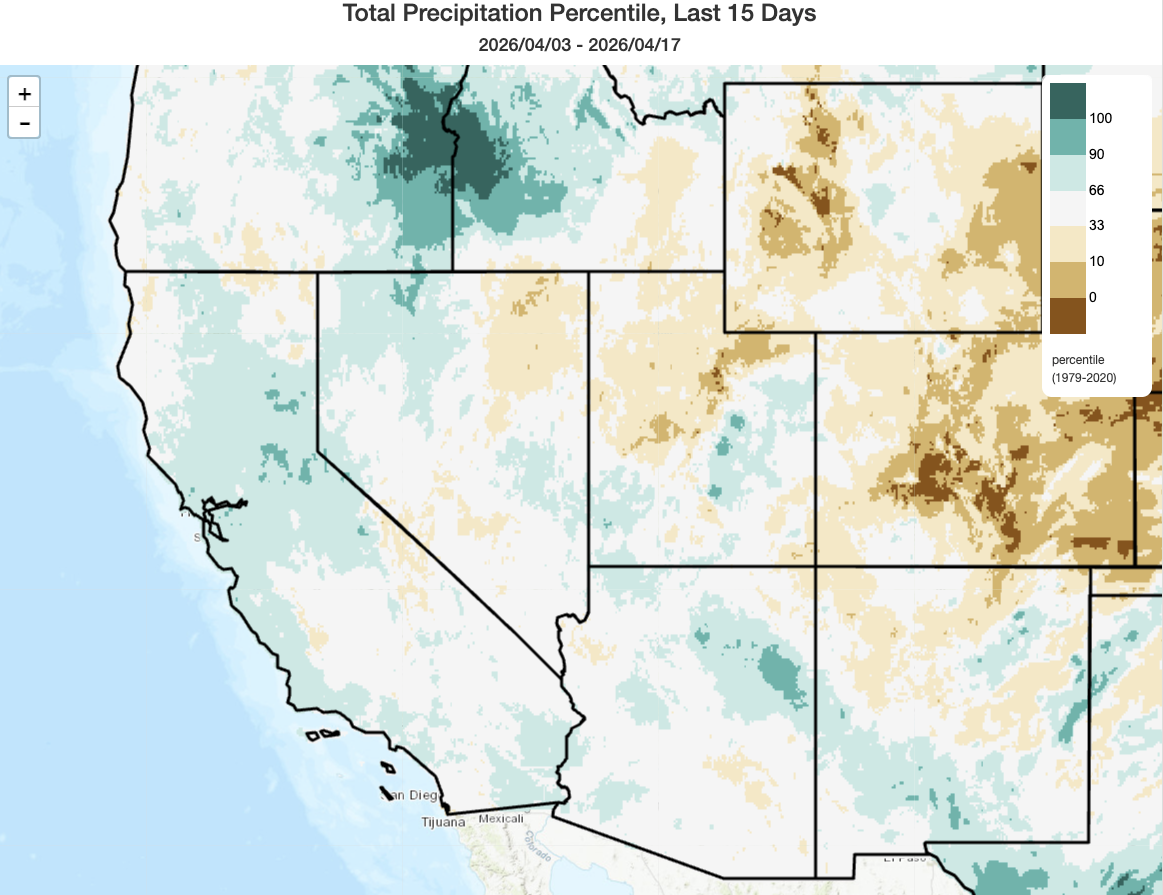
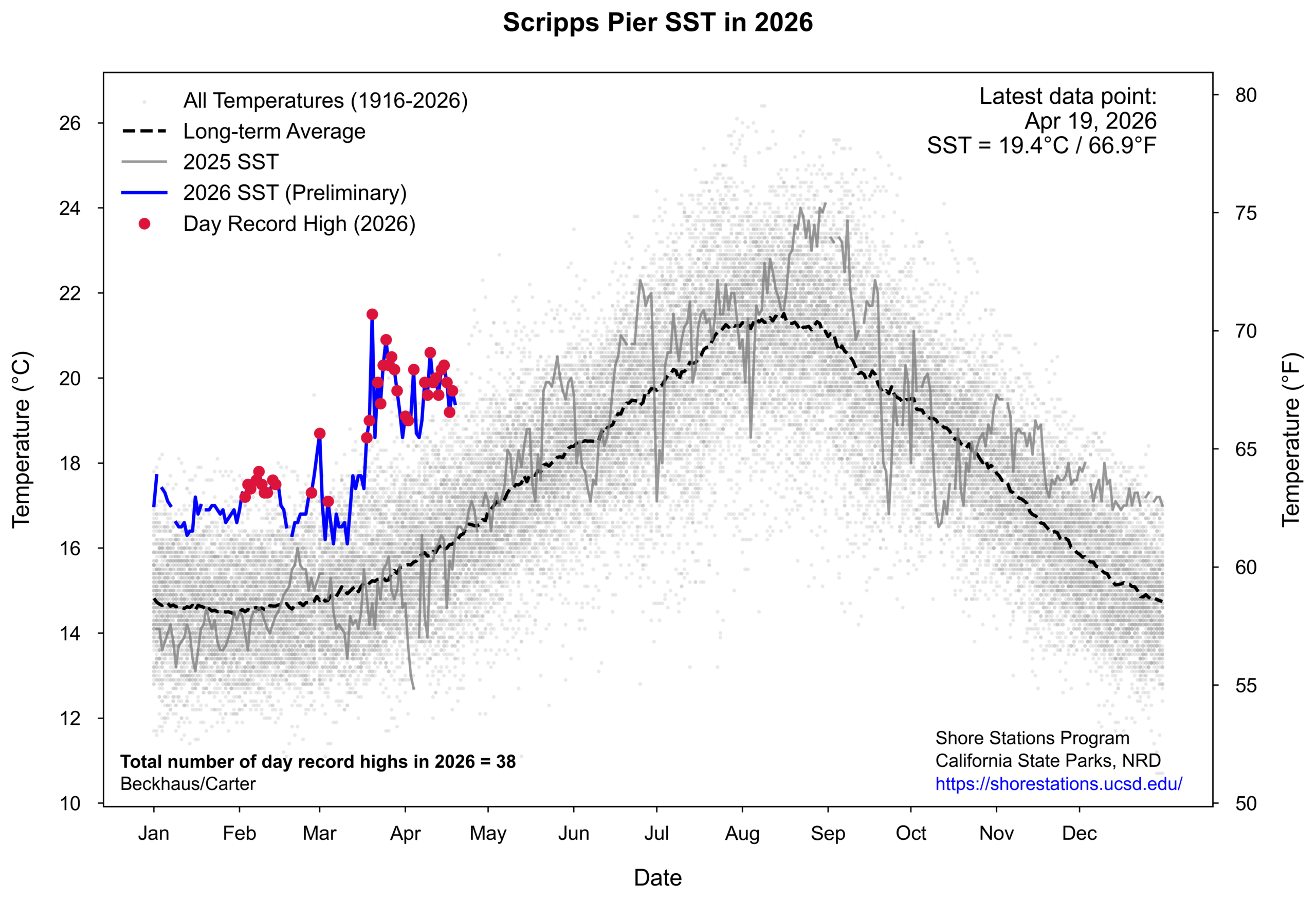
What a strange Water Year it has been in 2025-2026! We started the WY with record rainfall during Oct-Dec across much of the central and south coast, including the wettest Oct-Dec period ever observed in Santa Barbara, Ventura, Kern, and parts of LA County. Then, California oscillated between periods of exceptional dryness and quite stormy conditions in Jan-Feb (including one of the largest single Sierra snowstorms in recent decades, the-multi-foot accumulations (which melted almost immediately) before experiencing by far the hottest and in some cases the driest March on record across much of California and the broader West. Now, in April, the tables have turned once again: quite active and damp conditions have returned, especially in northern and Sierra portions of the state (including notable April mountain snowfall). In fact, it is possible that some locations in the Sierra and western foothills could (with the current forecast) end up seeing a top-3 wettest April on record! Temperatures have also been much cooler (both in relative and even absolute terms) than during our record-shattering March, but in a testament to just how skewed our recent experience has been, they have remained mostly above long-term averages even in the past 2 weeks (and have been especially warm along the immediate coastline of central and southern CA to extremely anomalous ocean warmth–more on that below).
Despite all of this, Sierra Nevada snowpack remains in a virtual dead heat with 2015 for “lowest on record to date” (though, again, this year has featured much higher actual precipitation than bone-dry 2015, so the situation is not directly comparable). And while Upper Colorado River basin snowpack has stabilized somewhat in recent days due to somewhat cooler (but still above average) temperatures and renewed precipitation, it remains by far the lowest on record for the calendar date.
Another notable late-season storm this week will affect mainly northern and central CA, bringing additional soaking rainfall, scattered thunderstorms, and mountain snow
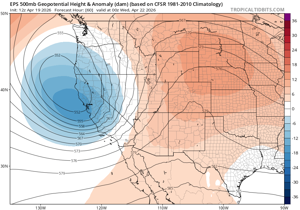
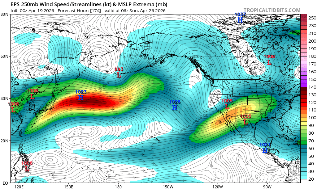
Our unusually active April pattern appears set to continue, at least this week–and possibly beyond. A “bowling ball” low (i.e., one that’s moving rather steadily with mean westerly flow and is not fully cut off from steering flow/the jet stream) will move into Northern California overnight into Monday, and linger through Tuesday–bringing another round of widespread precipitation, some isolated to scattered thunderstorms, and more late-season Sierra snowfall. SoCal will remain, mostly, dry with this event, but the system will represent another in a series of unusually robust late-season storms in NorCal.
This week’s system, while still impressive for the time of year, does not look like it’s going to be quite as dramatic as last week’s. That system was much slower moving, had entrained considerable subtropical moisture, and brought with it conditions highly favorable for multiple rounds of strong and even severe thunderstorms in many areas (which did ultimately materialize, largely as forecast, but brought even heavier precipitation than originally predicted in some spots). This system will feature a weakening cold front, as opposed to a strengthening one; in fact, I suspect the initial wave of precipitation could even “underperform” current model expectations.
But the secondary wave of precipitation on Tuesday is where this system will likely make up for its potentially anemic arrival. Colder air aloft will destabilize the airmass, a cyclonically curved jet overhead will provide respectable forcing, by midday on Tuesday–likely triggering lines of convective showers and isolated to scattered thunderstorms. (There will once again be a possibility of isolated severe thunderstorms in the Central Valley, though I don’t expect the threat will be as widespread or long-lived as last week.) Snow levels will start out quite high once again with this system, likely well above pass level, but will crash on Tuesday as colder air aloft moves in with potentially significant accumulations again above 6k feet or so.
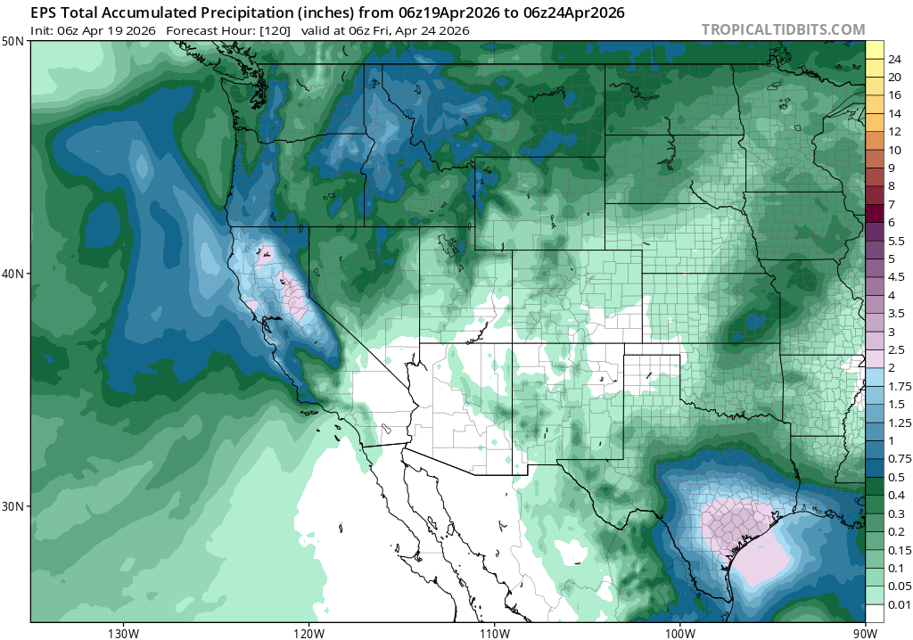
Generally, I expect that precipitation totals will be considerably lower with this system than the last, with perhaps a few local exceptions; combined with other precipitation that has already fallen so far this month, however, it will help push monthly April totals into increasingly impressive territory for this “last gasp” month of California’s rainy season.
Relatively active pattern could linger into late April or early May, but uncertainty is high
Seasonal predictions this year have been confounded by extreme variability, extensive Northern Hemisphere blocking, and multiple episodes of persistent record-breaking temperature dipoles. Looking ahead to late April and early May, it does appear there is a wider range of potential outcomes to consider once again. In general, there are no indications of additional systems as wet or cold as the one slated to arrive this week, or the ones experienced earlier in April; it is possible this week will feature the last major winter-like system of the season. But the ensembles do not indicate that the precipitation season is definitively over, not by any means; lesser precipitation events are scattered across most model ensemble members right into early May. So while temperatures will likely rise during this period and overall less precipitation is expected, continued (lesser) April and then May showers appear quite possible.
Notable, for late April, will be the strength of the subtropical jet stream over and just south of California into the Central U.S. The STJ typically weakens considerably by spring (if it was even notably present in winter in this part of the world!). But this year, it has driven a notable sequence of events in the subtropical central and eastern Pacific, from persistent Kona Lows in Hawaii and associated record-shattering rainfall and flooding to contributing to ridge-building during our exceptional March heat episode to now allowing for the persistence of an unusually active weather pattern to continue at the tail end of the California rainy season. It is possible that this persistently overactive subtropical jet over the eastern Pacific could be related to the extremely warm ocean surface temperatures in this region (see more below), because this intensifies the local poleward SST gradient (which can, in turn, increase the air temperature gradient above–and, indirectly, affect the thermal wind balance that drives the jet). Right now, ensembles suggest this enhanced STJ could continue into early May–so I would not be too surprised if this supports at least occasional showers continuing later into the spring than usual in California.
What’s record oceanic warmth and the Pacific Meridional Mode got to do with it?
Speaking of exceptional events, yet another is currently unfolding in the Pacific Ocean itself: An increasingly extreme marine heatwave, which began to develop as early as late 2025 but has recently intensified and broadened even further during March-April, is now becoming a major driver of conditions from Hawaii to Mexico to California and beyond. In fact, a vast region of the subtropical Pacific in this triangular region approximately between Hawaii, the Pacific Coast of Mexico, and central/southern California is experiencing record-breaking sea surface temperatures. In some ways, this increasingly resembles the exceptional terrestrial heatwave in March–but this time, in the ocean.
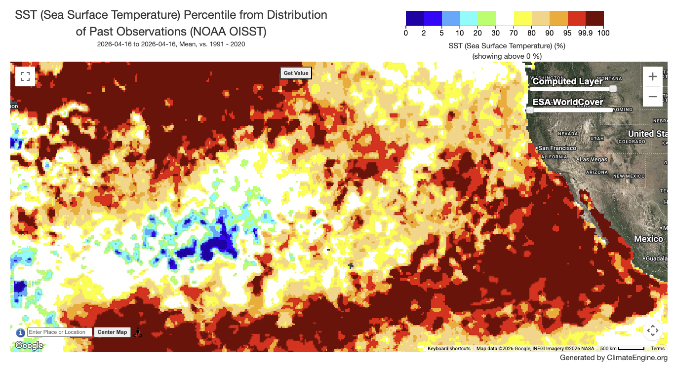
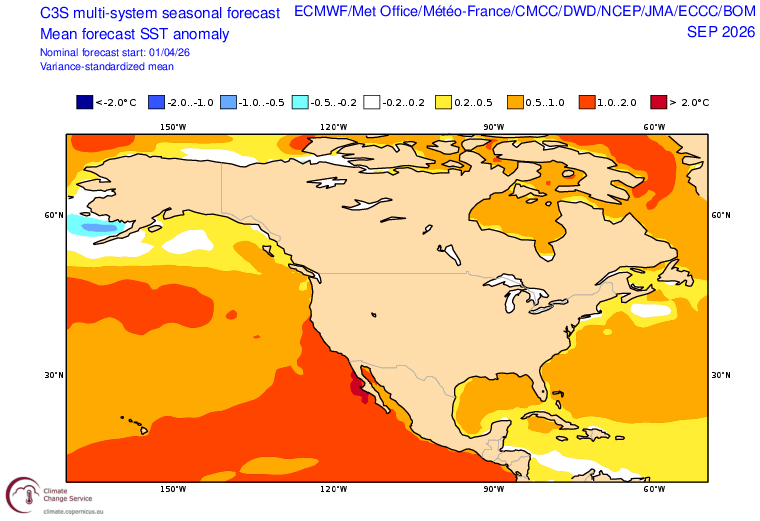
Subtropical ocean warmth in this region tends to be highly persistent, especially when it occurs in spring. Accordingly, seasonal model predictions suggest that this huge region of exceptional oceanic warmth will not only persist for months, or even seasons, but will further expand and intensify to cover essentially the entire Pacific Coast of North America by late summer. The southwest-to-northeast-oriented axis of maximum SST warm anomalies appears to map onto the positive Pacific Meridional Mode (PMM)(PMM), which has increasingly been recognized as a (possibly partially causative) precursor to El Niño. Given the currently extreme ENSO-region predictions from most global modeling centers for the summer, autumn, and winter to come, this increasingly positive PMM is certainly a striking development.
But even prior to a mature El Niño event developing, these extremely warm ocean temperatures will strongly affect CA and broader Southwestern climate in the weeks and months to come. It’s clearly already warming near-shore air temperatures, sometimes dramatically, and will continue to do so for many months.
First, I’d expect a muted “May Gray/June Gloom” marine layer season this year, especially in SoCal but perhaps also northward along the coast. That doesn’t mean there won’t be any fog or stratus, but it will likely be less persistent, less chilly, and may not penetrate as far inland. In fact, there might be some uncomfortably muggy/humid days in SoCal under the marine layer as dew points rise into the 70s along the immediate shoreline. California temperatures will likely be warmer than average, though not necessarily due to extreme daytime maximum temperatures but instead driven preferentially by greatly elevated overnight warmth and occasional humid heatwaves.
Later in the summer, from July/August onward into September/October, there is a pretty good chance of elevated convective activity along the western fringe of the typical monsoon region. This does include most of California. Also, extremely warm SST will raise the odds of “tropical remnant events” in California by this time–especially if a strong El Niño event does ultimately develop, which would result in favorable upper-level conditions for East Pacific hurricanes atop already enhanced “hurricane fuel” from the warm oceans.
In short: I expect the exceptional and likely long-lived anomalous warmth of the subtropical (and also tropical, and eventually extratropical–the whole North Pacific, really, by late summer) to be a key driver of conditions this spring and summer, and that could yield a summer quite different in California and the Southwest than we’ve seen in quite some time.
Join me for a live virtual office hour on Tuesday, April 21 to discuss the active pattern and context of record Pacific warmth
See you at noon Pacific Time on Tuesday, April 21!
Discover more from Weather West
Subscribe to get the latest posts sent to your email.