A very hot start to California summer (except for the immediate coast)
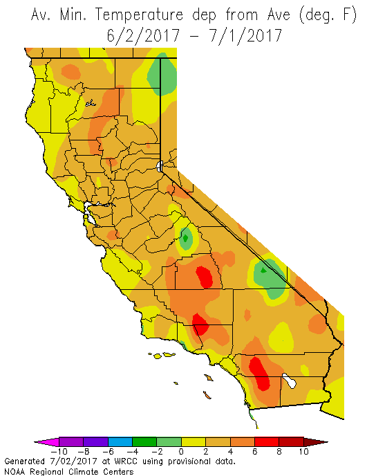
After a relatively mild spring across most of California, June brought quite the reversal. A prolonged, record-breaking, and unusually “muggy” heatwave enveloped nearly all of California for multiple weeks, and temperatures have only fallen back to average over the past few days. This remarkable early-season heatwave set innumerable daily temperature records across the American Southwest, tied or broke several June monthly records, and actually exceeded or tied the hottest temperature on record at a handful of sites (including Needles, CA and Las Vegas, NV). The very prolonged nature of the heat, combined with the presence of an unusually humid airmass over Northern California, made the human impact of the heat even worse–and also led to consecutive “hot day” and record warm overnight temperature records being set in a number of locations.
Interestingly, this searing heat did not quite make it all to the way to the Pacific coast–and while coastal areas in the Bay Area and Los Angeles area were still warmer than average, the lack of sustained offshore flow and the presence of relatively cool ocean surface temperatures allowed these regions a very localized reprieve from the extreme heat. This “cool coast/hot inland” setup is most pronounced during California heatwaves occurring earlier in the calendar year, when coastal upwelling tends to be strongest and when the natural “air conditioning” provided by the marine layer is at its most effective. Autumn heatwaves, on the other hand, tend to be characterized by stronger offshore flow and are more “isothermal”–with similarly hot temperatures occurring far inland and at the immediate coast.
Western ridge rebuilds; heat & and monsoonal flow commence
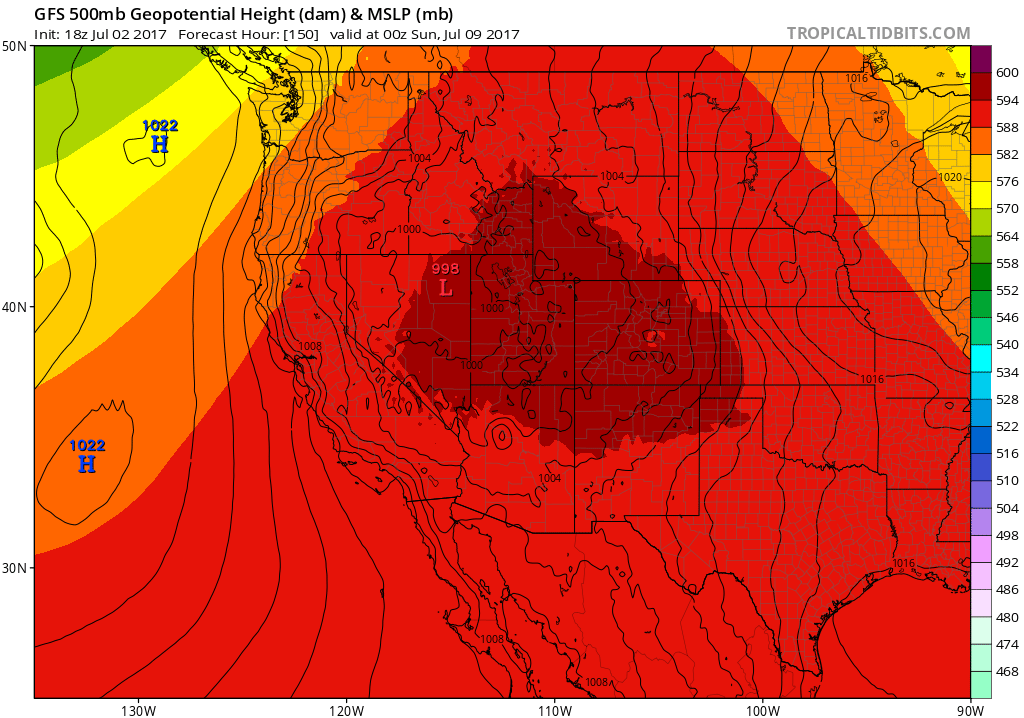
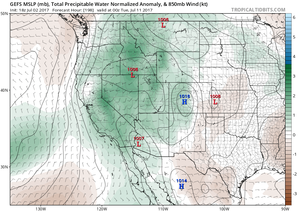
It does appear that Western heat will make a return this week. This, time, as the western ridge builds, middle atmospheric winds will turn toward the southeast over California–opening the door for a substantial influx of monsoonal moisture for the first time this year. As anticyclonic circulation strengthens in the coming days, afternoon thunderstorms will develop to an increasingly widespread degree over the deserts of northern Mexico and southern Arizona, the remnants of which will eventually move from east to west over Southern California. This is a classic early monsoon pattern, and it’s one that the global weather models can capture well at the large scale, but the details are usually rather hard to discern more than a couple of days in advance.
At the moment, it does appear that Southern (and possibly central California as far north as the Bay Area) may be in a generally favorable position to see occasional pulses of moisture and mid-level atmospheric instability over the next 2 weeks. This will probably lead to bouts of widespread mountain and desert thunderstorms, and probably at least a couple of shots at isolated thunderstorms across coastal areas. The timing is impossible to pin down at this point, as weak mesoscale disturbances rotating around the 4-Corners High will dictate the highest likelihood of thunderstorms. As usual, there will be some fire weather concerns associated with dry lightning (especially in the wake of our big heatwave).
The upcoming heatwave won’t be nearly as intense as the last one, although it will still be quite hot away from the coast (and increasing humidity across Southern California may yield increasingly “muggy” conditions as well). There is a bit of uncertainty at the moment regarding how long the strong western ridge will persist. But there are indications that it will be pretty long-lived–and may yield a prolonged 2+ week period of relatively hot conditions and somewhat frequent opportunities for monsoonal moisture and associated convective activity (especially mountains and deserts). It’s that time of year!
Discover more from Weather West
Subscribe to get the latest posts sent to your email.