Prolonged, dangerous heatwave imminent for areas away from coast
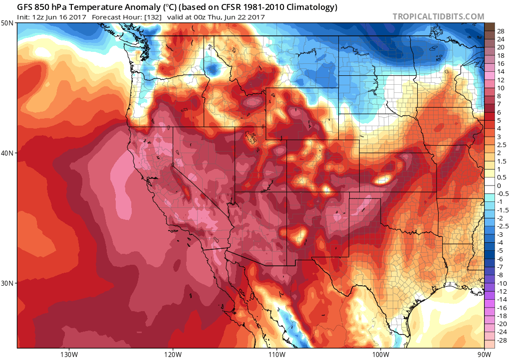
After a relatively mild May and early June period across most of California, a rather remarkable heatwave is already underway and will likely persist for many days. Today will be the first of potentially 7-10 very hot days across inland portions of California and interior portions of the American Southwest, and numerous high temperature records are likely to fall in the coming days. The upcoming heat will be of a dangerous intensity and duration in a significant number of highly populated regions, including the Phoenix, Tuscon, Las Vegas, Bakersfield, Fresno, and Sacramento metropolitan areas. Cities closer to the Pacific coast will still see hot to very hot temperatures over the next week, but not to quite as exceptional a degree as these inland areas.
Dynamics of a heatwave with some unusual characteristics
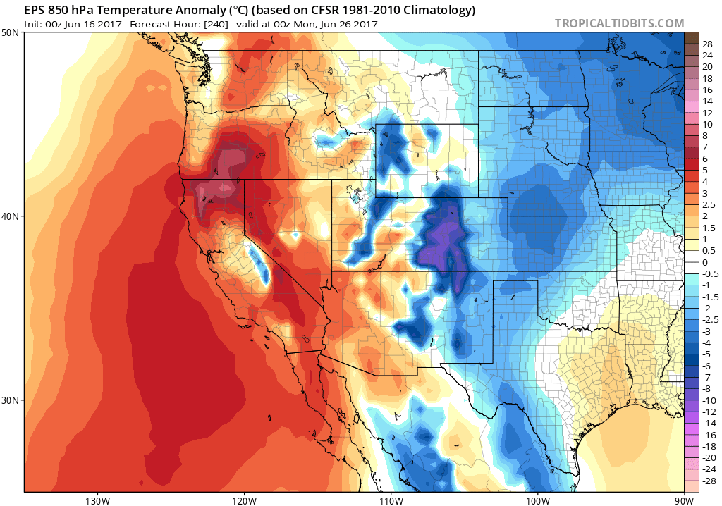
The present heatwave strongly resembles a similar event which occurred just last year (in June 2016), which brought record temperatures to inland desert portions of the Southwest. The event over the next 7-10 days, however, has the potentially to slightly more intense and significantly more prolonged–meaning that overall impacts could be considerably greater. It’s interesting to note that both the GFS and ECMWF model ensembles did a good job capturing this event–with strong signals for anomalous warmth appearing 10-14 days in advance.
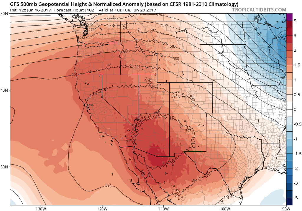
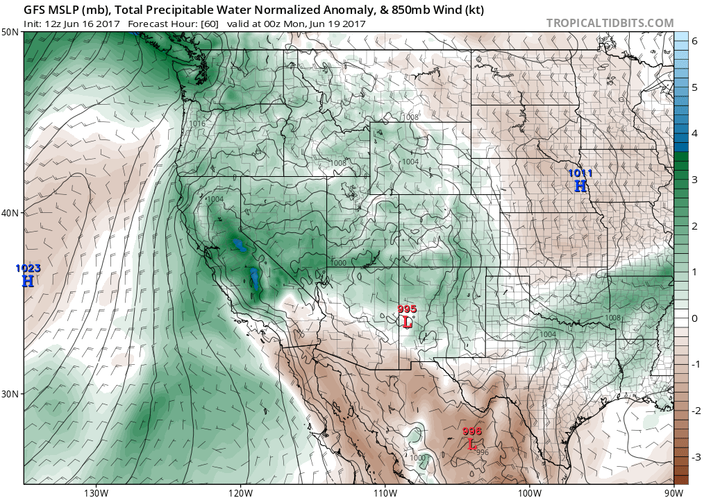
A strong and broad high pressure ridge is developing over the West Coast and interior Southwest, and will shift slowly westward over time. As it does so, the hottest temperatures will slowly shift from the southern Arizona deserts this weekend to the California interior early next week. Though it’s often California’s good fortune to experience “dry heat”–during which low surface dewpoints actually decrease the “apparent temperature” and take the edge off otherwise searing temperatures–that won’t necessarily be the case during the present heatwave. An unusually moist airmass is currently in place over much of California, which can be linked to the passage of an unusually strong atmospheric river over the Pacific Northwest yesterday (which brought heavy June rain to Washington but just clouds to Northern California). Linger moisture will become trapped within the stagnant airmass under the building ridge–which ultimately means that the extreme temperatures associated with the upcoming heatwave will coincide with a rather moist airmass and unusually high surface dewpoints.
This added moisture has several implications. First, it will make the intense heat feel even more oppressive (i.e. “muggy”), as apparent temperatures will not fall below the actual temperature as they often do during California heatwaves. Second, higher dewpoints will greatly inhibit overnight cooling across inland areas. In fact, portions of the Central Valley could see overnight lows staying as high as 70-80 degrees. Lack of overnight cooling is one of the strongest predictors of heat-related illness during prolonged heatwaves, so this presents significant concerns. Finally, the relatively “juicy” airmass by California standards will allow afternoon thunderstorms to develop over the Sierra Nevada on most afternoons during the heatwave. While not currently depicted in model forecasts, previous experience with events like these suggests that there will be at least a small chance of some convective build-ups and perhaps some isolated thunderstorms outside of the Sierra Nevada. These would be most likely over the San Joaquin Valley, where the confluence of extremely hot temperatures and outflow boundaries propagating away from Sierra Nevada storms could act as a localized trigger. The chance of this happening is low, but it’s worth mentioning as an indicator that this heatwave is a departure from the norm in California.
Sweltering inland, but merely “hot” near the coast
This heatwave will behave more typically in another respect, however: immediate coastal areas will not experience exceptionally hot temperatures during this event. This is a characteristic shared with nearly all June heatwaves in California. Why? The near-shore Pacific Ocean is still too cold enough in May and June to generate strong near-shore sea breezes when things heat up inland–acting as a natural air conditioner for places within about 10 miles of the coastline. Later in the summer (by August and September), sea surface temperatures are warmer, and this effect is less pronounced. This is the reason that San Francisco and the beaches of Southern California typically see their hottest temperatures of the year in late summer and autumn. On the other hand, the upcoming heatwave will likely be prolonged enough to curtail coastal upwelling–meaning that near-shore SSTs may begin to rise by next week and provide progressively less relief as the event drags on.
While the coastal plain of California experiences highs mostly below 90 degrees next week, most of the Central Valley will see temperatures approaching 110 degrees (and perhaps even getting close to 115 in some portions of the San Joaquin). California’s southeastern deserts will see temperatures of 115-120 degrees. Incredibly, the Phoenix, AZ region may see temperatures rising into 122-123 degree territory. Except along the immediate coast, these values will likely break daily temperature records in many places, and will approach monthly June records in some spots. In the hottest desert regions, all-time high temperature records (for any month) may be at risk.
Relief in sight? Maybe not.
Heatwaves in California rarely last longer than a few consecutive days, or a week at the most. Yet it’s not clear at this point that the developing heatwave will be quick to dissipate. In fact, the ECMWF ensemble now suggests that the ridge may re-strengthen considerably next weekend after weakening only slightly late next week–turning this already remarkable heatwave into a 10+ day event. The GFS is a bit more merciful in showing a partial breakdown of the ridge in 8/9 days, but at this point it’s hard to say which solution is more likely. Either way: this will likely be a high-impact and very uncomfortable event for those living away from the ocean for the next week at least. Stay tuned.
Discover more from Weather West
Subscribe to get the latest posts sent to your email.