Rain, at last, in Southern California today; colder (and drier) pattern to come
Very wet October in NorCal transitioned to very dry first half of November
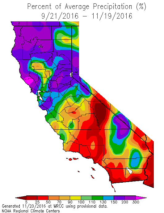
After a remarkably active early autumn storm track brought prodigious rainfall to the Pacific Northwest and the northern third of California, conditions during the first half of November were markedly drier. Early season precipitation surpluses have declined toward more typical values for this time of year, and about 2/3 of California is now near or below average for the year to date. In Southern California, conditions remain extremely dry–and in some places there still hasn’t been any meaningful precipitation so far this season. As I discuss below, however, this will most likely change in a matter of hours.
Topsy-turvy weather across Northern Hemisphere; extraordinary Arctic “heat wave”
The past 60 days have featured a very impressive range of weather extremes across the Northern Hemisphere–most of which have been related to the relentlessly above-average temperatures that have pervaded most corners of the planet over the past few years. Innumerably many autumn high temperature records have been set, including here in California.
But some of the most remarkable atmospheric anomalies have been occurring up in the Arctic. Over the past few weeks, a truly extraordinary “heat wave” has been taking place at a time of year when temperatures should be plummeting to bitterly cold values after the onset of “Polar Night.” Near the North Pole, surface temperatures have been at or near the freezing point for an extended period of time–around 35 degrees F above average, and not cold enough to allow for the formation of sea ice. This extreme warmth, combined with unusual wind patterns, have combined to produce record-low sea ice extent across much of the Arctic Ocean basin. In fact, (apparently) for the first time in the observational record, significant multi-day sea ice losses have occurred during the peak freeze-up season. Meanwhile, in Northern Siberia, extreme cold and incredibly deep snowfalls have been observed–itself likely a consequence of the lack of sea ice to the North. This has led to a rather incredible atmospheric setup where actual temperatures currently increase as one goes north from Eurasia to the North Pole.
Despite onset of #PolarNight, temperatures near #NorthPole increasing. Extraordinary situation right now in #Arctic, w/record low #seaice. pic.twitter.com/zpS8hDK2nG
— Dr. Daniel Swain (@Weather_West) November 16, 2016
These highly anomalous conditions in the Arctic are more than just a curiosity; there’s an increasing amount of evidence that sea ice loss is affecting weather conditions in mid-latitude regions (i.e. where we live). The details regarding this interaction, unfortunately, remain quite hazy–and it’s still difficult to say exactly what effect the extremely low Arctic sea ice might have on California weather. I would venture, however, that an increased meridional temperature gradient over the West Pacific due to the southward-displaced cold pool over Eurasia may have fueled the unexpectedly strong North Pacific jet stream earlier this autumn. Extremely anomalous Arctic temperature and sea ice conditions are now expected to persist through much of the coming winter, so I may revisit this topic a bit later in the season.
Substantial SoCal rainfall (& thunderstorms?) today, then colder/drier
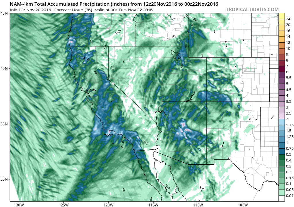
Some good news closer to home: significant rain and snow have already arrived across NorCal, and a second wave is currently developing closer to SoCal this afternoon. This precipitation is associated with reasonably cold air aloft, and so much of the Sierra Nevada has been blanketed by fresh snowfall over the past 24 hours. While the cold front does not currently appear all that impressive on radar or satellite imagery, an increasing amount of moisture and instability is expected to re-energize this storm as it moves across the Southern California Bight this evening.
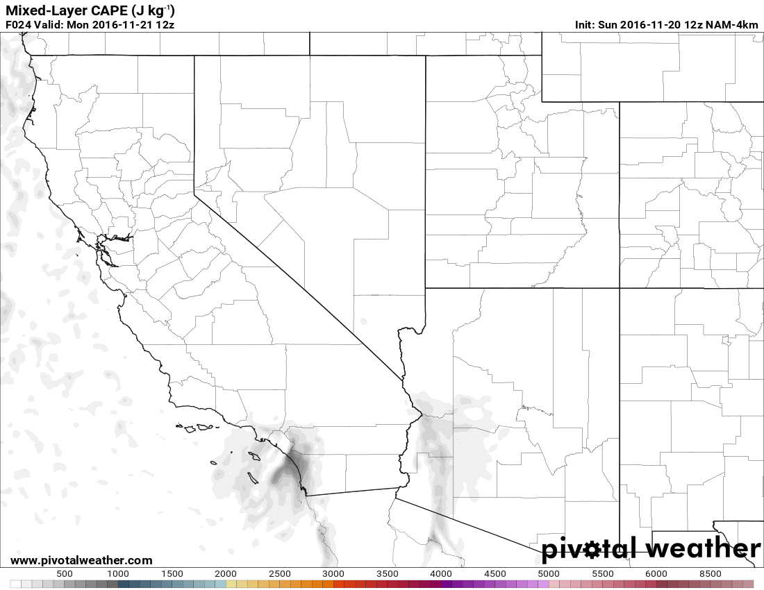
Scattered convective showers are already popping up near the LA Basin, and I would expect these to increase throughout the day. The cold front itself may be rather narrow but will be highly convective, and could contain some impressive downpours and embedded thunderstorms this evening. In fact, convective parameters at the moment look fairly impressive, so I wouldn’t be too surprised to see a stronger cell or two. Widespread significant rainfall is expected in both Los Angeles and San Diego–perhaps upward of half an inch in most spots. While this won’t be a huge storm system, it will represent the first widespread soaking rainfall of the season across the Southland.
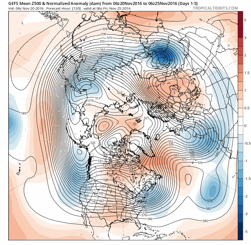
Unfortunately, the forecast for SoCal turns much drier in the long range–and after today’s precipitation there may be little more for the next 10+ days. NorCal will remain reasonably wet, with precipitation around average for this time of year over the next 10 days. Importantly, the NorCal systems over the next 10 days will be relatively cold–and will produce healthy snowfall accumulations across at least the northern portion of the Sierra Nevada. It appears that the longwave-pattern over the Pacific will shift subtly toward one less favorable for California storminess over the next 1-2 weeks, and more toward the dry pattern which continues to be depicted by the seasonal forecast models for December-March. Notably, this setup doesn’t represent a total “precipitation shutout” for California, but the forecast position of high pressure over the Pacific would tend to favor colder, less moisture-laden systems taking a more inland track. It will be interesting to see if this trend continues as we head into December–our first “core” rainy season month. In the meantime, enjoy the rain!
Rain, at last, in Southern California today; colder (and drier) pattern to come Read More »