Major monsoonal moisture surge to bring fairly widespread California thunderstorms (wetter south, drier north), with NorCal fire weather concerns
Continued heat, with record vegetation flammability across interior NorCal
I’ll keep this section brief, as there is much to discuss regarding the upcoming pattern itself. But suffice it to say that the interior of NorCal has continued to bake for most of July, despite the slightly lessened pace of record-breaking high temperatures. Some areas across the NorCal interior are continuing to experience their hottest summer on record to date, and this is in the midst of an extreme to record breaking drought in the same region. As a result, soil and vegetation dryness are now approaching or have already reached record levels–not just for the calendar date, but for any time of year. This has yielded vegetation flammability that is similarly off-the-charts. And that’s reflected by the extraordinary and extreme fire behavior being almost continuously observed on large fires like the Dixie Fire, currently burning in (primarily) Plumas County at the moment, even in the absence of extraordinary ambient fire weather conditions. This record vegetation dryness and drought, especially in northern and central CA, is the context through which the upcoming probable lighting event should be viewed from a fire weather perspective.
Deep surge of monsoonal moisture & instability across *all* of CA
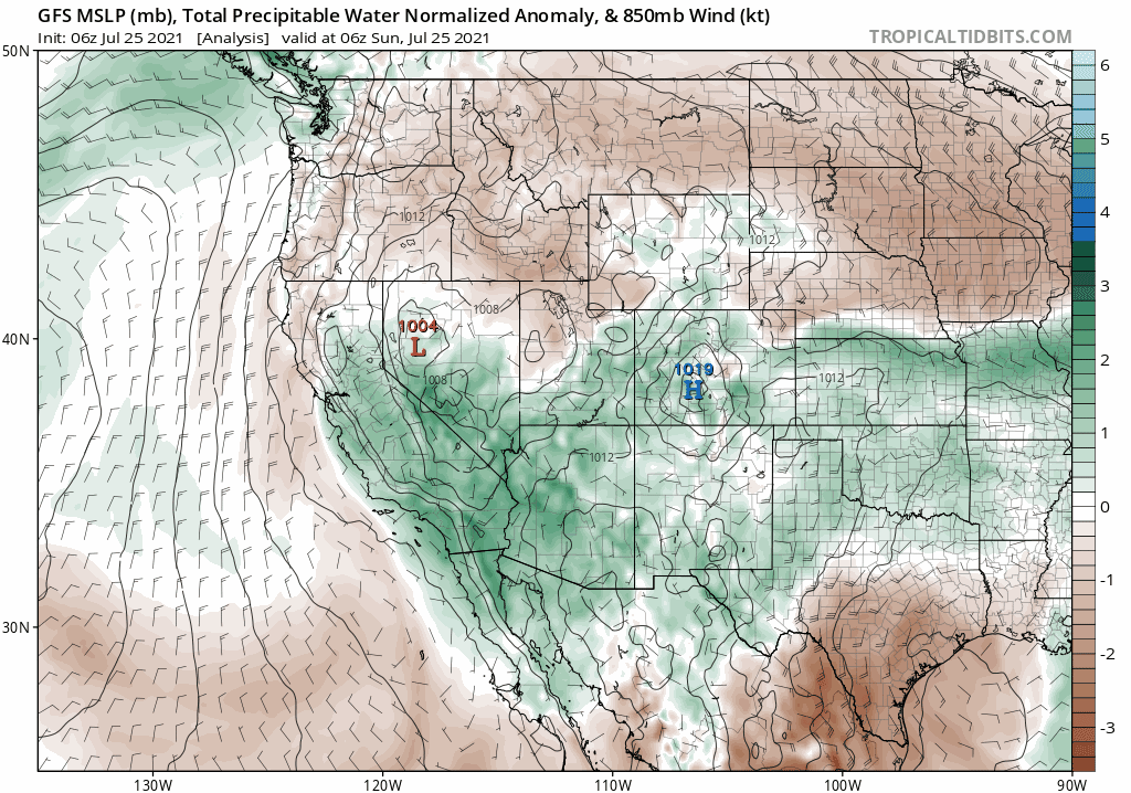
I continue to be fairly impressed by the extent and depth of projected moisture and instability across a good portion of California at various points over the next few days. This will be a true monsoonal surge–with distinct easterly flow over SoCal, and southeasterly flow across NorCal–complete with multiple easterly waves that will provide some mid-level lift and focal points for convective activity. Additionally, a weak low pressure system off the central CA coast will offer some mid-upper diffluence over the regions through mid-week–further enhancing the mid-level dynamics that are sometimes missing during monsoonal surge events.
This looks to be a classic, relatively high-end monsoonal pattern across CA. There will be at least a slight chance of some thunderstorm activity across every corner of the state during this event, but the likelihood will vary significantly from place to place and the character of the storms themselves will vary much between NorCal and SoCal (see below).
At the moment, the first wave (due in tonight) appears to be the weakest and least significant of the week. Some isolated SoCal thunderstorms are possible, but this one could potentially fizzle out. But that’s much less likely to happen with subsequent waves beginning Monday and continuing through at least Wednesday. During that period, subtle mid-level features (vorticity maxima as well as broader easterly waves) will contribute additional bursts of instability and weak mid-level lift–which will likely be more than enough to trigger occasional high-based thunderstorms across the region at times. Timing these subtle features is still almost impossible this far out, so I won’t try to do so. But there will likely be multiple peaks and lulls during this fairly extended monsoonal event, and SoCal will likely see activity before NorCal.
Wet(ter) storms south, dry(er) storms north; fire risk highest NorCal
This event appears poised to bring quite a moist airmass to California, with precipitable water in the 98-99th percentile for summer. That means there will be plenty of moisture to work with, by July standards, to generate convection. But most of this moisture will be in middle and upper levels of the atmosphere, especially as one moves progressively farther north within California. What does that mean in practical terms?
Well, in SoCal, most thunderstorms will be accompanied by rain, perhaps even heavy rain. Isolated dry lightning strikes will be possible outside of rain cores, but in general I don’t expect widespread dry lightning across SoCal during this event. Instead, I would expect to see pretty good coverage of downpour-producing storms, which could still spark local fires but could also produce localized flooding (mainly mtns and deserts) due to heavy downpours. I would also expect very muggy and uncomfortable conditions across SoCal during this event, as the marine layer becomes suppressed and surface dewpoints become very elevated.
In central and northern California (west of the Sierra Nevada crest), the story is more complicated. Here, there will be a much drier sub-cloud layer–so despite the large amount of overall moisture in the atmosphere, and the relatively high likelihood of convective activity, wetting rainfall is pretty unlikely. Brief showers are still likely with thunderstorms that develop across NorCal, but due to a combination of that dry sub-cloud layer and relatively fast motion of cells, dry lightning is much more likely up north. Rainfall ranging from only a trace to maybe a few hundreths is most likely from these thunderstorms. This is bad news from a fire weather perspective, because (as noted above) vegetation is at record dry levels and the lightning ignition efficiency will likely be quite high. The brief showers that may occur up in NorCal with this probable lightning event will still likely allow for a high likelihood of new fire ignitions, since there just won’t be enough water to extinguish any new starts.
For the Sierra Nevada along and east of the crest, a mix of drier and wetter storms is likely–and some of these could actually produce pretty heavy rainfall. There could be a risk of debris flows in areas that have recently experienced wildfire this summer–particularly on the Tamarack Fire (which is still actively burning!). For the Dixie Fire, I would be more concerned about dry lightning and outflow winds, as well as yet another round of explosive fire-generated pyrocumulonimbus activity (i.e., a very tall column with the possibility of fire-generated lightning and fire-generated extreme winds) over the next few days. While brief precipitation is *possible* in Plumas County, I wouldn’t count on it…and there’s a pretty high chance that new lightning, convective wind gusts, and strongly plume-dominated fire behavior will outweigh any benefits.
Overall, I think there is much lower “bust potential” with this event than the one last week. Mid-level support is much stronger, and there will be multiple opportunities over several days for significant convective activity. I am still not sure how likely a widespread dry lightning event is up in NorCal, but the possibility is certainly there. These likely won’t be completely dry storms, but there’s a good chance they will be “dry enough” storms to produce new fire ignitions and extreme fire behavior on existing fires in Norcal. In SoCal, lightning fire risk will be reduced (but not zero) because storms will be wetter–and there could even be a few conspicuously heavy downpours/flood events. Most areas in NorCal will not see measurable precipitation this week, despite the relatively widespread lightning risk, and while heavy downpours are indeed possible across SoCal, some spots may still remain dry down there too. Such is the nature of monsoonal activity in the summer…
Additional moisture surges/easterly waves possible through next weekend
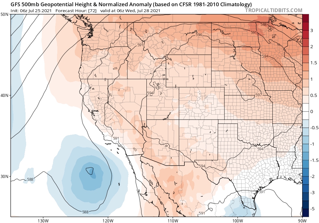
As noted above, both the ECMWF and the GFS suggest that an additional wave or two of convective activity could occur between mid-week and next weekend. That’s still a bit speculative given how poorly the models usually are in capturing monsoonal surges more than a couple days out, but the overall pattern will continue to be supportive for the possibility of some wetter thunderstorms in SoCal, and perhaps some drier storms in NorCal. Additionally, much of California will be warmer than average during this period–especially across the northern interior (of course) but also along the coast (mainly due to suppression of the marine layer and warm overnight temps due to the humid airmass). There could also be some warming of coastal ocean temperatures during this period as northwesterly flow and offshore upwelling is curtailed. In general, I expect the coming week to be one of the more active statewide summer weather periods we’ve seen in the past few years (with the clear exception of the Great NorCal Dry Lightning outbreak of August 2020–which I still don’t think this one is likely to match, fortunately). As always, I’ll be following up with the day-to-date details on Twitter.