Strong La Nina conditions likely to affect California during fall and winter
2010-2011 Fall/Winter Outlook
La Nina conditions have been developing since early summer 2010, and negative sea surface temperature anomalies (SSTs) have continued to increase almost continuously since then. Further intensification of the present La Nina event is likely over the next 1-3 months. Given the magnitude and early onset of La Nina conditions across the Eastern Equatorial Pacific, significant impacts are possible along the West Coast of North America.
[ad#post-ad-w]

Overview
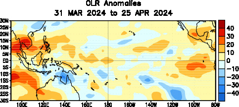
Negative SST anomalies have been increasing in magnitude since mid-May 2010. As of late September, SST anomalies in all four Nino Regions have approached or exceeded -1.5°C, which is generally considered the threshold by which “strong” La Nina events are defined. Smaller regions with anomalies of -2.5°C or greater have begun to appear in September, and subsurface anomalies as high as -6°C are presently being observed. Easterly wind anomalies have been persistent in the Eastern Pacific, and outgoing longwave radiation (OLR) anomalies have been consistent with a significant La Nina episode.

Evolution
The date of increase of SST anomalies thus far has been impressive–among the highest ever directly measured for significant La Nina events. Even more impressively, the present La Nina (by at least one measure) may be the strongest ever recorded at this time of year. Considering the earliness of the season, the ongoing and sustained high rate of SST anomaly increase, and the fact that La Nina events tend to intensify during the fall season, I expect the present La Nina to continue to increase in magnitude for the next 1-3 months. Dynamical and statistical climate forecast models nearly all forecast the maintenance or further strengthening of La Nina conditions through the 2010-2011 winter season, with a few dynamical models indicating significant intensification. The CPC’s CFS model, in particular, has an ensemble mean bottoming out below -2.5°C during winter. There is, therefore, high confidence that strong La Nina conditions will be in place for all of fall 2010 and probably most or all of winter 2010-2011, as well.

Impacts on California and the West Coast
The role of tropical forcing in California’s winter weather has long been recognized in the meteorological community. The connections that do exist, however, are not always straightforward and often run counter to popular belief. ENSO events–either warm-phase (El Nino) or cool-phase (La Nina)–do influence the atmospheric circulation patterns over the Pacific Ocean and adjacent land areas. In a broad sense, El Nino events tend to lead to an enhanced subtropical jet stream and increased precipitation in Southern California (with unusually dry conditions over the Pacific Northwest), while La Nina often allows the Pacific jet to trend further northward, bringing increased precipitation to the Pacific Northwest (and below normal precipitation to Southern California). Across the northern 2/3 of California, however, there really isn’t a strong precipitation signal in either direction except during strong El Nino events. Northern California is the dividing line between the two extremes, and it’s hard to say where exactly that line will fall in any given year. In 2010/2011, however, the magnitude of the ongoing La Nina events is large enough that I feel there will be significant impacts in the Pacific Northwest (well above average precipitation) and in Southern California (below normal precipitation). The northern part of California may be subject to some notably strong and cold storm systems as the North Pacific jet becomes very active later in the fall, though La Nina’s effect on seasonal precipitation in Northern California is not clear enough to draw any conclusions in this regard. There has been significantly less research on the effect of La Nina on winter temperatures across California, but some relatively recent research (and anecdotal evidence) indicates that there is a weak correlation to below-normal temperatures across most of the state (except the southeastern deserts). I suspect, however, that the negative temperature signal may be stronger during intense and prolonged La Nina events than for all La Nina events in aggregate. Thus, below-average winter temperatures across most of California seem likely this year.
Summary
- Strong La Nina conditions likely to persist or intensify through fall/winter 2010-2011
- Above-average precipitation in the Pacific Northwest and far northern California
- Below-average precipitation in Southern California
- Below-normal winter temperatures across most of the West Coast
© 2010 WEATHER WEST

Strong La Nina conditions likely to affect California during fall and winter Read More »