Strong and cold NorCal storm Thursday, then a less active late January pattern to follow
A pretty quiet winter so far
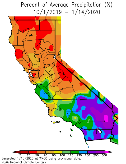
The rainy season arrived haltingly in 2019-2020. After one of the latest arrivals of wetting rainfall on record in parts of California, very heavy precipitation in late November and early December (particularly in southern California) suddenly ended what seemed like an interminably long fire season. After that brief but much needed wet interlude, however, the prevailing atmospheric pattern shifted toward one that favored occasional weak-to-moderate storms, but no large precipitation events. As a result, season-to-date precipitation deficits gradually increased across the northern 2/3 of California–though SoCal is still riding on the coattails of that unusually intense burst of early-season precipitation and remains near or above seasonal averages. Thus, a pretty striking contrast exists between far northern California (where precipitation has been less than 50% of average to date) and far southern California (where precipitation has been as much as 50-75% *above* average to date).
Intense cold frontal passage in NorCal expected Thurs AM
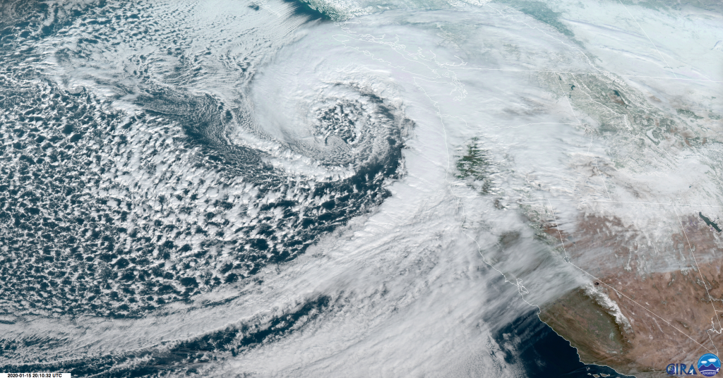
A strong and well-defined winter storm system (classic extratropical cyclone!) is currently located off the coast of the Pacific Northwest, and is slated to bring widespread precipitation to California tomorrow. Due to a pre-existing cold airmass, this storm is actually expected to produce accumulating snow down to sea level in parts of the Seattle and Vancouver metro areas, though not quite to the degree as earlier model forecasts might have suggested.
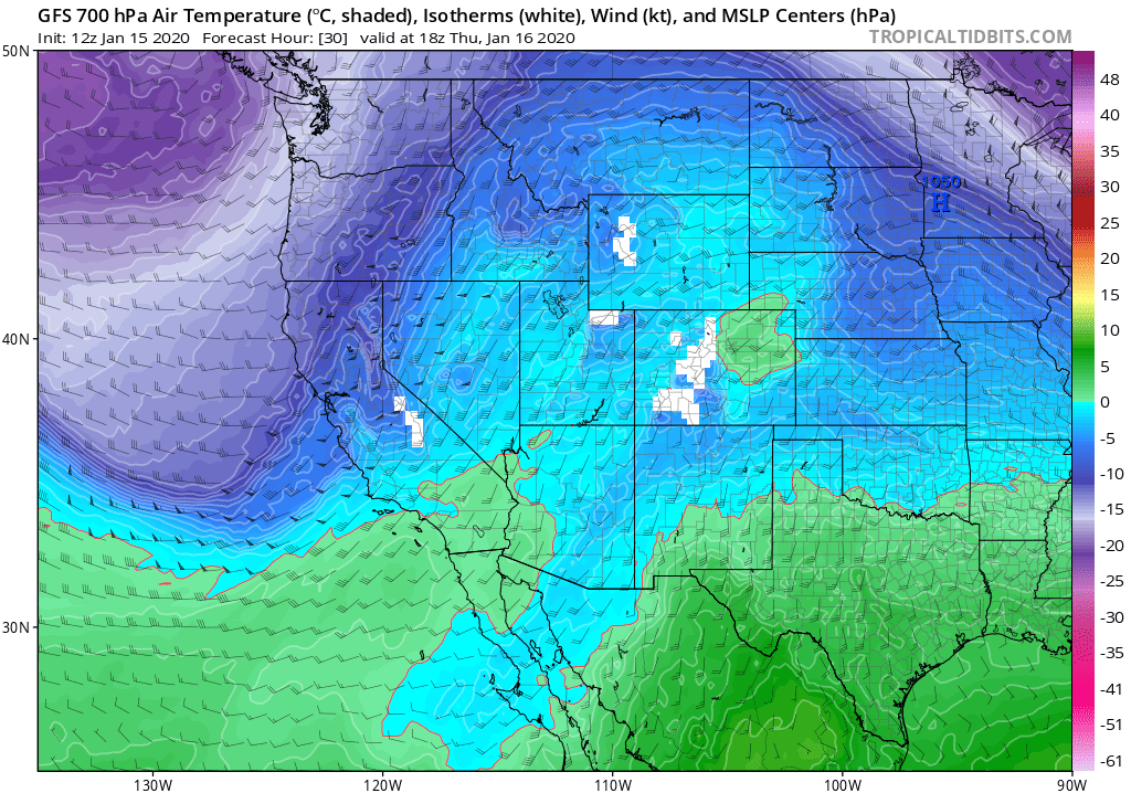
In Northern California, the models have converged on what now appears to be a pretty strong cold frontal passage on Thursday. An unusually well-defined cold front will usher in a relatively brief but possibly quite intense burst of very heavy rainfall, gusty winds, and possibly even thunderstorms. The storm will also be associated with pretty cold air aloft and strong frontally-forced ascent, and will bring heavy accumulating snowfall down to ~2,000ft or perhaps even a bit lower (which includes much of the Sierra Nevada foothills). This, in combination with the fact that the worst rain/wind will likely occur during daylight (i.e., commute) hours tomorrow, suggests that this storm will be a relatively high impact event despite the relatively low likelihood of widespread flooding or wind damage. High-resolution convection-resolving models are also suggesting the potential for the formation of a “narrow cold frontal rainband” (NCFR) feature tomorrow across parts of NorCal (including the SF Bay Area), which could potentially produce a narrow line of torrential downpours and very gusty winds.
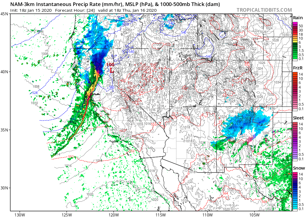
Behind the front, the airmass looks relatively cold and unstable, so I would expect a standard “scattered shower and isolated thunderstorm” convective regime (though heavy snowfall could persist longer in the Sierra Nevada). Southern California will see some precipitation out of this storm, but the cold front will weaken pretty dramatically south of Point Conception so I would expect few impacts there other than wet roads.
Slightly unsettled conditions next 5 days, then drying out. But…
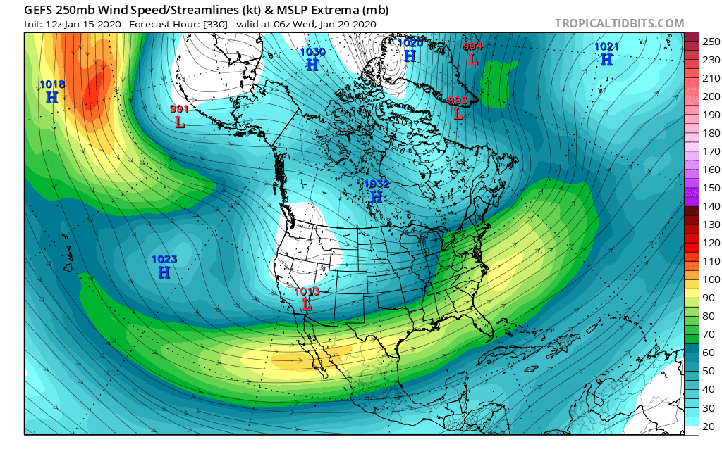
Following Thursday’s stronger NorCal system, a couple of additional (weaker and warmer) systems may affect the state through the upcoming weekend, although I would expect additional rain/snow accumulations to be pretty modest. After that, most model ensembles suggest a drying and warming pattern is likely for much of the rest of January. However, it’s unlikely that this period will be completely dry–and won’t be characterized by the kind of persistent ridging that totally blocks the storm track. While below-average precipitation is likely for a 2+ week period, a few smaller precipitation events will likely sneak in under the developing ridge. Additionally, recent runs of both the GFS and ECMWF are hinting that there is a chance (around 1 in 4 odds) that a relatively strong subtropical jet could undercut the broader ridge along the West Coast. If that happens, the potential for warm/moist southern stream storms to affect California would increase substantially. Time will tell which outcome ultimately comes to pass, but at least in the meantime tomorrow’s storm should help top up our currently below-average mountain snowpack (which is currently running around ~75% of average for the date).
Strong and cold NorCal storm Thursday, then a less active late January pattern to follow Read More »