California fire season explodes with a new lightning outbreak on the way; El Niño strengthening as expected
A remarkably active California summer
Summer 2015 has thus far featured remarkably active and unusual weather conditions across most of California. Quite a few waves of monsoonal moisture have brought intense mountain and desert thunderstorm activity, some of which has locally made it into the coastal plain and Central Valley.
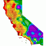
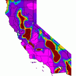
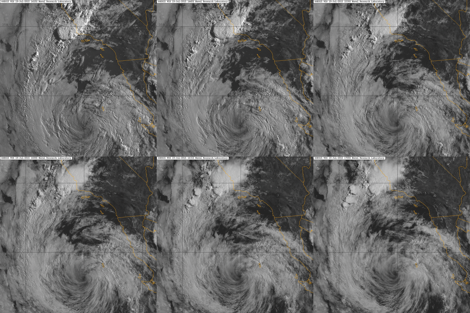
By far the most notable event in the past few weeks was the landfall of the remnants of former Hurricane Dolores in Southern California, which brought a 3-day period of widespread heavy precipitation and prolific thunderstorms to the southern third of the state. This event ended up being the most significant California tropical remnant event in recent memory, and brought record-shattering July rains to the San Diego area and surrounding deserts. Widespread flash flooding occurred, and significant damage occurred in a few spots, including the collapse of a bridge over heavily-traveled Interstate 10. To put the magnitude of this event in perspective: the official city of San Diego observation site recorded more rainfall in 3 days during July 2015 than during all previous months of July since at least the 1800s….combined. Another rather mind-boggling statistic: almost all of southern California experienced more rain during one weekend in July 2015 than did most of Northern California during the entire month of January 2015.
California’s fire season shifts into extreme high gear
There has been much discussion about–and consternation over–the growing potential for dangerous wildfire conditions as California’s extreme multi-year drought persists and intensifies. With a handful of notable exceptions, much of the state had escaped relatively unscathed so far over the course of the drought despite the existence of extraordinarily dry vegetation and rapidly worsening forest mortality. Unfortunately, that relatively good fortune has started to change rapidly in recent weeks as an increasingly serious wildfire outbreak has developed across the northern 2/3 of the state. Last week’s heatwave in NorCal provided the initial trigger for the first wave of fires, and although some of those wildfires are now contained, it severely taxed California’s wildland fire fighting resources. Then, over the weekend, a major dry lightning event unfolded over the northern 1/3 of California, triggering well over 100 new fire starts. The situation has worsened to the point that Governor Jerry Brown has declared a state of emergency, the National Guard has been activated (and Air Force Reserve aircraft have been flying regular sorties into fire-affected areas), and over 10,000 firefighters are currently engaged in active firefights around California.
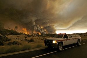
This outbreak coincided with the explosion in size of the Rocky Fire in Lake County, which (although apparently not caused by lightning) has now burned around 70,000 acres of mixed forest and chaparral east of Clearlake. The Rocky Fire has been exhibiting “ultra-extreme” fire behavior, burning with such intensity and speed that it has routinely generated its own weather conditions. The convection column associated with such extreme “plume-dominated” behavior has produced numerous pyrocumulus clouds, leading to strong and erratic winds, “fire whirls” (which are about as terrifying as they sound), and (anecdotally) even some lightning strikes. CalFire reported that the Rocky Fire burned over 20,000 acres in a single 5-hour period in the middle of the night over the weekend–which appears to be unprecedented for a fire burning in these fuels and in this part of the world. The end result is a fire that has thus far proven to be essentially uncontrollable–and continues to escape all attempts at substantial containment as it burns primarily to the north and east. The severity of this and other ongoing fires in California can almost certainly be attributed to the extremity of the ongoing drought–the magnitude of which has likely been amplified by global warming.
Major lightning event possible later this week
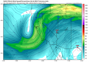
Unfortunately, there’s some additional bad news on the fire weather front: a major lightning outbreak is probably on tap for Northern California from later Thursday through early Saturday, and most of these thunderstorms will produce little precipitation. A fairly deep upper-level low off the California coast will further strengthen as it slowly moves ashore late Thursday night into Friday.
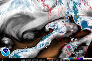
This setup–with a relatively deep low close to the NorCal coast, an impressive jet streak nosing inland, relatively strong mid-level divergence, and a bit of colder air aloft thrown into the mix–appears strikingly like the classic analogue for widespread autumn lightning outbreaks in Northern California. While moisture will definitely be the limiting element, these is a chance that some mid and upper-level moisture might get entrained into the circulation from East Pacific Tropical Storm Guillermo currently spinning near the Hawaiian Islands. Even without that added moisture, elevated convection would likely occur over much of NorCal, very possibly including coastal and valley areas (i.e. including San Francisco, Sacramento, and Eureka). Dry lightning and associated fire starts will therefore be a major concern, since even if light precipitation does occur, drought-stressed fuels are extremely receptive to ignition sources this year. Events like this are always subject to a great deal of uncertainty, since quite a few ingredients need to come together in order for a major lightning event to occur. But recent model forecasts have actually come into closer agreement that the end-of-week of event could be quite substantial (and perhaps focused further south than the last round of lightning along the North Coast–this time, from the Bay Area into the mid-Sierra foothills).
El Niño continues to mature; very strong event still likely
El Niño update: it’s still there, and it’s continuing to strengthen as expected.The ongoing event is already quite strong, and although much has been made of daily fluctuations in the Niño region ocean temperatures, all available evidence continues to point toward continued strengthening into the fall months and persistence through winter 2015-2016.
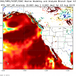
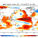
Interestingly, the strongest westerly wind burst yet this year has just occurred in the western tropical Pacific, which has initiated a powerful new Kelvin wave that is now propagating eastward across the Pacific basin and will continue to reinforce the strengthening event through September. It’s still too early to say exactly how El Niño will influence California’s upcoming winter, though it still appears that there’s a significantly increased chance of a wetter-than-average winter. Of shorter-term interest: extremely warm near-shore sea surface temperatures off the Mexican and California coasts will continue to present an increased potential for East Pacific tropical remnant events through September and possibly October.
One thing is certain: this has been one of the most interesting summers weather-wise in California in quite a few years, and that trend is likely to continue over the next couple of months. Stay tuned.
© 2015 WEATHER WEST