After another extraordinary mid-winter dry spell, major atmospheric river to soak NorCal later this week
An exceptionally dry January…once again.
California has experienced some serious “weather whiplash” over the past several months.
Extremely dry conditions heading into the early fall months gave way to a relatively brief ~2 week period of extremely heavy precipitation throughout much of coastal Northern California in early December, shattering local calendar date rainfall records in many places and even approaching all-time daily/December monthly records in a few spots around the Bay Area. These very high regional rainfall totals were caused by an influx of warm and moist air into California from the subtropics courtesy of a series of “atmospheric rivers” (the emerging technical term for narrow corridors of very high atmospheric water vapor transport, typically associated with mid-latitude storms). Despite the prodigious amounts of water that fell from the sky during the December event, most of this precipitation fell within 100 miles of the Pacific Ocean–and the precipitation that did reach the Sierra Nevada Mountains fell mostly as rain rather than snow due to ongoing record warmth.
Then…the spigot shut off. Although a couple of very odd southern-track systems approaching far southern California from the subtropics and brought some localized significant precipitation to that region over the past couple of weeks, January 2015 was an extraordinarily dry month across most of California. Across the northern 2/3 of the state, there was almost no precipitation to speak of–and in the Bay Area, no measurable rainfall whatsoever occurred at most observation sites. Numerous locations set new records for the lowest January precipitation ever recorded, and quite a few of those records are truly “all time” records–it is strictly impossible to ever receive less than 0.00 inches of precipitation. San Francisco’s precipitation record, in particular, goes back to the Gold Rush era (1850), and January 2015’s grand total of 0.00 inches broke the previous record of 0.06 inches–which was set just a year ago (2014) at the height of the Ridiculously Resilient Ridge. This is especially remarkable given that January is the climatological peak of the rainy season in the Bay Area. Further, the present mid-winter dry spell (which is almost certain to end later this week) will go down in the record books as one of the three longest in San Francisco history.
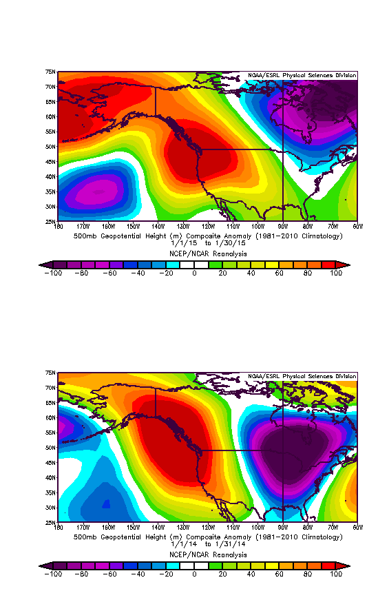
The culprit: a persistent, strong region of high pressure anchored over the northeastern Pacific/West Coast of North America has deflected Pacific storm systems to the north of California–just like last year. In fact, the similarity of the large-scale atmospheric wave pattern between January 2014 and January 2015 is extraordinary. While the longevity of the current dry spell still isn’t quite what it was last year–thanks to our December wet spell–the Warm West/Cool East atmospheric pattern that has been quite common in recent winters appears to once again be repeating itself this year.
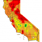
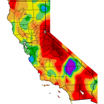
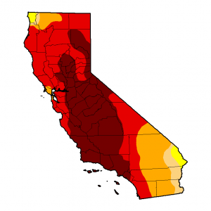
Drought update: little long-term improvement to date.
At this point, it almost goes without saying that January 2015 was extremely warm throughout California. Record warmth occurred on a number of days across large portions of the state, though the Central Valley was notably cooler for much of the month as the long-missing Tule Fog made at least a temporary reappearance. Conditions were particularly warm in the Sierra Nevada, where snow coverage and depth has declined almost continuously for the past 45 days.
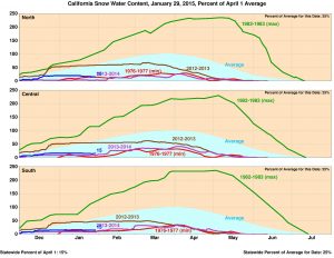
In fact, snow surveys and automated snow sensors agree that the snow water equivalent in 2014-2015 to date is among the lowest on record, and by Monday 2/2 will likely be tracking near (or even below) levels seen in 2013-2014 and 1976-1977.
While parts of central and northern California did indeed see some meaningful short-term reduction in drought intensity after early December’s intense precipitation, drought metrics in these regions have been slowly re-intensifying over the past months as extraordinarily warm and dry conditions persisted during January. The severe lack of snow across many of the Sierra’s major basins, in particular, has large implications for California’s water resource management and future reservoir storage.
Big changes on the way: major precipitation event likely in NorCal this week
As seems to have become the theme over the past few years, an intense precipitation event now appears likely to immediately follow an extraordinary dry spell across Northern California. Confidence has been growing in recent days that another extremely moist plume of subtropical moisture will take aim at NorCal during the first week in February, bringing heavy to excessive precipitation to at least the far northern part of the state.
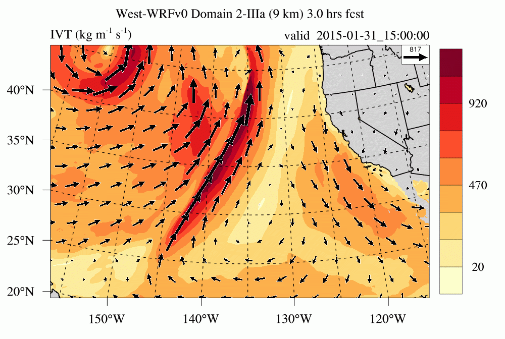
Recent numerical model runs have been starting to shift this atmospheric river further south along the California coast, meaning that places at least as far south as the Bay Area are likely to see significant precipitation over the next 7-10 days. While there’s still quite a bit of uncertainty regarding the details of this upcoming pattern change, it’s fair to say that someone along the West Coast is going to get a serious soaking, and the focus may well be the northern 1/3 of California. Simulated rain totals for a ~7 day precip event have been very impressive for the North Coast, actually exceeding 20-25 inches of liquid in a couple of recent GFS runs (which is about as high as I can recall having seen in a global model, though it’s possible this could be at least partly due to the recent increase in GFS horizontal resolution). Atmospheric rivers are certainly capable of delivering that kind of precipitation intensity in NorCal, but the question more than a few days out is always where exactly the associated moisture plume will come ashore–and whether it will stall out over a particular region for an extended period of time, raising flooding concerns. At this point, it’s still to early to discern the details, but given the impressively juicy airmass that next week’s storms are likely to tap into I would not be surprised if at least some portion of NorCal was dealing with some significant flood concerns within 7-10 days.
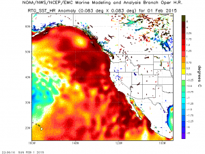
In great contrast, the southern 1/3 of the state is likely to remain completely dry (and very warm–perhaps near 80 F!) for the duration of this storm sequence. Also, it’s worth noting that sea surface temperatures immediately offshore of California remain extremely elevated–and are locally more than 3-4 F above average for this time of year. These near-record temperatures could provide some extra moisture to the incoming storm systems, as occurred during the December storm sequence in NorCal.
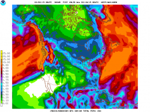
There is further uncertainty regarding what happens after next weekend. Numerical model solutions currently disagree regarding the persistence of this wet pattern–certainly realizations suggest that this could be a “one-and-done” storm sequence over 4-5 days, and other suggest a continuing parade of moist/warm atmospheric rivers through mid-February. What is interesting, though, is that it appears quite likely that temperatures will remain very warm–perhaps extremely warm–over the next two weeks. In fact, even in rain-soaked areas, surface temperatures may well remain in the 60s F for much of California and even approach 70F as far north as the Bay Area! This would constitute an extraordinarily warm mid-winter precipitation event for NorCal, and likely lead to extremely high snow levels (certainly above 8,000 feet, and perhaps even 10,000 feet at times, since temperatures around ~5,000 feet could be as high as 50-55 F). The reason for this uncertainty appears to be the continued persistence of anomalous high pressure over the northeastern Pacific Ocean. While the high pressure center will briefly be displaced far enough to the east to allow for warm/wet conditions to occur in early Feb, a slight westward shift could easily shut off precipitation in California once again, leading to warm/dry conditions again later in the month. At this point, it’s not clear which solution will win out. In the meantime, it will be very interesting to watch the evolution of yet another extreme pattern swing in California’s weather over the coming days. Stay tuned!
© 2015 WEATHER WEST