Early-season storm for NorCal this weekend; extraordinary drought continues, but pattern different from last year
Recent weather summary
This will be a rather brief update, and will focus on the projected arrival of a modest early-season Pacific storm system on Saturday.
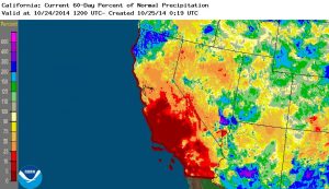
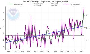
Recently, widespread significant (and occasionally heavy) rainfall has fallen across most of the Pacific Northwest and more recently across the far northwestern corner of California. The North Coast region has received locally upward of 5 inches of precipitation over the past couple of weeks, which has had the highly beneficial effect of effectively ending the fire season across the far north. Unfortunately, this meaningful precipitation has been mostly confined to the far northwestern portion of the state, and has yet to reach the core of the extreme of the exceptional drought region that extents across most of California. Places south of the I-80 corridor–including the Bay Area and Sacramento Metro area–have seen very little precip thus far this season. While early fall precipitation can be highly variable this far south in California–and mostly dry Octobers are far from unprecedented–most of California remains below average precipitation-wise for the past 60 days. The notable exception is the North Coast region, which is running well above average for the very early part of the rainy season. Warm to hot conditions have been the rule elsewhere, and California is still on track for its warmest year in recorded history.
Early-season storm system headed for NorCal
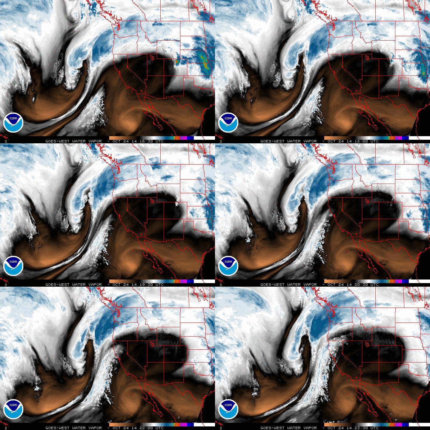
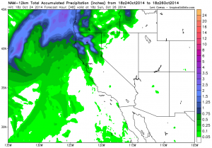
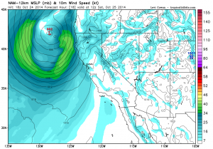
A fairly potent Pacific storm system is currently developing off the coast of Northern California, and will move ashore in the Pacific Northwest on Saturday. This deepening low will generate some pretty sharp pressure gradients across the Pacific Northwest and far Northern California, and has the potential to bring strong and gusty winds to a fairly wide region. Especially since these will be the first significant southerly winds in quite some time, some minor wind damage may occur across parts of NorCal on Saturday. This system has a respectable moisture tap, though the very impressive-looking subtropical connection apparent on satellite imagery consists almost entirely of very high-level cloudiness and thus won’t be able to generate large precipitation amounts. Still, this will be a pretty healthy October storm system for regions north of the I-80 corridor, and will probably bring at least some rainfall (and high mountain snowfall) a little further south than that–including the Bay Area and Sacramento regions. A couple more inches of precipitation are possible this weekend along the North Coast, with as much as a quarter inch or so down as far south as San Francisco.
This incoming system also appears to be fairly convectively unstable, and the high-resolution models suggest the potential for thunderstorms across much of NorCal on Saturday (even in areas outside of the usually-favored Northern Sacramento Valley). Near the coast, surface instability may be enhanced by the much-above-average (and in some cases record-high) sea surface temperatures that have been in place for months now. It’s possible that there will even be sufficient surface instability (given relatively the relatively high October sun angle, warm surface temperatures, and significant vertical wind shear) for some severe thunderstorms tomorrow, though these would most likely be confined to the Central Valley. Widespread storms are not expected, but there could definitely be some interesting conditions scattered around the northern part of the state tomorrow.
What does the near future hold?
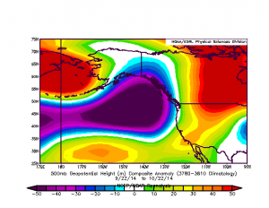
Conditions will dry out and warm up once again after Saturday’s storm departs NorCal, and unfortunately no precipitation is likely to fall anywhere in SoCal. However, numerical model guidance is suggesting that additional Pacific systems may continue to affect NorCal for much of next week. While the vast majority of the associated precipitation will remain to the north of the I-80 corridor, any precipitation at all is clearly welcome at this stage in our exceptional multi-year drought. One piece of good news for the drought-weary, at least in the short term, is that the all-too-familiar pattern of incredibly persistent ridging over the far northeastern Pacific Ocean appears to have weakened and shifted well to the east in recent weeks. While unusually high geopotential heights remain over the American West in both the short and long-term mean, the longitudinal axis of the anomalous ridging is further to the east–just far enough, based on recent events, to allow some weakening storm systems to make it as far south as NorCal. The strong subtropical ridge to our southeast is still preventing truly strong and moist storm systems from bringing widespread significant precipitation to California, but the current pattern does not much resemble the now-infamous Ridiculously Resilient Ridge. This is merely an observation; this is not to say that enhanced ridging won’t return later this winter (and there are decidedly mixed signals from the seasonal forecast models regarding what may happen later this rainy season). But over the coming week, at least, it sure will feel an awful lot like fall in Northern California.
© 2014 WEATHER WEST