Recent rain welcome, but not nearly enough: more dry weather on tap
Recent Weather Summary
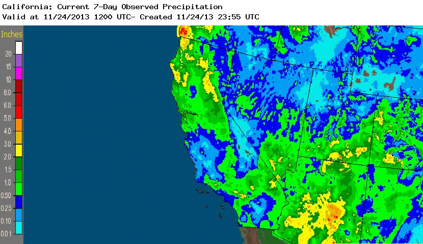
The weather system that affected the entire state of California last week ended up being somewhat more impressive than initially anticipated. Despite the overall lack of strong dynamic forcing, some cold air aloft and a locally sharp frontal boundary ended up producing some heavy convective precipitation over a fairly wide swath of Northern California. Later in the week, the same low pressure area brought scattered thunderstorms to Southern California which even resulted in a couple of highly-localized instances of flash flooding. Almost the entire state received a decent soaking rain from this system, though the spatial distribution of precipitation was not what might typically be associated with a late-November system: the southern deserts received almost as much as the San Francisco Bay Area!

Locally very strong offshore winds developed in the wake of the departing low across a large portion of Northern California, resulting in some serious wind damage in a few locations and actually fanning a number of new wildfires in Napa, Lake, and Mendocino counties. Despite the significant rainfall experienced only 24-48 hours earlier, Red Flag Warnings were issued for parts of the Bay Area and several thousand acres eventually burned. Having Red Flag conditions–let alone multi-thousand acre fires–is pretty extraordinary in the Bay Area this time of year, let alone immediately following a soaking rain event. This fire activity is a testament to the effect the incredible dryness of calendar year 2013–coupled with the longer-term dry period spanning multiple water years–is having on the regional environment.
Did recent rainfall make a dent in the long-running deficit?

So, the big questions remains: did this week’s precipitation help to alleviate California’s enormous water deficit? Well, in a word: no. While any precipitation is certainly better than no precipitation, this is normally a rather wet time of year across most of the state. This week’s precipitation event was very locally heavy but generally a light-to-moderate event at best.

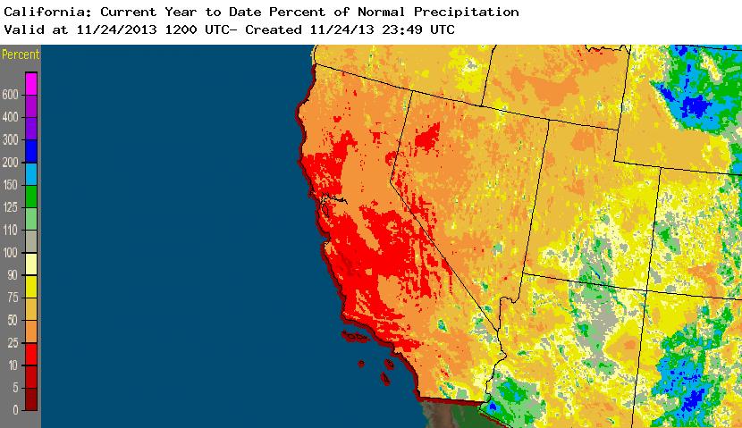
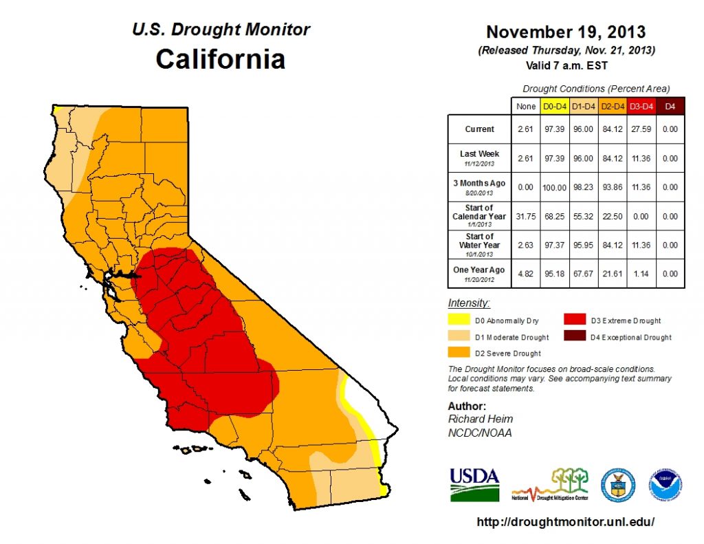
The entire state remains well behind average precipitation, even for the month of November. Calendar year 2013 remains on track to be the driest on record for California, with some regions in Central California set to exceed previous records by a very wide margin. The most recent Drought Monitor update depicts a large expansion of “extreme drought” conditions in California, which now cover more than a quarter of the state.
The medium term outlook: more of the same.
The million dollar question right now is when this extremely persistent dry spell will come to a more meaningful end than merely a day or two of modest precipitation. The answer: not within the foreseeable future. While for a while it appeared that a new system could drop some substantial precipitation over much of California around Thanksgiving, this system is now expected to drop southward well offshore and weaken with most or all precipitation missing the state to the west and south. Rain may come tantalizingly close to the coastline later this week, but the majority will fall into the Pacific Ocean and not into our major hydrological basins. Southern California stands the best chance at seeing some light showers out of this, but it will almost certainly bring lighter precipitation than the last system.

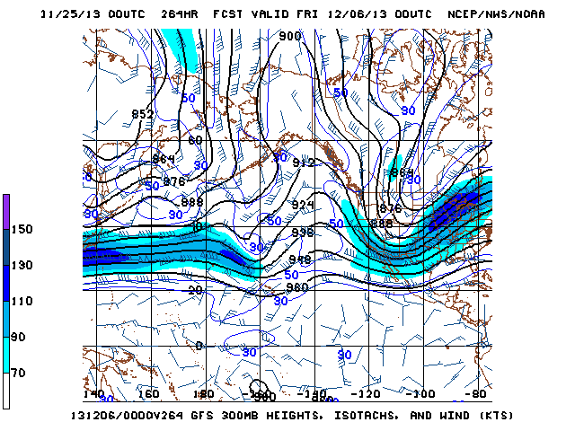
In the longer range, there are some vague signs of a slight shift in the longwave pattern as the mean East Pacific ridge retrogrades ever-so-slightly to the west and (perhaps) weakens slightly. This still isn’t a very favorable pattern for significant California precipitation, but it may at least open the door for a marginally more active pattern. One thing to keep an eye on for early December is the possibility of an Arctic outbreak over the Western U.S. Recent runs of the GFS and ECMWF have been depicting a high-amplitude high-latitude blocking pattern with very cold air pooling downstream over western Canada and spilling out into the Pacific Northwest and Northern Rockies. While California is probably too far south and west to receive any really cold air in this sort of pattern, the extended model ensembles suggest the possibility of further retrogression such that some cold air could eventually invade from the north and east. This is still a very dry pattern, but it’s certainly more interesting than what we’ve had as of late. Stay tuned!
© 2013 Weather West
Recent rain welcome, but not nearly enough: more dry weather on tap Read More »