Rain, for a change: very cold and wet pattern for California
The very long-anticipated–and nervously hoped for–pattern change has finally arrived. After nearly a full winter of extremely dry and stable conditions over California, particularly the northern half, an extended period of cold, wet, and unsettled weather is finally headed toward the state.

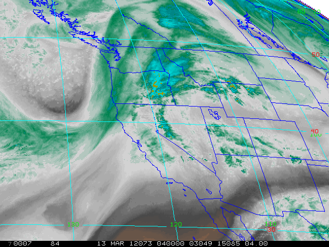
The first in a series of storm systems is currently moving onto the coast in far northern California, and is expected to bring periods of heavy rain and gusty winds to the northern 2/3s of the state through Wednesday. Rain totals will be pretty hefty in favored NorCal locations–probably in excess of 5 inches on south-facing slopes. Significant flooding is not anticipated due to the extremely dry antecedent conditions.
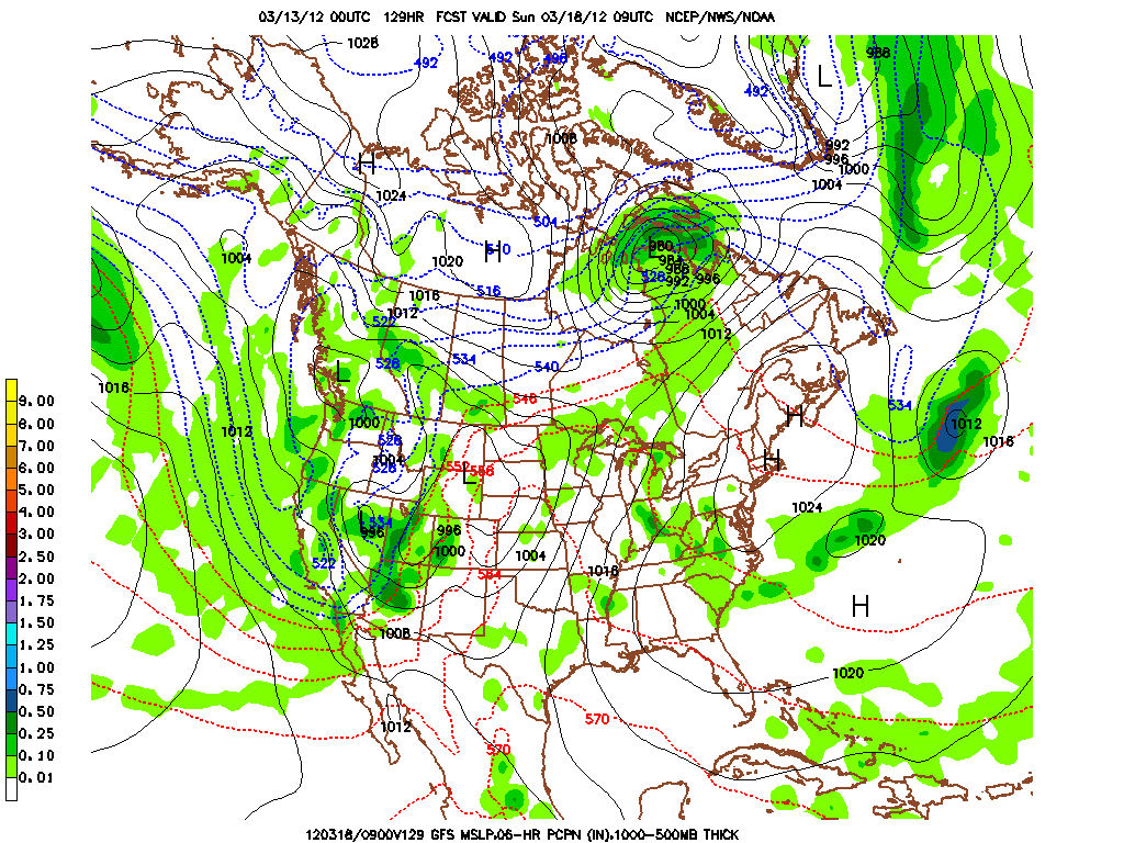
Later this week, a very deep trough, fueled by a powerful jet streak on its back side, will deepen off West Coast. Very cold Arctic air will be ingested into the trough, and at present it looks like a pretty strong storm system will develop on the leading edge. More heavy rain and gusty winds are likely in NorCal, and given the heavy rainfall expected earlier in the week this could result in some minor hydrological issues.
Probably of more interest, though, is the very cold and unstable airmass expected to move in behind the primary cold front over the weekend. This trough will be very slow-moving, and California will be in a very favorable position for convective activity for at least 48 hours from late Friday to late Sunday. In addition, snow levels could be very low in convective precipitation, especially if the latest models solutions pan out.

Thunderstorms and hail are quite likely across most of the state Saturday and Sunday, and snow levels will plummet below 2000 feet in NorCal and perhaps as far south as the Mexican border before all is said and done. North of Point Conception, it is certainly conceivable that snow levels could drop locally below 1000 feet, given recent model forecasts of 500 mb thicknesses approaching 520-523 dm over San Francisco with 850 mb temperatures of -5 to -6 C. This could be a fairly widespread convective setup, and some stronger/organized thunderstorms will be possible given favorable wind shear, strong jet-level winds, and very steep lapse rates.
In short…the next week will bring more active weather to California than the entire winter has cumulatively to this point. This is much-needed rain and snow, and will probably be enough to at least mitigate the impacts of an otherwise extremely dry winter.
© 2011 WEATHER WEST
Rain, for a change: very cold and wet pattern for California Read More »