Rapidly-developing storm to bring impressive array of active weather to Southern California
Please note: this post will be one of two over the next 48 hours. The present brief post discusses Southern California storm impacts on Sunday; the latter (and longer) post on Monday morning will discuss impacts of El Niño to date and some thoughts regarding why they have been notably–though not fundamentally–different from those historically observed during big El Niño events.
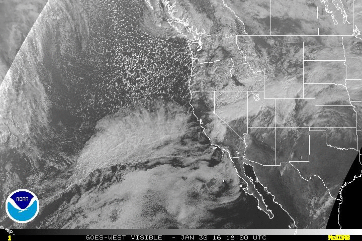
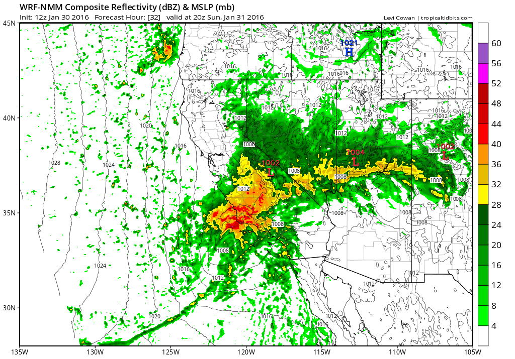
A pretty big storm is headed for Southern California this evening, yet the radar (and even satellite) imagery remains rather quiet at the moment. The reason: instead of taking a long eastward trajectory over the Pacific Ocean–as so many systems destined for California do–this one is developing much closer to home: only 500 miles or so west of Santa Barbara. An area of surface low pressure is rapidly developing this evening on the cyclonically-curved side of a locally-enhanced subtropical jet stream. This surface low is only just starting to become visible on the last couple of satellite frames from a couple of hours ago, but is expected to deepen rather quickly as it approaches the coast Sunday morning. As the surface cyclone wraps up, a strong cold front will develop over the Southern California coastal waters–aided by some unusually cold air aloft becoming entrained into the broader circulation.
This trajectory and relatively rapid cyclogenesis near the California coast is somewhat unusual, though it tends to be more common during strong El Niño years when a strong jet stream resides over or just south of Southern California. This jet configuration is highly favorable for the development and strengthening of low pressure systems near the California coast. In this particular instance, this system has a fair amount of atmospheric moisture to work with as it interacts with the tail end of an atmospheric river that brought very heavy precipitation to the Northern California mountains on Friday. In addition, cold air wrapping into the system from Northern California will contribute to strong baroclinicity as this storms moves over Los Angeles. In other words: a bunch of different ingredients are coming together for a pretty impressive event tomorrow morning across Southern California.
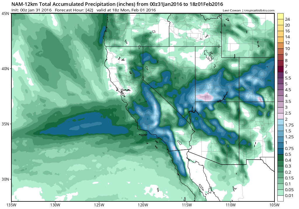
Interestingly, there was tremendous model disagreement regarding whether this storm would develop at all in the first place. The GFS had been suggesting the potential for a very strong storm to affect the Bay Area this weekend as early as a week ago; the ECMWF suggested nothing of the sort. Eventually, the models (finally) converged on the present solution, which is closer to the original GFS forecast (but instead shifted southward a few hundred miles). In fact, this system is expected to bring only light rainfall to the Bay Area and points northward on Sunday, though it may still bring significant snow accumulations to the Sierra Nevada (and notably the Eastern Sierra, as unusual easterly upslope flow occurs on the backside of the low) .
Southern California impacts: heavy rain, strong winds, thunderstorms, and even low elevation snow?
Tomorrow will be a great weather-watching day in Southern California. Nearly all of Southern California will likely receive over an inch of rain tomorrow, with many spots exceeding two inches and some orographically or convectively favored areas possibly receiving 3 or more inches. Most of this rain will fall during a fairly intense burst around the time of cold frontal passage, and may be accompanied by thunderstorms given strong instability and jet-level forcing. Given a rapidly strengthening surface low, some very strong winds may exist just above the surface. There is some question regarding the degree to which these strong winds will mix down to the surface across Southern California, but the potential exists for some locally very strong wind gusts (in excess of 50 mph), especially near any thunderstorms that develop. Flash flooding will be a possibility, given the intensity of precipitation, and I would not even be surprised to see a couple of waterspouts move ashore as brief tornados if the cold front is as strong is as currently expected.
In the wake of the strong cold front, even stronger winds are possible across portions of Southern California as cold advection allows strong winds aloft to mix down to the surface. Damaging wind gusts well over 60 mph will be possible in some locations, especially in the mountains and deserts. I suspect there may be quite a few wind damage reports coming in by tomorrow evening. Also, snow levels will rapidly fall below 3000 feet behind the cold front, and lingering precipitation could turn into a few inches of wind-driven snow as low as 2500 feet.
To top it off–this storm will likely push most or all of Southern California to near or above average precipitation for the entire month of January–and, in some spots, perhaps even ahead January of 1998!
And what about the longer-term?
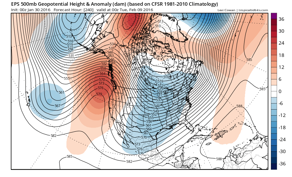
After Sunday’s big storm in Southern California, conditions will dry out considerably across the entire state (though occasional precipitation is still expected across the northern half of the state, the “parade of storms” will be over for the time being). There are indications that a high-amplitude ridge may develop over the far eastern Pacific and remain quasi-stationary for about a week, potentially keeping things pretty dry for the next 7-10 days. But this kind of high-latitude blocking pattern is susceptible to “undercutting” by the subtropical jet, particularly during strong El Niño years. Numerical models are also notoriously bad at simulating such undercutting events, so it’s possible that things swing back in the wet and active direction more quickly than current solutions might suggest.
Stay tuned for more in-depth El Niño-related post on Monday morning!
© 2016 WEATHER WEST
Discover more from Weather West
Subscribe to get the latest posts sent to your email.