Recent weather summary
Warm, dry, and occasionally windy conditions have been the rule across most of California over the past two weeks. While California is certainly no stranger to early fall heat waves–in fact, coastal parts of the state are famous for them–the early part of October was remarkably warm even by local standards. A slew of cities from the San Diego area all the way up toward the Mendocino Coast set daily high temperature records during the first half of October, and San Francisco had its warmest start to any October on record. Fire danger has been extremely high due to ongoing exceptional drought conditions and weather conditions favorable for fire spread, but somewhat remarkably major fire activity has remained low in recent days. Away from the far North Coast, where 2+ inches of rain fell during September, any moisture that had been deposited earlier by September precipitation has long since evaporated.
Unsettled weather on the way for NorCal, but no big storms on the horizon
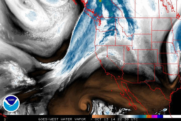
A pretty significant pattern change is on our doorstep this evening as the strong West Coast ridge weakens and is displaced southeastward. In its place, a relatively strong trough will dig southward off the California coast on Tuesday, eventually bringing moderate precipitation to the North Coast and light precipitation elsewhere across most of Northern California. Despite some early indications that this system had the potential to bring more widespread significant precipitation, the necessary dynamics unfortunately have not materialized.
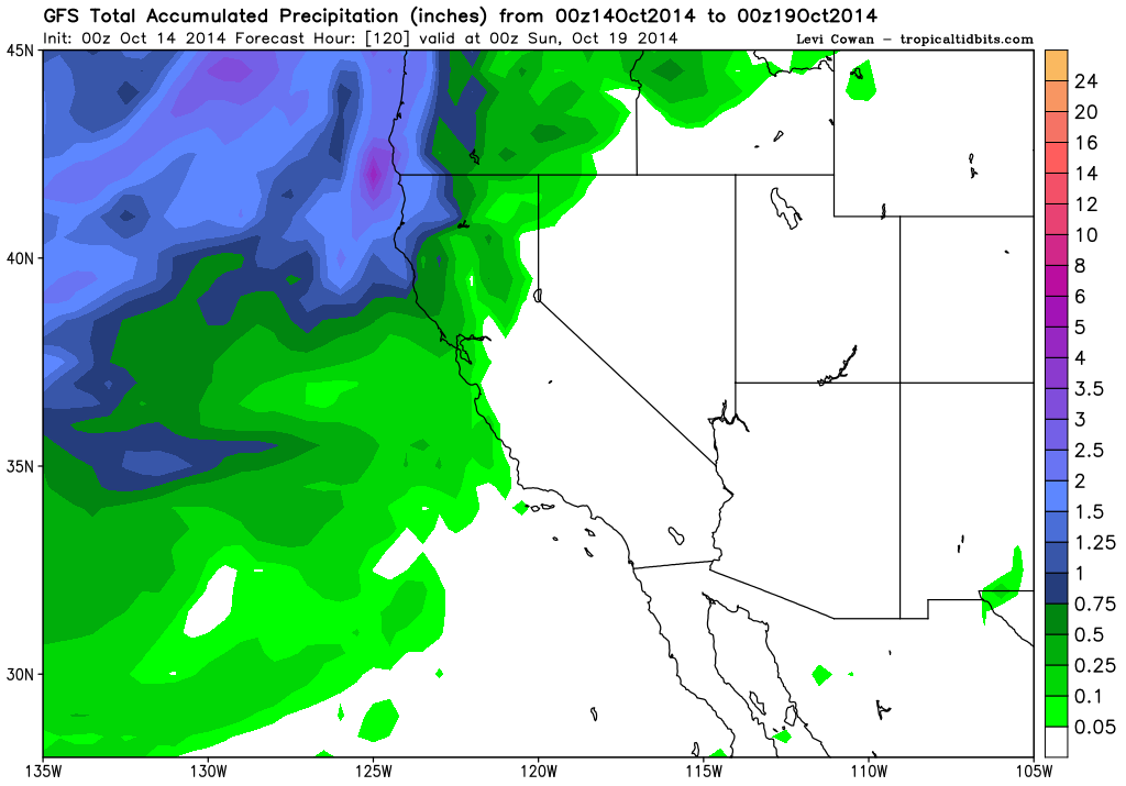
As a result, it looks like nearly all precipitation this week won’t make it much further south than the I-80 corridor–perhaps somewhat further south near the Bay Area. Precipitation from this first system should actually be considerably less than that received during the September system in most places, with only around a tenth of an inch for Sacramento and San Francisco. The mountains and foothills may see up to a few tenths of an inch, and the far North Coast could up to 1-2 inches.
A second system later this week may bring more precipitation to the state, and some of the models suggest that rain may be a little more significant and make it a bit further south that with the first system. However, the models have been struggling with this pattern change (not an uncommon occurrence during the transition seasons), and the general trend has been toward a drier solution as each system comes into short-range focus. Thus, prospects for widespread significant precipitation from either of the two systems this week are low (with the exception of far NorCal, where some favored mountain regions could pick up 2-3 inches over the next 7-8 days). A primary benefit of this week’s system will be to decrease fire danger considerably across much of the northern half of the state, which is good news after what has proven to be a long, tense fire season.
Prospects for the rest of fall (and beyond?)
Seasonal forecasts are always tricky in California, though now that we’ve reached mid-October it may be possible to offer some modest insights about what’s likely to occur during the next two months.
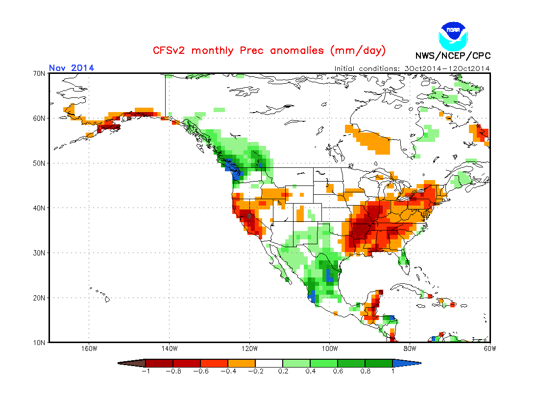
The official CPC forecast and recent CFS model ensemble projections both suggest that November will be drier than usual across most of California, and the CFS suggests that December may also be fairly dry. Despite some attenuation of the record-warm northeastern Pacific SSTs in recent days, much warmer-than-average water remains, and this may continue to exert at least a modest influence on atmospheric conditions for as long as these anomalies persist. A weak El Nino continues to chug along in the Pacific, but the dynamical models forecast little strengthening though the winter, so it appears that strong ENSO teleconnections won’t play a role this winter.
While the upcoming pattern is not conducive to the kind of heavy precipitation-bearing systems that could bring drought relief to California, it is nonetheless nice to see the return of some zonal flow over this part of the Pacific (as opposed to the persistently “blocked” storm track associated with the Ridiculously Resilient Ridge over the past couple of winters).
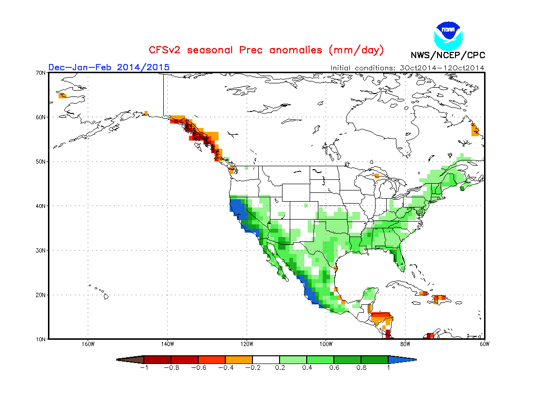
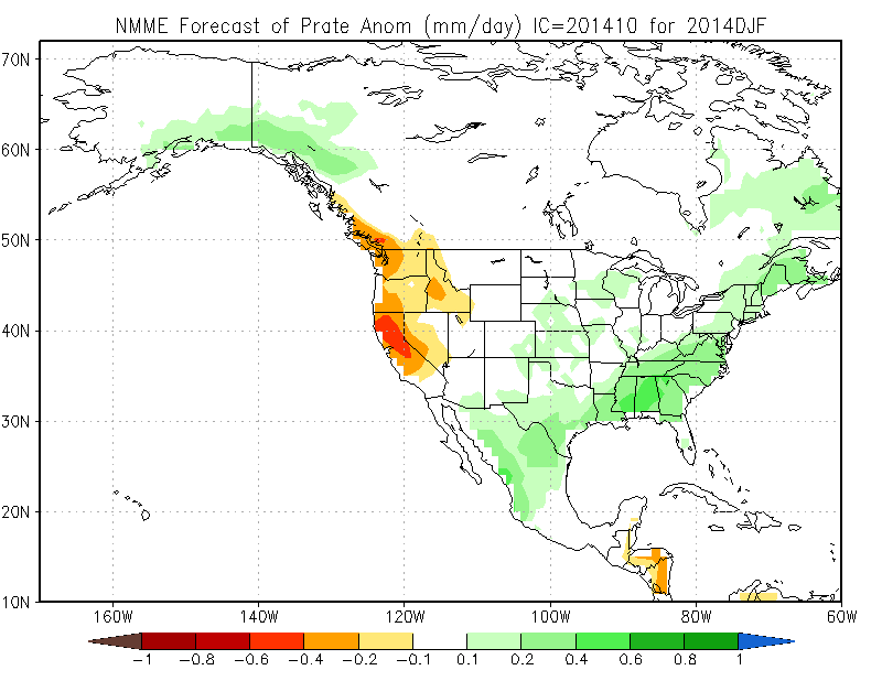
However, it’s still too early to say whether persistent ridging will return later in the season. NCEP’s CFS model has been consistently suggesting the possibility of very wet conditions in California during the January-February-March 2015 period. Despite some excited discussion in the blogosphere about these long-lead projections in light of the ongoing extreme drought, it is prudent to point out that at the moment the CFS is an extreme outlier in the new North American Multi-Model Ensemble. That is to say: 7 of 8 models depict dry conditions in California during December-January-February, with the CFS being the lone model projecting (very) wet conditions. As I’ve pointed out before, model skill for winter precipitation in California at 3+ month lead times is still pretty low, so I wouldn’t put too much stock into any of these forecasts. But it certainly bears repeating that there is presently no sign of meaningful drought relief on the horizon–either in the short run or long run. For now–enjoy what raindrops do fall this week!
© 2014 WEATHER WEST
Discover more from Weather West
Subscribe to get the latest posts sent to your email.