An unusually strong Pacific jet persists, driving continued unsettled West Coast weather into June
The May and early June weather pattern across the West Coast has been–and remains–a changeable one. Repeated late season trough and low pressure sequences, bringing both unusually late-season showers as well as periods of fire weather-elevating dry north winds–have been the rule for some time. Much of this has been facilitated by an unusually strong late-season Pacific jet stream, particularly the subtropical branch over central and southern CA and points east. This unusually late-season showing of the subtropical jet is likely a product of the extreme warm ocean water to the southwest of California and the subsequently increased thermal differential between the subtropics and midlatitudes–something that is not uncommon during the developing stages of a strong El Niño event and amid the positive phase of the Pacific meridional mode (both of which are conditions currently in place).
This general pattern makes it hard for mid-tropospheric ridges to build directly over California, though it does tend to favor the Pacific Northwest and western Canada as a location for strong and/or persistent ridging as a more active lower-latitude wind pattern “undercuts” the blockier pattern up north. And, indeed, over the coming week we are likely to see a progression from an anomalous West Coast trough to an anomalous West Coast ridge–both facilitated, in different ways, by an unusually strong and eastward-extended jet stream.
First, a trio of late-season low pressure systems will bring June showers, cool temps, and gusty winds to PacNW and part of NorCal
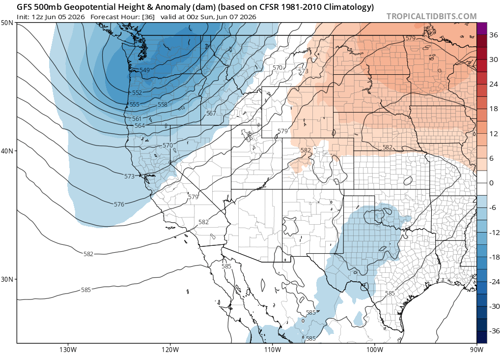
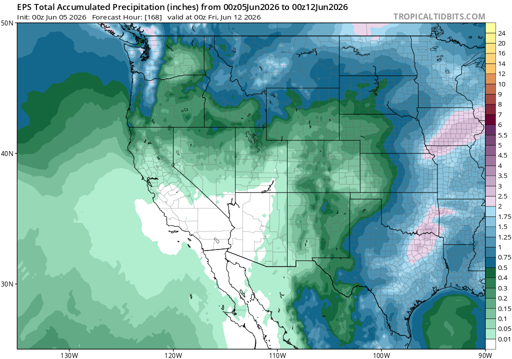
From this weekend into early next week, we’ll be on the cooler and even damper side of things across much of the West Coast. A double-barreled low pressure system will ease toward the OR/CA border this weekend, bringing showers (and possibly some thunderstorms) to the Pacific Northwest. Northern California will certainly be under the influence of the trough, with cool temperatures, breezy conditions, and lots of clouds. Just how far south the mostly light June showers make it remains somewhat murky, even a few days out. There is a modest chance of a soaking rainfall along the North Coast and northern interior mountains of NorCal if the low pressure ends up on the stronger side of the range of current predictions–which would be unusual, though certainly not rare, for this time of year. There’s a better chance of at least some light showers up that far north, and at least a slight chance that some drizzle or light showers could extend as far southward as the SF Bay Area at some point. What’s guaranteed is quite mild, even cool, June conditions across much of CA and wetter conditions in the Pacific Northwest.
Heading toward the middle of next week, one final low pressure system will slide southeastward through the mean trough along the West Coast. But this one will take a more northerly, “inside slider”-like trajectory and will thus not bring precipitation to California (though it might bring some additional final showers to the PacNW). Instead, it will likely bring another round of warm and dry north winds to at least northern California, with moderate attendant fire weather conditions (though it’s important to note that vegetation in most areas is still not near peak seasonal dryness, and these winds will probably not be extreme though they will usher in a notable pattern change). Downslope flow will likely induce some compressional warming in NorCal during this period, which may be bolstered by the ridge building in from the southwest.
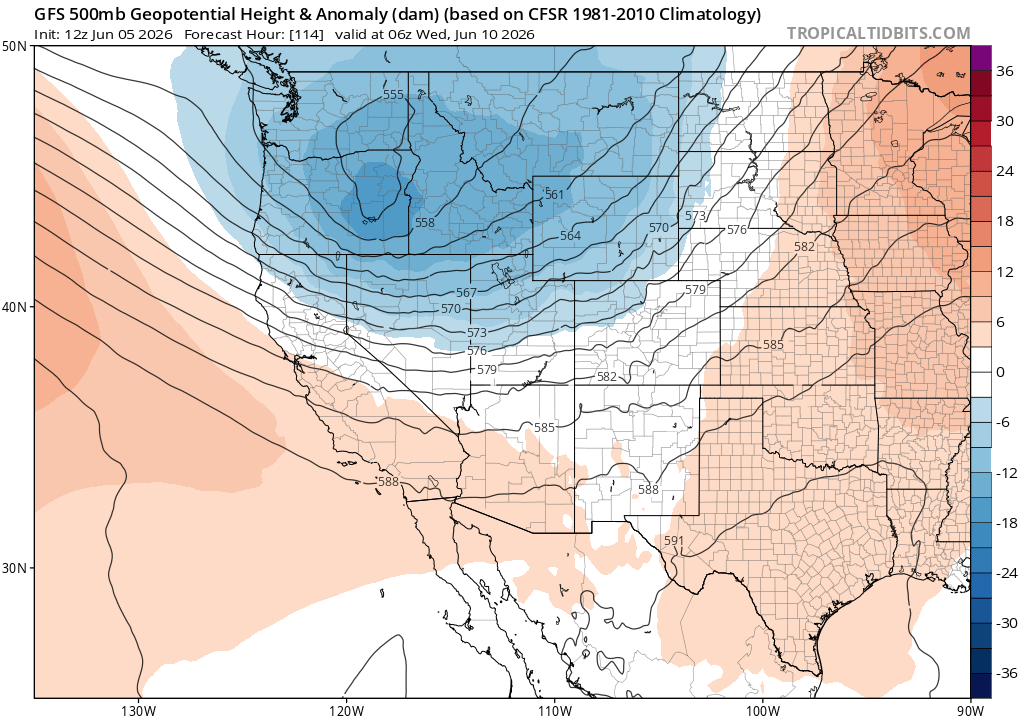
Then, unusual June Pacific jet extension will drive a major “ridge-building” event, likely leading to PacNW/NorCal heatwave into mid-June
Once the mid-week low pressure system moves on to the east, a broad and strong ridge of high pressure now appears highly likely to build in along or just west of the West Coast from later next week and then continuing well into mid-June. This ridge will not be centered over California, so its maximum impacts (in terms of heat and dryness) will be centered farther north (up in the Pacific Northwest and British Columbia). But due to its projected size, intensity, and persistence, this ridge will still usher in a major California pattern change–with a trend toward much warmer and drier conditions likely.
Just how hot will it get in mid-June? Well, there’s still considerable uncertainty. Right now, it looks like the highest odds of truly anomalous “heatwave” conditions will be across Washington and Oregon as well as far NorCal. But there is still some possibility of a more widespread major heat event across essentially the entire West Coast during this period, including most/all of California. There has also been some buzz online about this ridge/heat event being like the record-shattering June 2021 event, but I don’t see much support for such a highly extreme event at this point. There have been a couple of outlying model ensemble members showing truly extreme heat, especially some of the new AI ensemble members, and the pattern is somewhat structurally similar (in terms of position and physical origins), so it’s something to keep an eye on. But what is clear at this point is that a major shift to hotter and drier conditions is likely; exactly how dramatic it’ll be remains TBD.
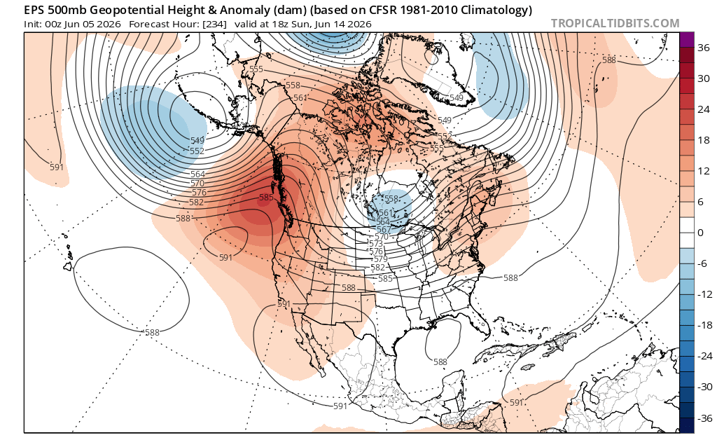
Speaking of those physical origins: It looks like this will be a pretty classic case of an unusually strong/eastward extended Pacific jet directly contributing to aggressive “ridge-building” downstream (in this case, right along the West Coast). The meteorology involved in such events spans multiple processes, from local mass accumulation near the jet exit region (leading to surface high pressure) to diabatic heating (where latent heat released from condensation warms the airmass and raises 500mb GPH heights). There may even be an indirect contribution, both to this jet extension and the eventual strong ridge, from a recurving West Pacific typhoon! And past experience suggests the models can struggle with the exact placement and magnitude of ridges under such conditions, which is one reason I will be keeping an eye out for further intensification of the upcoming ridge/heat event centered over the PacNW but possibly extending southward into CA.
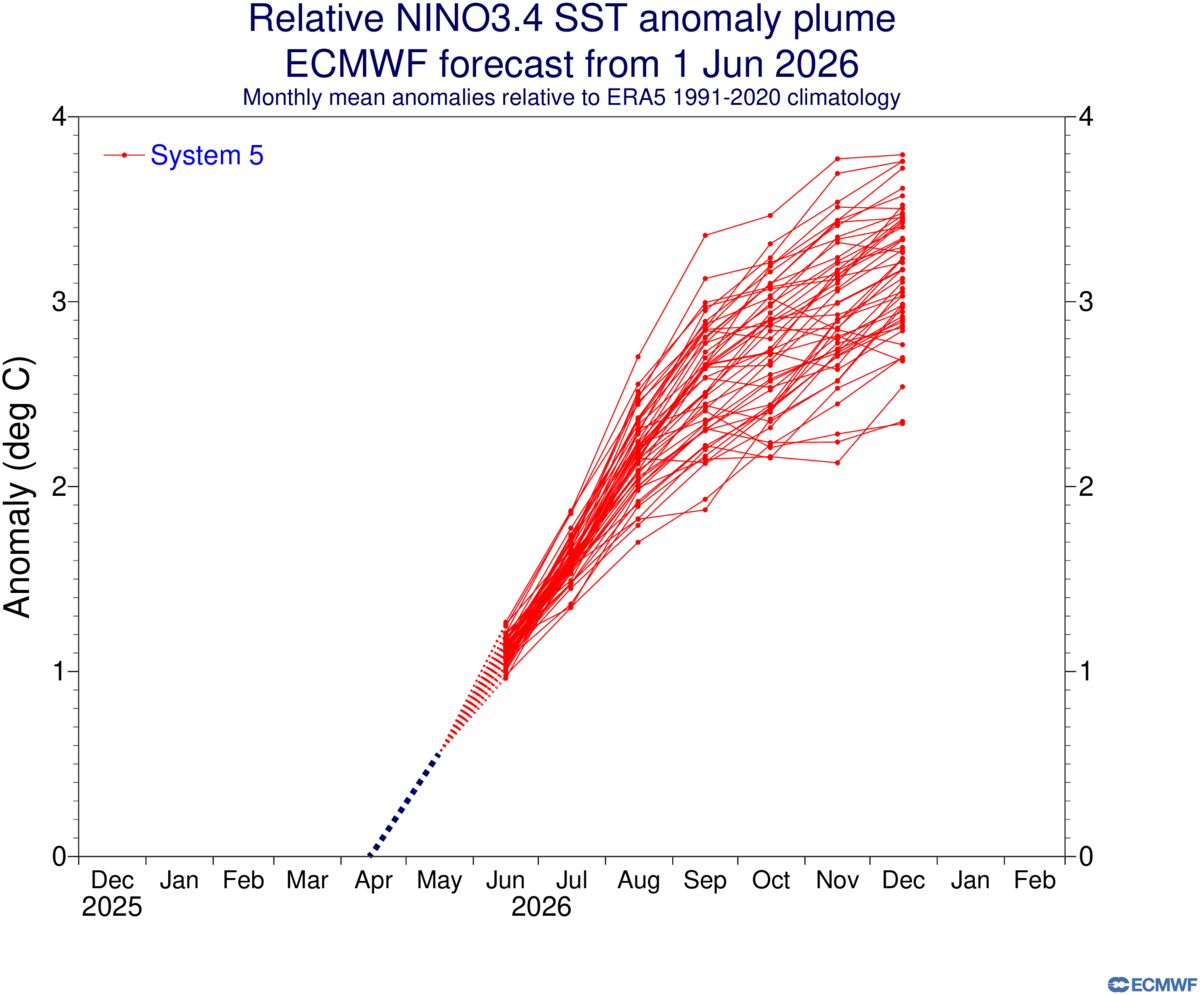
All signs continue to point to a very strong El Niño event by autumn; stay tuned for updates.
The updated June ensemble predictions are starting to come out, and if anything they are indicating the potential for even more extreme outcomes than earlier forecast cycles. I’m going to wait for the full suite of new predictions to become available (in mid-June) before taking another deep dive, but I’ll likely have a solely El Niño-focused blog update in mid-late June along with another dedicated livestream. So, stay tuned! In the meantime, everything from my ENSO-focused livestream in May still very much applies.
New research on Western U.S. sub-daily precipitation extremes
We just published some new (open access) research, led by Dmitri Kalashnikov, on Western U.S. sub-daily precipitation extreme, and associated trends. We confirm familiar spatiotemporal patterns and find evidence of emerging increases in the heaviest downpours. We also find recent increases–including, in some cases, reversal of historical trends–in potential atmospheric contributors to sub-daily downpours during 2000-2024 vs 1980-2024. This includes widespread (and, in summer, robust) increases in column water vapor despite mixed or even decreasing trends in surface humidity!
There are some other interesting tidbits here for those interested in (for instance) the fraction of Western U.S. heavy downpours associated with lightning, or relationships between such downpours between various modes of climate variability (including ENSO, the Pacific Decadal Oscillation, and the Arctic Oscillation), so please feel free to check out the full paper or the full associated social media thread (posted across platforms).
Discover more from Weather West
Subscribe to get the latest posts sent to your email.