Record wet in Northern California; huge snowpack threatens floods
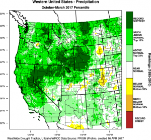
It’s official: the Northern Sierra “8-Station Index”–comprised of 8 precipitation observation sites in the northern half of the Sierra Nevada watershed–has eclipsed 1982-1983 to become the wettest Water Year (Oct-Sep) period on record! Even more remarkable is that this record has been set so early in the calendar year–even though May-September is the dry season in California, some additional precipitation in this region is all but inevitable in the coming months, which will push this record total even higher. Statewide precipitation metrics are not far behind. Precipitation in 2016-2017 is closely paralleling 1982-1983, and stands a good chance at breaking the long-standing record later this year.
All of this beneficial, drought-busting water, though, hasn’t been evenly distributed throughout the state. While Southern California has been wetter than average this winter, precipitation accumulations have not been nearly as anomalous as in the northern portion of the state (the Los Angeles basin, for example, is hovering just slightly above average for the Water Year to date).
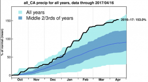
The record wet conditions, however, have not been confined to California–a band of record or near record wetness extends from the northern coast of the San Francisco Bay Area inland across the Northern Sierra and then further across the interior West (as far east as western Wyoming and Montana!). This band of exceptional seasonal precipitation is the product of a persistently active and somewhat southerly storm track this winter, which brought frequent atmospheric rivers to the coast.
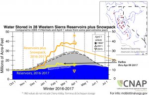
California snowpack is also extremely impressive this spring, though (as has been previously noted) it has for the most part lagged total precipitation due to the relative warmth that has co-occurred with this record wet Water Year. The tremendous amount of accumulated water in the high Sierra snowpack is just what the doctor ordered with respect to drought relief, but may pose some problems in the coming weeks if it melts too quickly. Growing concerns over major snowmelt flooding have already triggered pre-emptive disaster declarations, especially east of the crest along the Highway 395 corridor and in far western Nevada. It remains to be seen just how much flooding may result from melting of this snowpack–and it will largely depend on just how warm temperatures get over the next few weeks.
Yet more precipitation next 3-4 days, but then major drying/warming trend
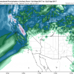
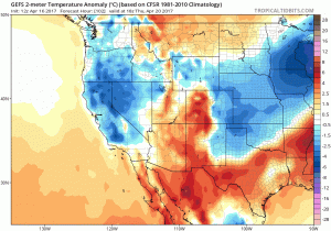
A couple more modest spring systems are expected to bring additional precipitation to Northern and Central California over the next few days. The southern third of California will likely stay mostly dry, with some showers possible as far south as Los Angeles County. A few more thunderstorms could rumble across the Central Valley, and some additional accumulating snowfall is likely at the highest elevations of the Sierra Nevada. But by next weekend, there is multi-model ensemble agreement that conditions will dry out and warm up pretty rapidly as a strong ridge builds directly overhead. Temperatures could rise to 10-15+ degrees above mid-April averages by next week, which will likely accelerate snowmelt. It’s still to early to say whether there may be a subsequent pulse of snowmelt flooding downstream, but the upcoming warming trend certainly bears watching from that perspective.
El Niño may be back in the picture this year (yes, already)
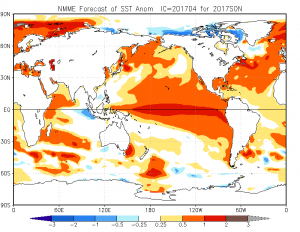
There are increasingly strong signs that El Niño may be making a comeback in the equatorial Pacific Ocean. With all the usual caveats (namely, that we’re still on the wrong side of the Spring Predictability Barrier), there is excellent multi-model agreement that a significant event may begin to unfold in the coming months. That would be pretty eyebrow-raising, since it has only been a year since the last big El Niño. It’s still far too early to discuss California implications, but if the current outlook holds then I would expect warm SSTs to begin having an influence as early as this coming summer. I’ll continue to follow developments in the tropical Pacific in coming blog posts. Stay tuned!