Recent Weather Summary
Weather conditions over the past two months have varied wildly throughout California.Extremely heavy precipitation and unusually warm conditions in early December in the northern/central coastal regions gave way to very cold and mostly dry conditions around the new year (though not dry enough to preclude some remarkable low elevation snowfall in the lower hills of Southern California).
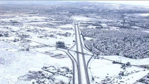
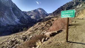
Early January continued to bring a mixed bag of conditions–Central California has remained completely dry since the subtropical tap in early December shut off, while parts of SoCal saw some unexpectedly heavy precipitation courtesy of a rather unusual cut-off low pressure area that moved in from the southwest. The Sierra Nevada, for the most part, has been dry over the past month–and in many places, quite warm (with daytime highs and even some overnight lows remaining well above freezing). Meanwhile, far northern California has experienced some significant precipitation over the past couple of days. When taken together, all of these varied conditions paint a complex meteorological picture–but on a statewide basis, conditions have trended once again toward much drier and much warmer than average over the past 30+ days.
A highly-amplified atmospheric pattern over North America–once again
What has been the cause of all this California weather volatility and the recent trend towards warmer and drier conditions (despite the fact that January is historically California’s wettest month?). A high-amplitude atmospheric flow pattern has once again developed over the Eastern Pacific and North America, deflecting the Pacific storm track north of its typical cool-season position along the West Coast and allowing repeated intrusions of extremely cold Arctic air to invade the American Midwest and Eastern Seaboard.
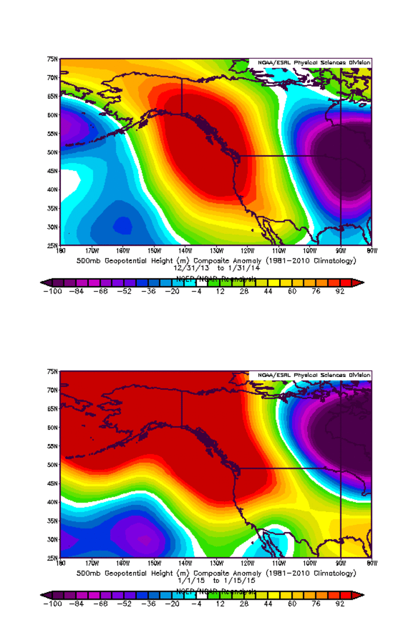
This unusual atmospheric configuration has occurred with remarkable frequency and intensity over the past several winters, and has been a major contributor to California’s ongoing extreme drought. While December’s heavy coastal precipitation–associated with a strong zonal Pacific jet–brought a substantial reprieve from this recurring high amplitude flow pattern for a brief period of time, recent observations (and, unfortunately, forecasts for the next couple of weeks) suggest that this persistent pattern has returned in the new year.
Is this the Ridiculously Resilient Ridge, Redux?
I’ve received a lot of questions lately regarding the possible re-appearance of California’s now-infamous persistent atmospheric pattern. As many have pointed out, California is no stranger to mid-winter dry spells lasting multiple consecutive weeks. In fact, these break periods–which often follow a particularly active period of storminess (like the one we received back in early December)–are a characteristic feature of cool-season climate in our part of the world. Dry spells lasting longer than 4 weeks, though, are very unusual, and the mid-winter break across much of California appears destined to last at least that long (and in the Bay Area and Sacramento regions, has already exceeded that duration).
The Ridiculously Resilient Ridge (as I defined it back in 2013) is a persistent region of unusually high atmospheric pressure in the middle levels of the atmosphere centered over the far northeastern Pacific Ocean. It’s a feature that existed in the long-term average geopotential height field (over many consecutive months), and does not refer specifically to the extraordinarily intense high pressure system that was in place for a 6-week period during Dec-Jan 2013-2014.
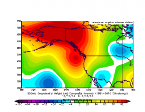
So, now that we’re once again witnessing a recurrence of a similar high-amplitude flow pattern and an extended mid-winter dry period across California, does that mean that the Triple-R has returned? No–not yet, at least. December’s active weather means that there is not yet a multi-month ridging signature over the northeastern Pacific, and thus the Triple-R as previously defined is not present at the moment. But strong ridging anomalies are now creeping back into monthly averages, and as this pattern continues for the next 1-2 weeks I do expect that a stronger signal will emerge.
Everything in context: heavy December rains, record-warm temperatures, and extremely low snowpack
December’s rains–especially near the Bay Area and along parts of the Central Coast–were very impressive, and in many instances brought more liquid water than fell during the entire calendar year of 2013. The fact that substantial precipitation fell in December means that calendar year 2014 and water year 2014-2015 are not going to set any all-time records for low precipitation. But now that California’s extreme drought is entering its fourth year, the state needs far more than merely “above record low” precipitation to alleviate the long-term effects of ongoing extreme warmth and low precipitation on a multi-year basis.
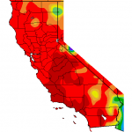
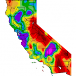
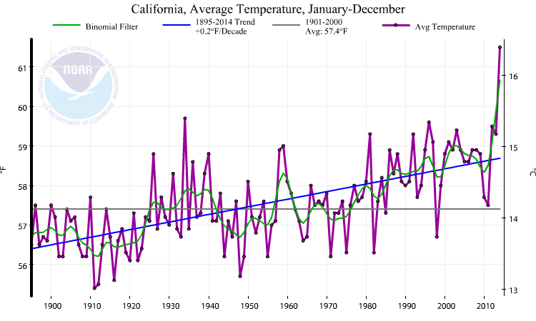
One particularly notable aspect of the recent conditions in California is the ongoing “snow drought” in the Sierra Nevada. December’s very heavy coastal rainfall did not translate to nearly as much mountain snowfall as might have been expected in a typical year, and mid-January snow water equivalent is tracking at near record-low levels once again–and is in fact on a very similar trajectory to both 1976-1977 and 2013-2014. The extremely minimal Sierra snowpack this year is the combined result of both regionally below-average precipitation to date across eastern California and well-above average (record-breaking) temperatures. Much of the moisture from December’s extremely wet “atmospheric river” event fell near the coast, and never made it all the way inland to parts of the state that are critically important for snowpack storage. Both daytime and nighttime temperatures have been well-above average in the Sierra for several consecutive winters (in some cases, elevations as high as 10,000 feet have been experiencing mean temperatures above freezing in mid-winter!), and has caused precipitation in this typically snowy region to fall primarily as rain. 2014 has officially gone down in the record books as California’s warmest year in recorded history (by a very wide margin), and one of the most visible manifestations of that record warmth is apparent in California’s extremely low snowpack.
Medium-term outlook: mid-winter heatwave coming to California; dry conditions to persist
After this weekend’s rain clears the North Coast, all of California will settle into a completely dry and increasingly warm period for at least the next 10-12 days. Very strong ridging will develop along the West Coast this coming week, and temperatures will slowly rise to well above-normal values by next weekend. In fact, the ECMWF is currently indicating that extremely warm conditions–indeed, record mid-winter warmth–could develop by next weekend as daytime temperatures exceed 70 degrees across most of California and perhaps even 80 degrees in some spots.
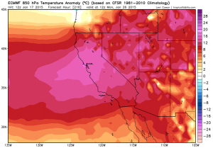
The GFS also indicates very warm and dry conditions, though it suggests temperatures will be slightly less extreme. Both the ECMWF and GFS ensemble means are completely dry for most of California out through 10-12 days–very impressive, given that January is the climatological peak of the rainy season in California. There are some hints in the GFS that a more zonal pattern may try to develop in early February, but realistically the sort of high-amplitude blocking pattern that will be in place during late January tends to be highly stable and often persists longer than projected by the global numerical models.
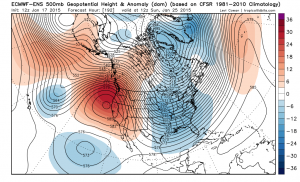
As a result, there’s an excellent chance that January 2015 could go down in the record books as the driest on record across a wide swath of California–especially near the Bay Area, where a number of stations have a respectable shot at recording 0.00 inches for the entire calendar month.
Update: El Niño simply isn’t there
Meanwhile, in the tropical Eastern Pacific, sea surface temperature anomalies have continued to fade in recent days. In fact, there now appears to be little anomalous warmth at all in the eastern part of the tropical Pacific (and some anomalous warmth has returned to the West Pacific Warm Pool). This means that the canonical El Niño teleconnections for the West Coast of North America almost certainly won’t be relevant for the rest of winter.
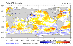
Even though the dynamical models continue to indicate an upward trajectory in tropical East Pacific SSTs over the coming months, it’s hard to envision such a drastic change becoming relevant before the end of the California rainy season (not to mention that these same models failed to capture the recent lack of warming in the East Pacific, and the influence of El Niño on California weather patterns in general is weaker than commonly thought). It will certainly be interesting to watch how the Pacific evolves in the coming months, especially given that SSTs along the California coast remain well above normal.
© 2015 WEATHER WEST
Discover more from Weather West
Subscribe to get the latest posts sent to your email.