Relatively quiet summer weather continues for most, but Arizona bakes as monsoon falters
Recent conditions across California over the past 3-5 weeks have been pretty typical by mid-summer standards. It has been pretty hot across inland valleys and deserts, relatively cool (and even occasionally chilly) along the immediate coast, with a few instances of afternoon thunderstorms activity the interior mountains. There have not been any major heatwaves recently, which is likely a welcome development for many folks.
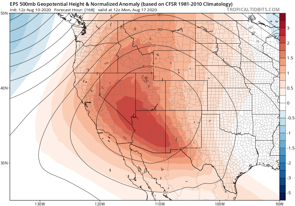
California’s boon, however, has been Arizona’s misfortune: a near-total failure of the North American Monsoon, especially on its western fringes, has lead to truly extreme temperatures across much of the interior Southwest and rapidly worsening drought conditions. Phoenix and Tucson both witnessed their respective hottest month on record–and Phoenix has already broken its previous record for greatest number of 110+ degree days in a single year (with many more such days likely before the end of summer). This extreme and persistent heat can be proximally attributed to the strength and position of mid-level atmospheric high pressure centered directly over the region. This pattern has not been at all favorable for the advection of subtropical moisture into the region from the south–a pattern typically associated with the seasonal wind reversal (i.e., “the monsoon”) that usually brings the Desert Southwest frequent afternoon thunderstorms during the second half of summer. The combination of clear skies and near zero soil moisture have produced a seemingly impervious heat dome over the region, and has become partially self-reinforcing at this point.
It goes without saying that California, tenuously positioned on the monsoon’s westernmost fringe even in the best of years, has seen no monsoonal moisture surges at all yet this summer–which is indeed unusual. The relatively minimal westward expansion of the persistent interior SW ridge also explains why there have been essentially no major California heatwaves over the past month or so.
Substantial warming trend this week, then remaining warm for rest of August
Beginning later this week, a substantial and fairly widespread warming trend will commence nearly statewide as a strong ridge builds in from the southeast. Initially, this warming will be most pronounced across the south and interior areas, but by the coming weekend this warmth will spread northward and closer to the coast. This does not look like an especially intense heatwave along the immediate coast, but it could be quite notable across inland areas that may see many consecutive days of 100+ degree heat. Daily temperature records this time of year tend to be quite high across inland valleys, so I don’t think this heatwave will break too many records (it is mid-August, after all!). More interesting, however, are signals that this heat may persist for several weeks (more or less) once it arrives. Multi-model ensembles are pretty emphatically suggesting that above-average temperatures will persist, once they commence later this week, right on into September in some spots. So there are signs, at the moment, that the second half of summer may be more anomalously warm than the first half across much of the state.
A bit of tropical moisture this weekend; hints of a stronger surge second half of August?
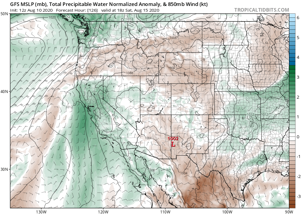
As noted above, it has been a very quiet summer in California from a monsoonal moisture perspective. And I actually don’t expect that to change over the next couple of weeks. However, there is a modest but growing potential that moisture from another source–decaying hurricanes in the eastern tropical Pacific–might find its way toward CA in the coming days. Remnant moisture from now-Hurricane Elida, currently due south of Baja California, may get picked up by southerly flow on the western fringe of the ridge bringing interior CA its heatwave this weekend. This initial moisture surge will probably bring some mid & high level clouds, pretty sunsets, and little else–outside of a very slight chance of a few dry lightning strikes if an unexpected mid-level disturbance can generate a bit of elevated convection.
But perhaps more interesting is the model ensemble signal pointing toward additional opportunities for tropical remnant moisture to surge toward California between now and the end of August. In fact, the GFS ensemble suggests there may be two additional opportunities for such moist southerly flow over the next 14 days–and these may bring a slightly higher potential for interesting weather than the initial surge this weekend. Details are always impossible to discern this far in the future with this sort of event, but it’s definitely something to keep an eye on in the coming days.
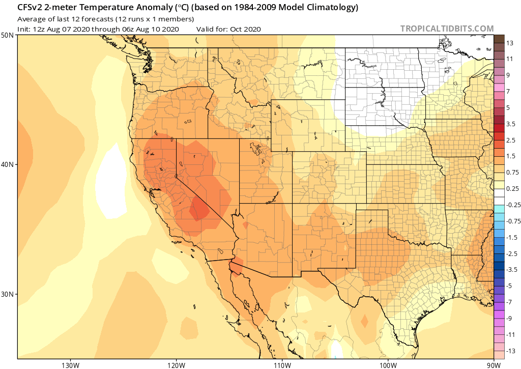
Seasonal predictions hinting at unusually strong signal for autumn/winter
There has been much consternation regarding the late summer/autumn peak of fire season this year in coastal California, given the high level of fire activity currently being observed both in NorCal and SoCal despite relatively modest weather conditions. Much of this is the legacy of a very dry 2019-2020 winter in NorCal and a warm spring statewide, and vegetation moisture levels have consistently tracking below average levels for several months. So many eyes in the wildland firefighting community have been focused on the autumn to come (aka, coastal heatwave and offshore wind season, when many of California’s most dangerous fires occur). What can we say right now about the season to come?
Unfortunately, there is currently an unusually strong signal for anomalous autumn warmth and dryness in 2020, which would likely exacerbate fire season. As October comes into better focus, it’s looking increasingly likely that California will experience warmer than average conditions and at least a modest delay in rainy season onset.
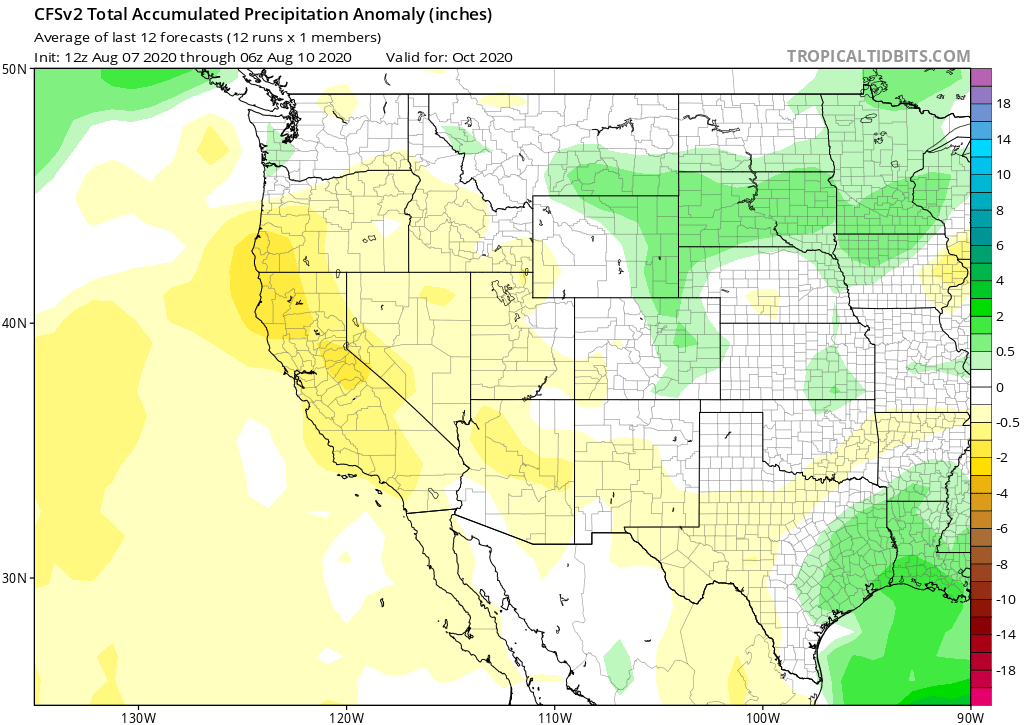
In fact, the latest round of seasonal modeling suggests that a strong California ridge/low precipitation pattern might persist from autumn into winter. It’s still quite early to talk about winter, and seasonal precipitation outlooks in California do not have a very good track record, but the current multi-model signal for a dry 2020-2021 winter is remarkably strong (and thus worth mentioning).
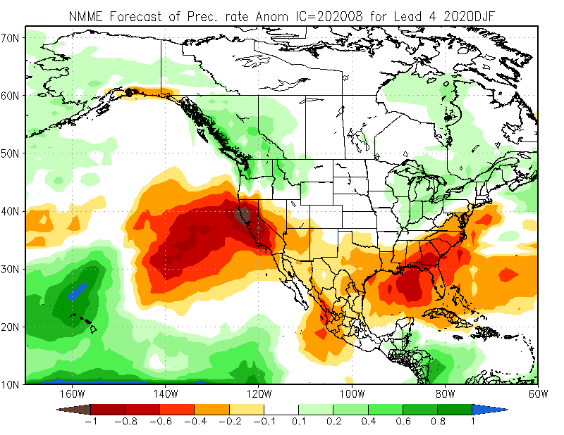
It’s hard to say from real-time model forecasts exactly what’s driving this tilt in the odds toward a warm/dry autumn/winter in California–but there are two strong hints. First, a developing La Niña event in the tropical Pacific is expected to peak (at modest strength) sometime during late autumn, coincident with widespread anomalous ocean warmth in the far western tropical and sub-tropical Pacific. Both of these SST patterns are conductive to sub-tropical ridging near and over California that deflects the storm track to the north, and tends to reduce precipitation. (You can read the peer-reviewed paper here, or the blog post describing our research here.) As we’ve seen in recent winters, however, other initially unforeseen factors can come into play that overwhelm the well-predicted ones and result in conspicuous seasonal predictive failures. I’ll revisit this again in a month or so, and it will be interesting to follow the evolution of the seasonal outlook this year.
