One of the hottest early season heatwaves on record for SF Bay Area
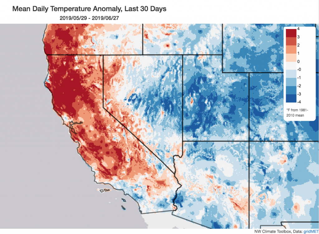
After a relatively cool and unusually wet spring across most of California, a very early season heatwave scorched much of the northern part of the state during the first week in June. This heatwave was especially unusual in that it was most intense (in a relative sense) right along the immediate coast of the San Francisco Bay Area–driven by an offshore flow pattern more reminiscent of September than June (a month when June Gloom is usually in full swing). This extreme heat event took many people by surprise and shattered countless daily temperature records, quite a few June monthly records (near the coast), and in at least a couple of instances appears to have set new all-time records for heat during “meteorological summer” (i.e., the months of June-August). (It is worth noting that no sites set all-time, any month records–a product of the fact that coastal California typically sees its hottest days in the autumn, when the marine layer is less prevalent and offshore flow more common.)
After that jarring burst of early month heat, a rather cool pattern has returned to the entire state in recent days (including the resurgence of a robust marine layer). Despite the recent relative coolness, however, June 2019 will go down in the record books as a much warmer than average month for the state of California due to the extremity of the heat earlier in the month. Coastal SoCal, for its part, has not been especially warm for most of June–and we are once again looking at a situation where the vast majority of the land area of the state experienced anomalous warmth while a majority of its population (which is concentrated along the SoCal coastal plain) experienced largely unremarkable–or even cooler than average–temperatures.
Amidst wild weather across most of Northern Hemisphere, California stays quiet
California’s cool and calm weather in recent weeks have been in stark contrast to the wild and genuinely extreme conditions being experienced across much of the rest of the Northern Hemisphere at the moment. Today, France experienced its hottest day on record (by an incredibly wide margin of 3F) amidst a searing heatwave bringing astonishingly hot conditions to much of western Europe this week. This heatwave was made possible by an unusually wavy jet stream pattern across the North Atlantic (sound familiar?), which in turn has been associated with strong “blocking” high pressure over Greenland.
This pattern still appears to be linked to the surprisingly persistent reign of high pressure in the Arctic during recent months (where nearly continuous record warmth and sea ice loss has been the norm). You may recall that I’ve mentioned this pattern repeatedly in blog posts since the beginning of the calendar year–including the indirect linkage to the breakdown of the stratospheric polar vortex this past winter. Well, that legacy still appears to be with us even as we head into early summer–and has led to an unusually chaotic atmospheric circulation regime across the entire Northern Hemisphere. While these effects will most likely lessen quickly and eventually disappear as summer progresses, it has certainly been interesting to watch the evolution of this process.
Gradual warming trend later in July; second half of summer could be much hotter than first
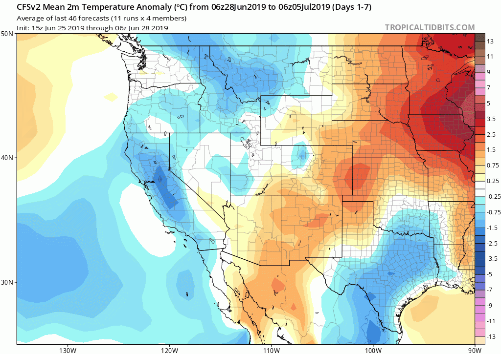
The next week or so will remain relatively cool and quiet across California, with most areas seeing temperatures near or slightly below average for the time of year. There are signs that a gradual warming trend may commence thereafter (just after the Fourth of July). No major heatwaves or extreme fire weather conditions are on the horizon at this point (for which most folks will be thankful!) but temperatures will probably not be as cool as they have been lately. The relatively cool and “trough-y” pattern will also mean a delayed start to monsoon season in the Desert Southwest–and subsequently in any chance of monsoonal moisture/thunderstorms across California’s mountains and deserts for at least the next 1-2 weeks.
Later in July (perhaps starting around the 10th or so), there are additional indications that more significant heat will be possible across much of the Western U.S. In fact, seasonal forecasts from NOAA’s CPC (as well as projections from individual long-range models) suggests a very high likelihood of warmer than average temperatures across California during the late summer and autumn this year. While outlooks that far out are not as accurate as short-term weather forecasts, this signal is quite strong and consistent across models at the moment. Suffice it to say: the relative coolness of the spring and early summer so far across much of California does not necessarily portend a cool summer overall–and there are currently some indications that the second half of summer could be much hotter than the first half. Stay tuned!
A couple of odds and ends
Many blog readers may be interested in our recent research on the observed warming of West Coast atmospheric rivers, led by Katerina Gonzales at Stanford University. While a more comprehensive thread on our findings can be found here or by clicking below, we thought the most thought-provoking finding was this: California’s atmospheric rivers have already warmed by more than 3.5F in some months–more than climate models had previously projected for the middle to end of the 21st century. Read more below:
Finally, I wanted to highlight a truly spectacular photograph by Weather West regular Shane Ritter. This image shows an incredible display of noctilucent (“night shining”) clouds in Northern Nevada earlier this week. Such clouds, made of ice crystals in the mesosphere, occur far above the altitude of all typical clouds–50 miles above the surface of the Earth, vs. 5-20 miles for most other cloud types. Noctilucent clouds used to be fairly rare at middle latitudes (and were more common closer to the poles), but sightings have increased considerably in recent years–a trend that has been attributed to the indirect effects of rising greenhouse gas concentrations (especially methane). Thank you, Shane, for sharing the high resolution version of this once-in-a-lifetime shot!
