After exceptionally wet May, typical early summer weather gradually returns to California
An impressively wet, cool, and stormy May across California
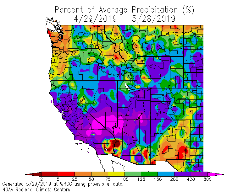
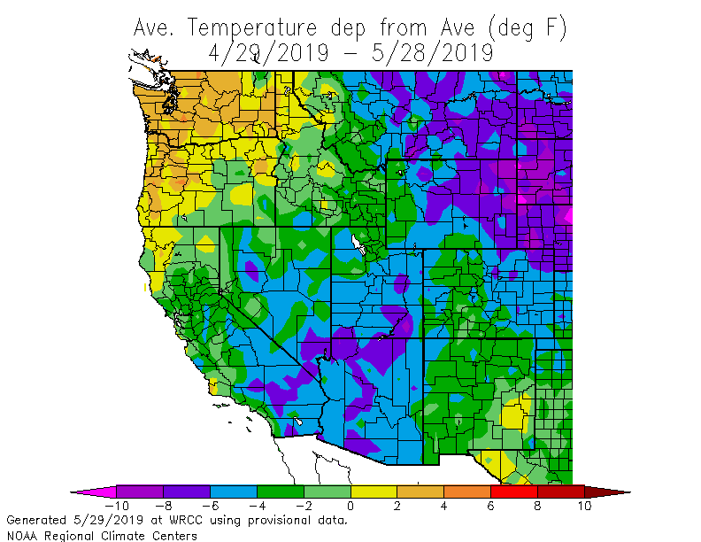
Nearly the entire State of California experienced remarkably wet and cool conditions during May. Some regions saw precipitation in excess of 400% of average for the 30-day period, and the onslaught of late-season precipitation dramatically slowed the rate of net melting of the Sierra Nevada snowpack, which is now far above average for the date. (It is worth noting that these enormous “percent of average” anomalies are largely due to the low climatological average precipitation this time of year; seeing this much precipitation during the heart of the winter rainy season would be fairly routine).
This “Mayuary” pattern has been largely beneficial to the region, delaying the start of wildfire season and topping up reservoirs (and, more importantly, snowpack). That said, the unusual timing of this late-season rainfall has been problematic for some agricultural interests in the Central Valley–and could perhaps lead to a more severe fire season later in the year in some areas as the prodigious amount of extra grass and brush resulting from all this damp weather dries and cures.
Spectacular “mothership” supercell thunderstorm in Shasta County
Another striking aspect of this unsettled weather pattern has been the prevalence of thunderstorms across certain portions of the state–including some coastal areas and especially the Central Valley at times. As noted in the last blog post, severe thunderstorms have indeed occurred in a few places (bringing very large (golfball-sized!) hail, localized flash flooding, and even a couple of weak tornadoes).
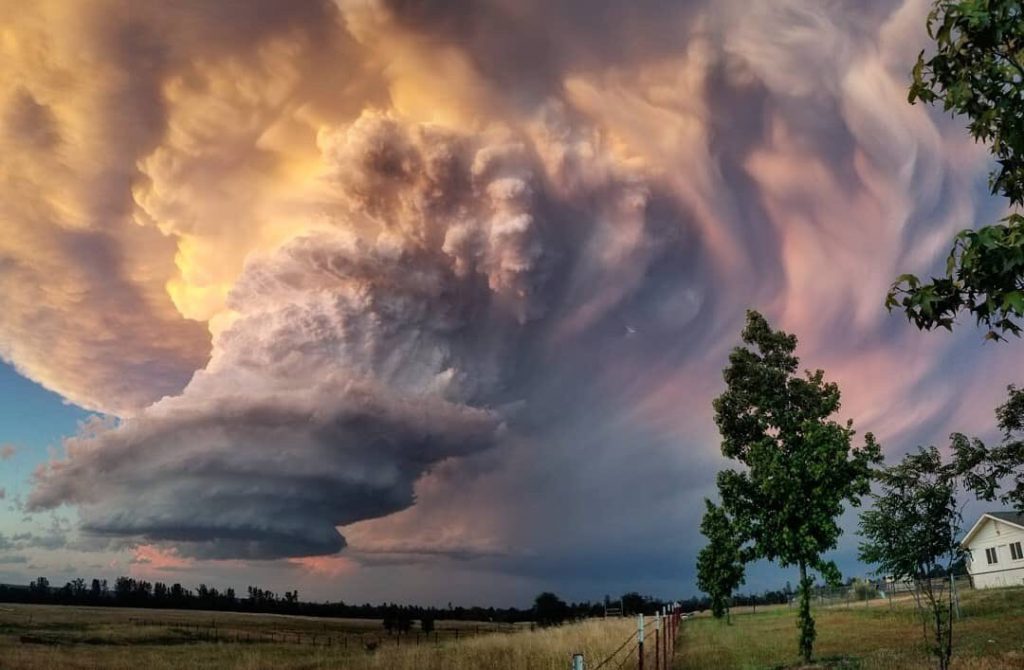
Some of these storms have been highly localized but spectacularly photogenic. In particular, a lone supercell thunderstorm in Shasta County last week generated much buzz in the meteorological community due to its rare strength, organization, and exceptional photogenicity. This low-precipitation supercell thunderstorm developed in very small region of deep atmospheric instability and localized vertical wind shear, and ultimately took on characteristics more akin to the most intense storms of “Tornado Alley” on the Great Plains. This cell developed a full-fledged mesocyclone with a rain-free base, as well as a wall cloud, and the NWS in Sacramento issued both severe thunderstorm and tornado warnings as a result. While there were no confirmed tornado touchdowns from this particular cell, extremely large hail (by California standards) occurred in Redding and adjacent areas. But perhaps most remarkable were the photographs and video footage of this event. I’ll let these speak for themselves, and have included a number of direct links below. A special thanks to the Weather West readers who captured and passed along footage of this memorable weather event!
For those interested in a bit of a deeper dive into California thunderstorm climatology, including the science behind supercells and the reasons why this part of the world sees far fewer of them than most other places in the U.S., check out my fairly lengthy Twitter thread from last week (no account necessary to view).
Topsy-turvy atmospheric pattern throughout Northern Hemisphere
California’s recent exceptionally wet and cool spell is not an isolated event–it has been part of a hemisphere-wide period of extreme weather conditions. Very cool and wet conditions extended across the southwestern U.S. into the Plains states, where record-breaking flooding continues to escalate, courtesy of a quasi-stationary Western trough and unusually strong Pacific jet stream. Meanwhile, all-time record heat continues to pervade the southeastern U.S.–where a very persistent ridge has lingered for weeks. At the boundary between these thermal and moisture anomalies, a remarkable stretch of severe weather (including one of the most prolonged tornado outbreaks on record) has affected many of the same areas currently plagued by record flooding.
Meanwhile, record warmth continues in Alaska, where sea ice continues to track at or below record lows. Extremely severe fire weather conditions in central Canada have led to enormous boreal forest fires (a single one of which is approaching a million acres) and subsequent choking smoke plumes extending for thousands of miles downwind. Elsewhere, all-time heat records have been set this past week in parts of the Middle East and Japan.
The high latitudes in general have actually been exceptionally warm as of late: the late-season weakness of the Polar Vortex (discussed in the last post) allowed cold Arctic air to spill southward into the mid-latitudes, resulting in alternating pockets of highly anomalous cold and warmth all across the Northern Hemisphere. Several researchers who have been studying recent links between atmospheric wave resonance, mid-latitude weather, and the rapidly warming Arctic have pointed out that the current pattern is very similar to one that is known to be conducive to high-impact weather extremes. While this subject remains the topic of ongoing scientific investigation, there is now emerging evidence that such patterns may be occurring with greater frequency and intensity as the Arctic continues to warm faster than the rest of the planet. Interestingly, though, this doesn’t necessarily mean that the impacts we experienced in 2019 will be exactly the same the next time this pattern repeats: the regions which receive extremely persistent warmth/coolness and very wet vs very dry conditions seem to shift with each iteration of the “wavy jet stream” set-up. I suspect this will increasingly become to be a topic of discussion in the years to come.
Unsettled conditions continue this weekend, but warmer/dryer weather on the way
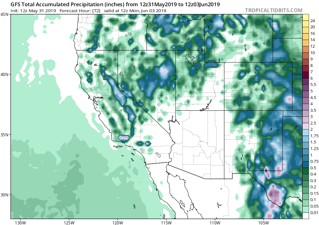
A lingering cut-off low pressure system will continue to bring afternoon showers and thunderstorms to a significant portion of California over the next 48 hours. This evening through Sunday evening, pretty widespread thunderstorm activity will continue to occur throughout the mountains and coastal hills, with some cells possibly drifting into the Central Valley. It’s not entirely out of the question that a couple of isolated thunderstorms could survive the westward trek all the way to the coast this weekend, although most thunderstorm chances will be away from the immediate coastline.
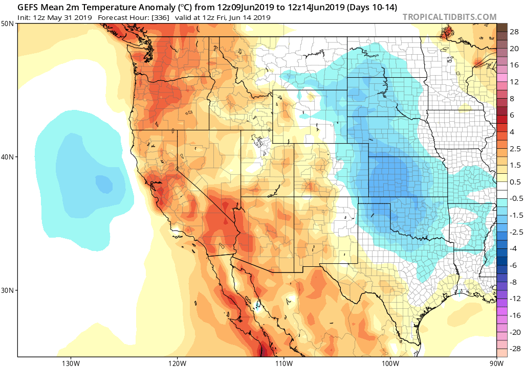
Temperatures will start to slowly rise this weekend before rising more quickly early next week as the low pressure system finally exits to the east. Then, for the first time in a long while, above average temperatures will return to California next week. No major heatwaves are on the horizon, fortunately, although this spell of warmer than average temperatures will likely feel especially hot due to the relative coolness as of late. Beyond the first week in June, a fairly typical early summer pattern appears likely to take hold, with some June Gloom stratus along the coast and summer-like temperatures persisting away from the immediate coastline.