After burst of early-season heat, a sudden shift to active weather across California
Recent Weather Overview
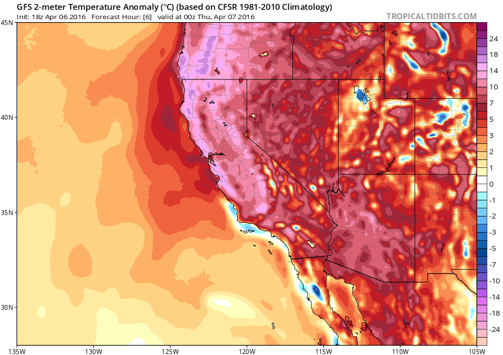
Essentially all of California received an early taste of summer-like temperatures this week. A very strong ridge of high pressure aligned with the West Coast brought very warm to hot conditions to a wide region–and and a number of temperature records were set on Wednesday from Southern California all the way north into British Columbia. This intense (but thankfully brief) heatwave comes on the heels of a period of relatively quiescent conditions across California.
As anticipated, the month of March did ultimately bring much-needed heavy precipitation to the northern 2/3 of the state–with many areas ending the month around 150-200% of the long-term monthly average precipitation. Southern California, on the hand, remained rather dry. This north/south split in precipitation has persisted through the entire winter despite the presence of very strong El Nino conditions in the Pacific. I’ve previously offered some thoughts as to why this might be occurring, and Bob Henson recently wrote an excellent piece on the relatively subtle storm track shift that plagued SoCal this rainy season.
There is some positive news to report: the Sierra Nevada snowpack as of April 1 is much healthier than in recent drought winters, and some of California’s most important (and largest) reservoirs are nearing capacity in the northern part of the state as a result of heavy precipitation in March. These two factors will likely alleviate some of the most acute short-term drought impacts this summer. On the other hand, though, it’s a bit discouraging that one of the strongest El Nino events in recorded history brought about a snowpack which, while much improved over recent extremely low snow years, was still below average. And the enormous magnitude of California’s long-term water deficits remain deeply entrenched from environmental and groundwater perspectives. So while much of California saw a modest reprieve this winter, our most severe drought on record is definitely not over yet.
Sudden shift to active conditions across California–especially south!
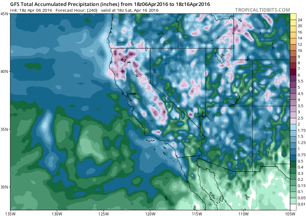
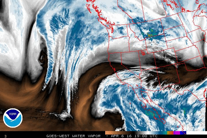
The rainy season is apparently not over yet, however, as a series of fairly robust storm systems are expected to sweep across all of California in the coming days. As of this writing, an unusually positioned cut-off low well to the southwest of Los Angeles is slowly moving northeastward, spreading mid and high-level subtropical moisture across the state. This low will continue to move closer to the SoCal coast tomorrow, bringing an increasing chance of showers in the very moist subtropical airmass. On Friday, this moisture plume will continue to spread northward, and showers will likely develop across most of NorCal as well. At the same time, a somewhat weaker but much colder Pacific system will begin to approach from the northwest, eventually merging somewhere near central California over the weekend. This is a rather “messy” pattern–with two lows interacting/merging directly over our region of interest. While the details are still a bit difficult to pin down, there is pretty high confidence in a period of rather active California weather beginning late Thursday and continuing at least through Monday.
Southern California will actually see the most precipitation out of this upcoming event, and some spots could actually see rather heavy precipitation (locally 1-2 inches or more when all is said and done). Accumulations in Northern California will probably be lighter but still rather widespread. Convective potential looks to be rather modest initially but will increase through the weekend, and so while isolated thunderstorms will be possible across much of the state on Friday, they may become somewhat more widespread (especially in the south) later in the weekend.
Interestingly enough, the GFS and ECMWF both indicate that this active spell will continue through at least the next 10 days, with a couple of opportunities for colder systems to drop down from the Gulf of Alaska through the coming week.
Given the chilly airmasses associated with these potential upcoming systems and the high April sun angle, instability will probably be respectable by California standards and additional periods of shower/thunderstorm activity will be possible. All in all, it looks like a fairly active first half of April is shaping up across the state. Stay tuned!
