Just how wet and cold was winter 2018-2019?
The 2018-2019 rainy season started exceptionally dry and relatively warm across most of California, and was punctuated by California’s deadliest and most destructive wildfire in history during the uncharacteristic month of November. But weather conditions since the new year could not have been more different: January and February were very cool and quite wet months across much of California. Not record wet, or record cold…but certainly enough to be noticeably damp in most spots for a nearly 2-month period and generate an extremely impressive Sierra Nevada snowpack.
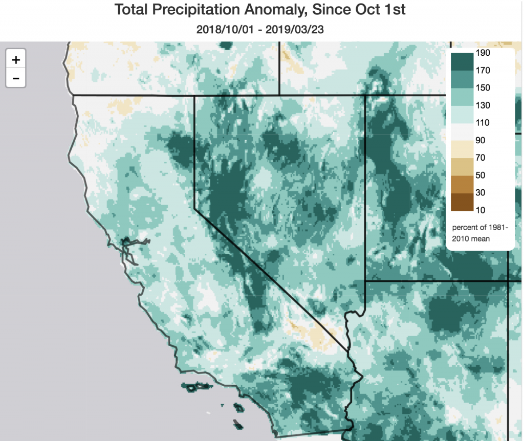
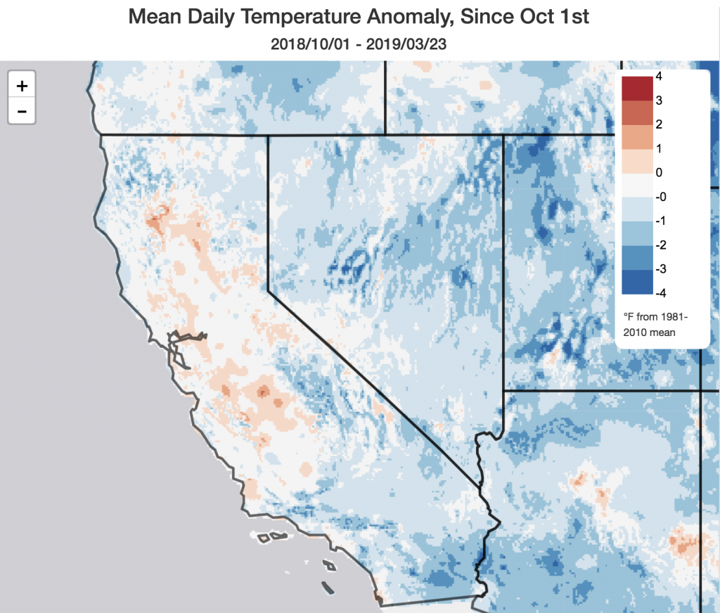
For the Water Year to date (i.e., since October 1, 2018) nearly all of California has experienced slightly to moderately above average precipitation. Overall cumulative precipitation anomalies have not been particularly exceptional, which explains the relative lack of serious flood issues (with the notable exception of the Russian River flood event earlier this month due to a stalled but very localized atmospheric river). And interestingly: temperatures for the full period really haven’t been that cold–shaking out pretty close to average for most of the state. (Of course, that somewhat masks the very cold conditions that occurred during February).
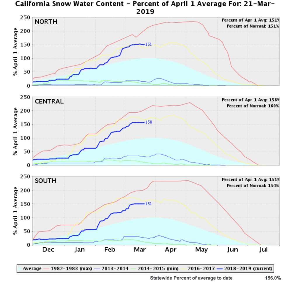
And, strikingly, it doesn’t explain the prodigious Sierra Nevada snow totals this year. So how, exactly, can California have received 156% of average snow water equivalent when precipitation over the same interval was only ~120% of average and temperatures were “near average?” Well, it all comes down to timing: the vast majority of those feet of snow fell during a 6 week interval during January and February that were particularly cold and wet. That storm onslaught–by itself–was enough to boost Sierra snow totals well above average values…for the entire season! Aside from being a short-term boon to California’s water supply (and ski industry), this year’s example offers a perfect illustration of how it may still be possible to see banner snow years even in a future where mean snowfall declines precipitously due to warming temperatures.
Unsettled conditions to persist, but anomalous warmth will start to creep in
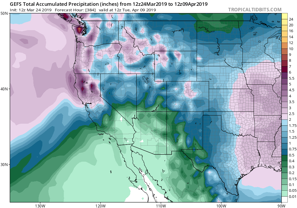
After a brief respite of warm and dry conditions across the state last week (during which cold and snow-beleaguered Seattle experienced its warmest winter temperature on record on two consecutive days!), more unsettled conditions will return to California this week. Widespread rain and mountain snow will again fall across Northern California, though areas south of the Central Coast will likely see only light precipitation. Models currently disagree regarding just how much rain will fall in the north–and how persistent this wet pattern will ultimately be. Right now, there doesn’t appear to be anything too exceptional in the cards–just a fairly run-of-the-mill early spring pattern.
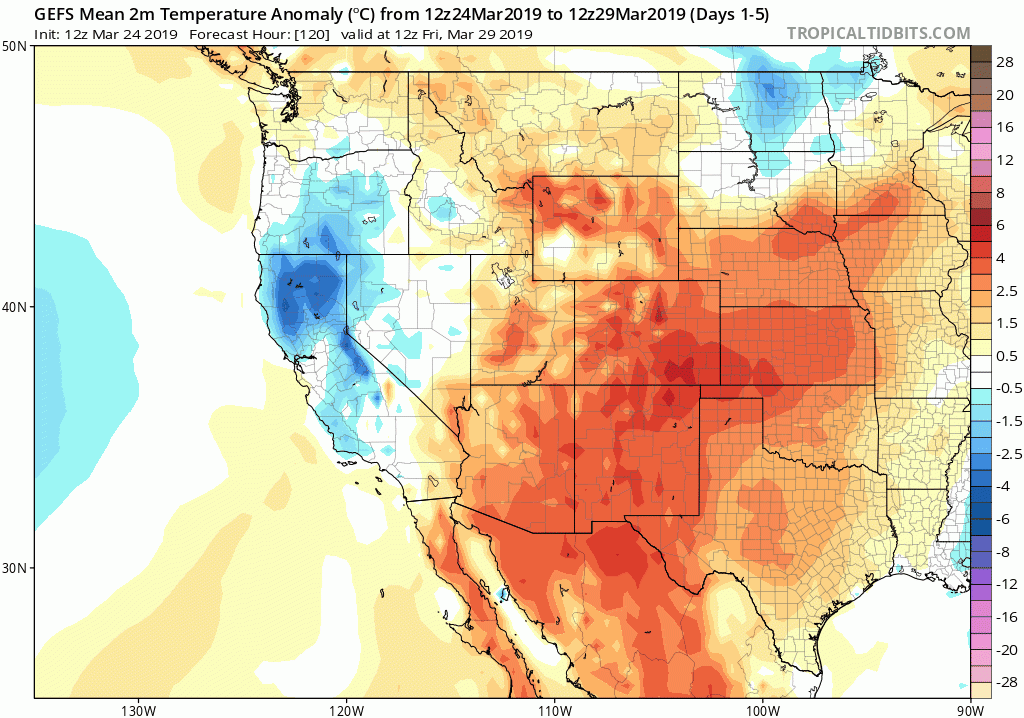
But there is one additional item of note: ensemble forecasts are suggesting that warmer-than-average temperatures will start to spread over much of the recently-cold American West by early April, despite ongoing precipitation. That suggests that the snowmelt season will likely begin to accelerate in the next 10 days. The large amount of water retained in the well above-average snowpack does portend a somewhat above average risk of snowmelt flooding in California this spring, though nothing like the extreme risk faced by nearly the entire Midwest and Mississippi River basin in the coming weeks. The good news: right now, there are neither any big early-season heatwaves nor any big storms on the horizon which could trigger rapid snowmelt.
El Niño still in the cards for this summer…and beyond?
El Niño conditions have officially been declared, although the event has been a rather anemic one so far (and mid-latitude teleconnections were weak to non-existent for most of the winter). Interestingly, there is pretty broad multi-model ensemble agreement that this event will persist into and even beyond summer–perhaps even strengthening further. That would be a pretty odd evolution, and we probably shouldn’t take ENSO projections for the summer and beyond too seriously yet as we’re still on the wrong side of the “Spring Predictability Barrier”. But if these forecasts persist, it does suggest that impacts in California could actually increase moving into summer and next autumn. Stay tuned!
(On a slightly in-the-weeds side note, these same models are also suggesting something potentially unusual going on with the warm “western boundary” ocean currents in most of the global ocean basins this summer (see Tweet above). Since I’m not a physical oceanographer, I’ve reached out to several to determine just how unusual it is. If you’re interested in following the public thread, check it out here. Otherwise, I’ll provide an update in the next post).
