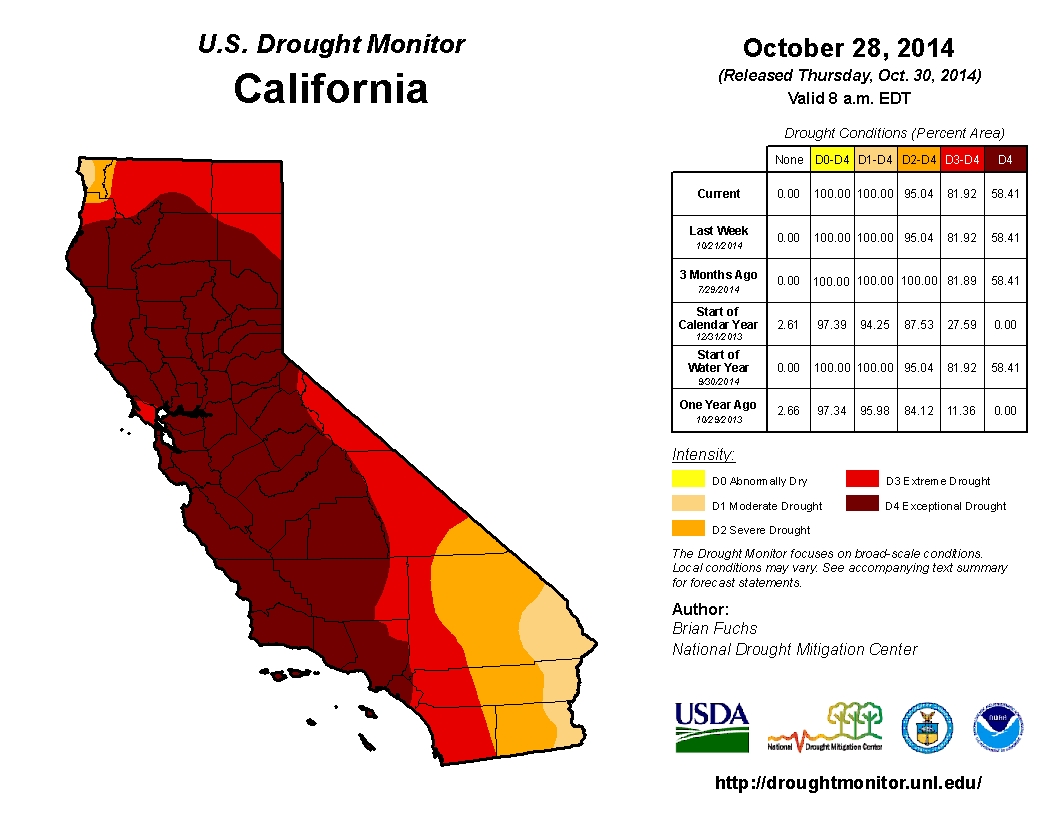
This will be a very brief update, but given the tremendous interest in the ongoing and extraordinary California drought and the imminent arrival of the most significant widespread precipitation event in many months, a quick summary follows below.
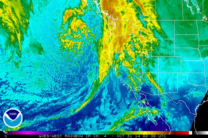
A rather significant storm system is approaching the Northern California coastline this evening, and will bring widespread rain and mountain snow as it moves ashore on Friday and Saturday. Precipitation totals will be modestly high for late October/early November–and will seem even more impressive given the conspicuous lack of wet storm activity in California over the past 2-3 years. Some of the heaviest precipitation may actually fall along the Central Coast due to the formation of a wave along the cold front, which may prolong precipitation in that region. Most of California will see at least 0.25 – 0.50 inches, with some coastal/mountain regions likely to receive 1-2 inches+.
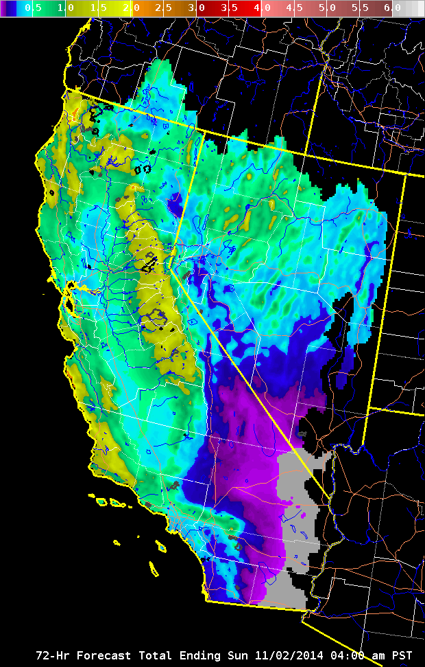
Even far southern California will get in on the action this time around, with totals as high as a tenth to quarter inch as far south as San Diego. The incoming system also appears to have sufficient cold air aloft to generate steep lapse rates over much of California later on Friday, and there will be a fairly widespread risk of isolated thunderstorms behind the front. Some localized hail and heavy downpours will be possible, but a significant severe weather event does not appear likely at the moment. Winter Storm Warnings have been posted for the Sierra Nevada Mountains–and this will likely be the first notable snowfall of the season above pass level.
Clearly, a single late-October rain event does not substantially mitigate the exceptional statewide precipitation deficits that have developed over the past several years of exceptional drought in California. But a widespread, relatively moderate soaking rain event like the one slated for this weekend will be highly beneficial in the short term (aside from some damp trick-or-treaters)-, and will hopefully reduce fire danger and plant water stress in some of the hardest-hit drought regions in Central California. Enjoy the rain!
© 2014 WEATHER WEST
