Recent Weather Summary
Active weather finally did return to the Golden State over the past several weeks. A handful of storm systems, driven by the first major easterly incursion of the low-latitude Pacific jet stream in over a year, brought substantial precipitation to essentially the entire drought region. One of these storms in particular was especially notable, bringing very active weather to Southern California (including severe thunderstorms and localized flash flooding).
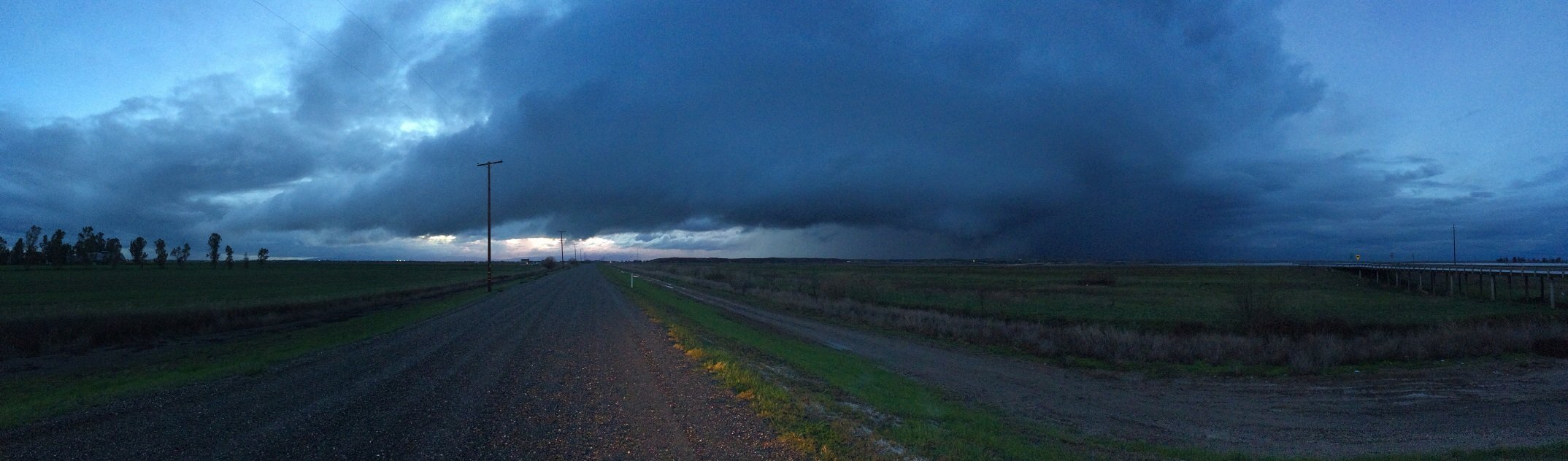
In some parts of Southland, this storm brought the heaviest 1 and 2 day rainfall totals in several years. In the unstable airmass associated with the low, a few strong thunderstorms also occurred in Northern California, which ultimately culminated in the touchdown of a brief EF-0 tornado in fallow agricultural land just east of Woodland, CA in the southern Sacramento Valley.
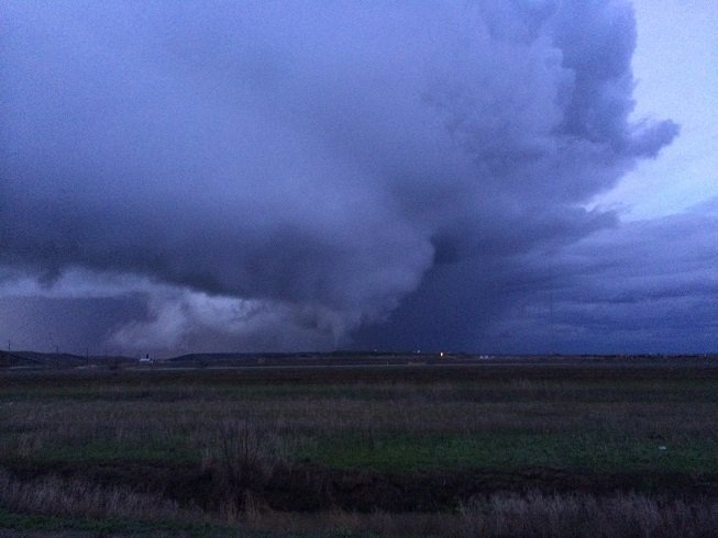
Weather West member “c33f” was lucky enough to capture this unusual event on camera, and photographs showing the impressive structure of the parent mini-supercell (and the tornado itself!) are included in this post. Elsewhere in California, the far northern reaches of the state have received more consistent precipitation over the past several weeks, as a moist plume of Pacific air (including a couple of modest atmospheric rivers) have sagged far enough southward to share some of Seattle’s rain with Eureka and the broader North Coast.
Recent precipitation in the context of ongoing drought
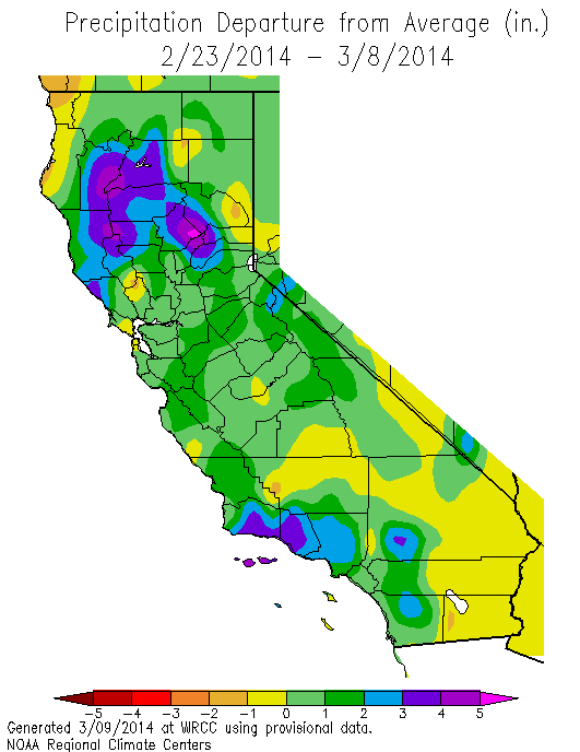
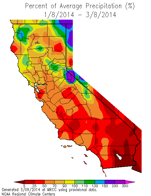
The occurrence of substantial precipitation across most of California in recent weeks represents a rare piece of good news in the midst of an otherwise rather stark situation. 30-day accumulated precipitation is actually near or above normal in some parts of the state, which is the first time that’s occurred in at least 14 months over any broad region in California. Rainfall intensities were high enough in many places to get the creeks and streams flowing, at least briefly, bringing some much-needed water to riparian ecosystems and generating a pulse of runoff into reservoirs at a critical time of year. 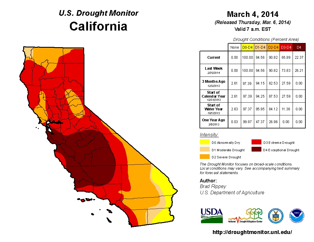 The seasonal grasses across California have finally–in early March–received enough water to germinate. Wildfire risk–at least for the moment–is fairly low thoughout the state. The Drought Monitor update after the major SoCal storm shows some modest, short-term improvement in drought severity in some places, though this took the form of a downgrade from “exceptional” to merely “extreme” severity in some cases.
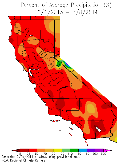
But what about the bigger picture? Amazingly, all this observed precipitation over the past 30 days doesn’t even bring us close to normal for calendar year 2014, let alone for water year 2013-2014. The vast majority of California remains below 50% of normal for the water year. Sierra snow water content, while slightly bolstered by recent storms in the south, remains at all-time record-low levels in the Northern Sierra and is dropping quickly elsewhere as unusually warm temperatures persist. And most concerning is the forecast for the rest of March: high and dry.
No “March Miracle” this year
The forecast for the next couple of weeks looks extremely unfavorable for additional improvement in drought conditions in California and unfortunately will lead to re-intensification across most of the state. At the time of this writing, it’s actually raining across more northern parts of the state, and precipitation is expected to continue and locally expand as far south as the Sacramento/San Francisco regions overnight tonight. Locally moderate to heavy precipitation is possible across the far north as this warm system continues to push moist air onshore, and given high temperatures in the lower levels of the atmosphere it would not be a total surprise to see a thunderstorm or two tonight.
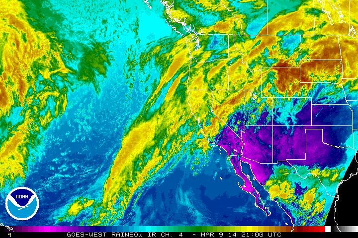
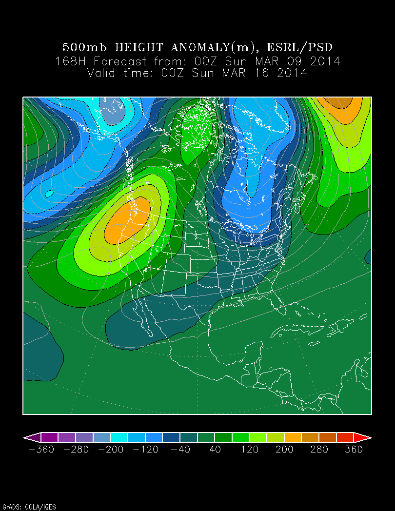
By Monday afternoon, however, all precipitation will be exiting the state as high pressure builds in from the south and west. This will set the stage for an extended period of completely dry conditions across the entire state, and possibly a period of record-high March temperatures as high pressure builds strongly overhead. In fact, the upcoming pattern greatly resembles that which occurred during the most intense period of geopotential height ridging associated with the “Ridiculously Resilient Ridge.” What’s not clear at this point is whether the upcoming high-amplitude ridging will have the same extraordinary persistence as the RRR. Current model projections do suggest the continuation of mean ridging over or near the West Coast for at least the next 2 weeks, which means that California will likely approach the end of March with little or no additional precipitation after the very modest event tonight. While some precipitation does typically fall in April, prospects for substantial and drought-busting rains decrease rapidly by the end of March.
Continued momentum towards the development of El Nino
NOAA’s official ENSO Alert Status was upgraded to “El Nino Watch” this week in response to numerical model projections favoring the emergence of warm sea surface temperature anomalies in the tropical East Pacific over the coming months.
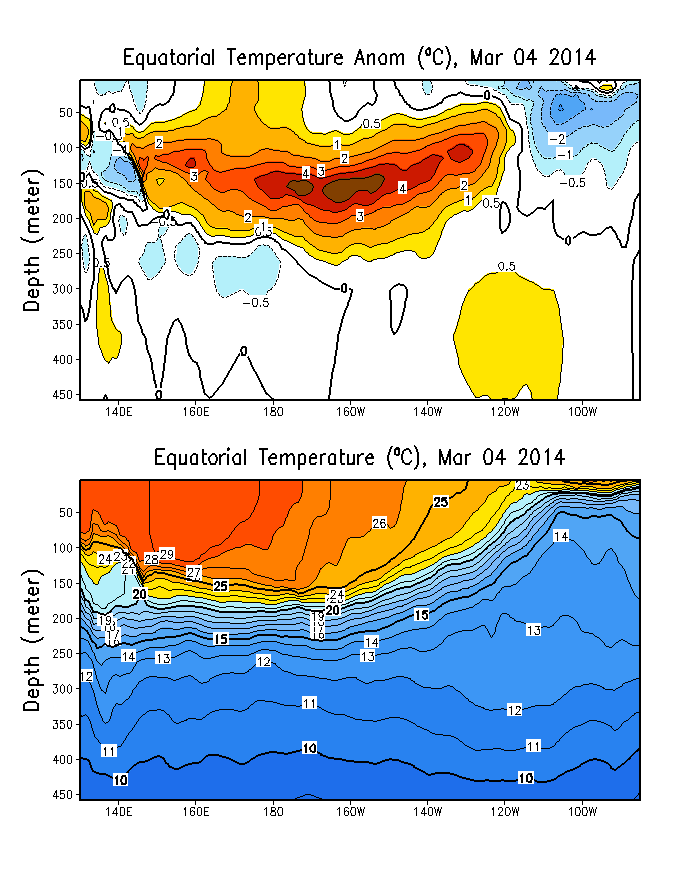
Recent observations continue to support these model forecasts, and at the time of this writing a very strong and sustained westerly wind burst is continuing to push a large pool of warm, sub-surface ocean water currently located in the Central Pacific further to the east. As I’ve previously mentioned, these sub-surface warm anomalies are quite large–now exceeding 4-5 degrees C–which suggests at least the possibility of a significant El Nino event later this year. I’ll continue to follow developments in the tropical Pacific in the coming months, so stay tuned to Weather West for updates!
© 2014 WEATHER WEST
